Turnpike Roads in England & Wales
Welcome! This website is a hub for information on the historic turnpike
roads of England and Wales.
Here you will also find something of the travellers who used these roads and records of turnpike features that have survived and can still be observed by the curious explorer.
Updating of historic tollhouse lists for all English and Wesh Counties
This site has page
clusters dedicated to;
·
the history of Turnpike Roads
and their routes (tables listed below)
·
Tollhouses that were built at turnpike gates to collect
tolls from road users (tables listed below),
·
Milestones that
informed travellers of the distance to the next town, and
·
Road Users who
benefited from the improved highway.
·
River Crossings – ferries and bridges
Also features that
preceded the turnpikes, particularly
·
Wayside Crosses that were
beside the old highways.
-------------------------------------------------------------------------------------------------------
The
site hosts research-based publications by leading historians of British roads. Click
on the name for the link
·
A definitive study by Dr Keith Lawrence on the Turnpike Roads around Nantwich, Cheshire can be accessed by clicking
this link.
·
Information on related turnpike trustees and on
Tollkeepers nationally is accessed by the Keith Lawrence Data page.
·
“Devon
Tollhouses; A Gazetteer” by Dr John Kanefsky; a comprehensive list
of Devon’s surviving toll houses and some mis-assigned tollhouses, with
historic notes; published April 2021.
------------------------------------------------------------------------------------------------------
Below is a list of summary tables, maps and
information pages accessible on this site
---------------------------------------------------------------------------------------------------
1. Tables and
maps relating to turnpikes
these use old (pre
1974) county boundaries
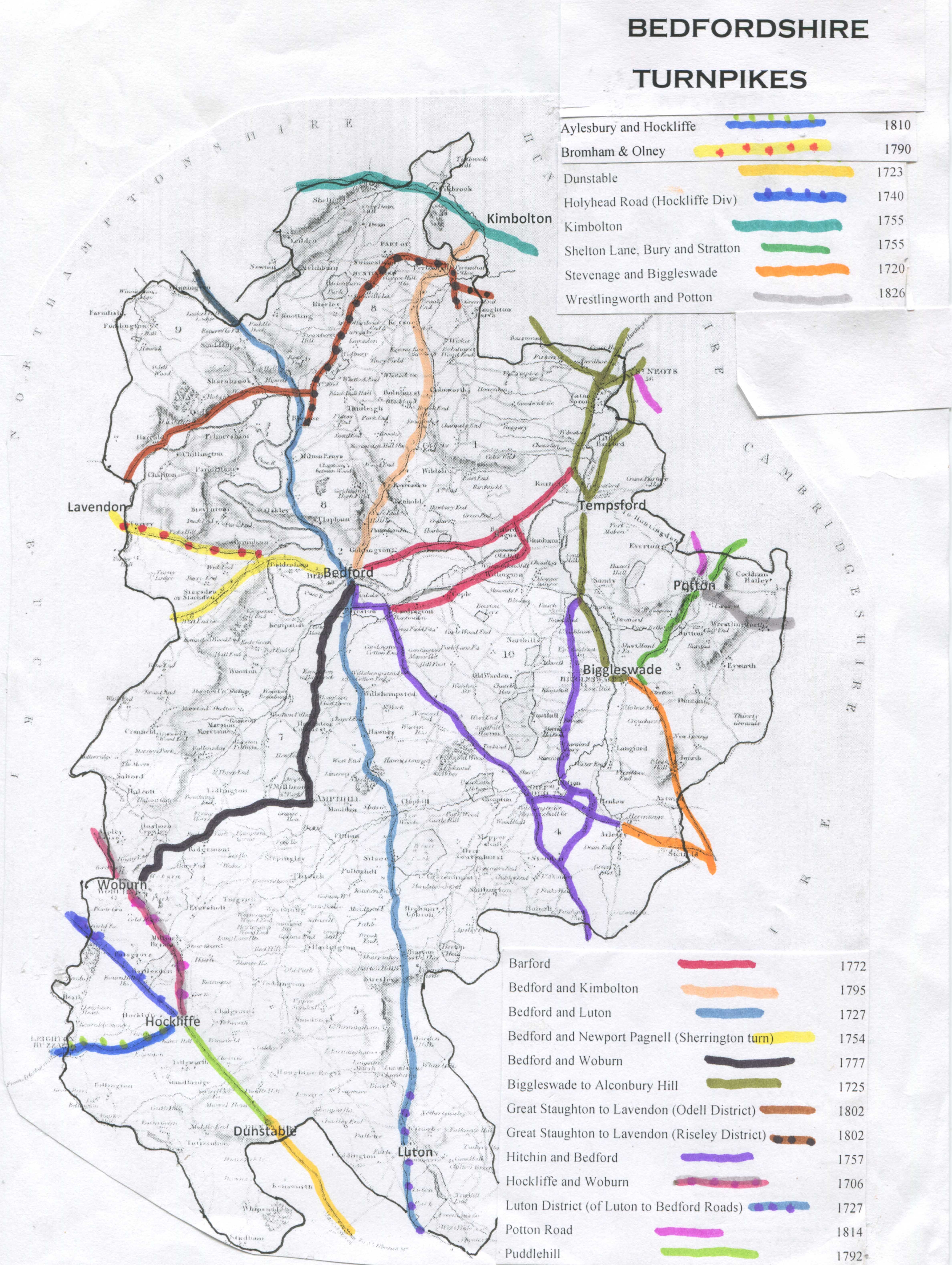
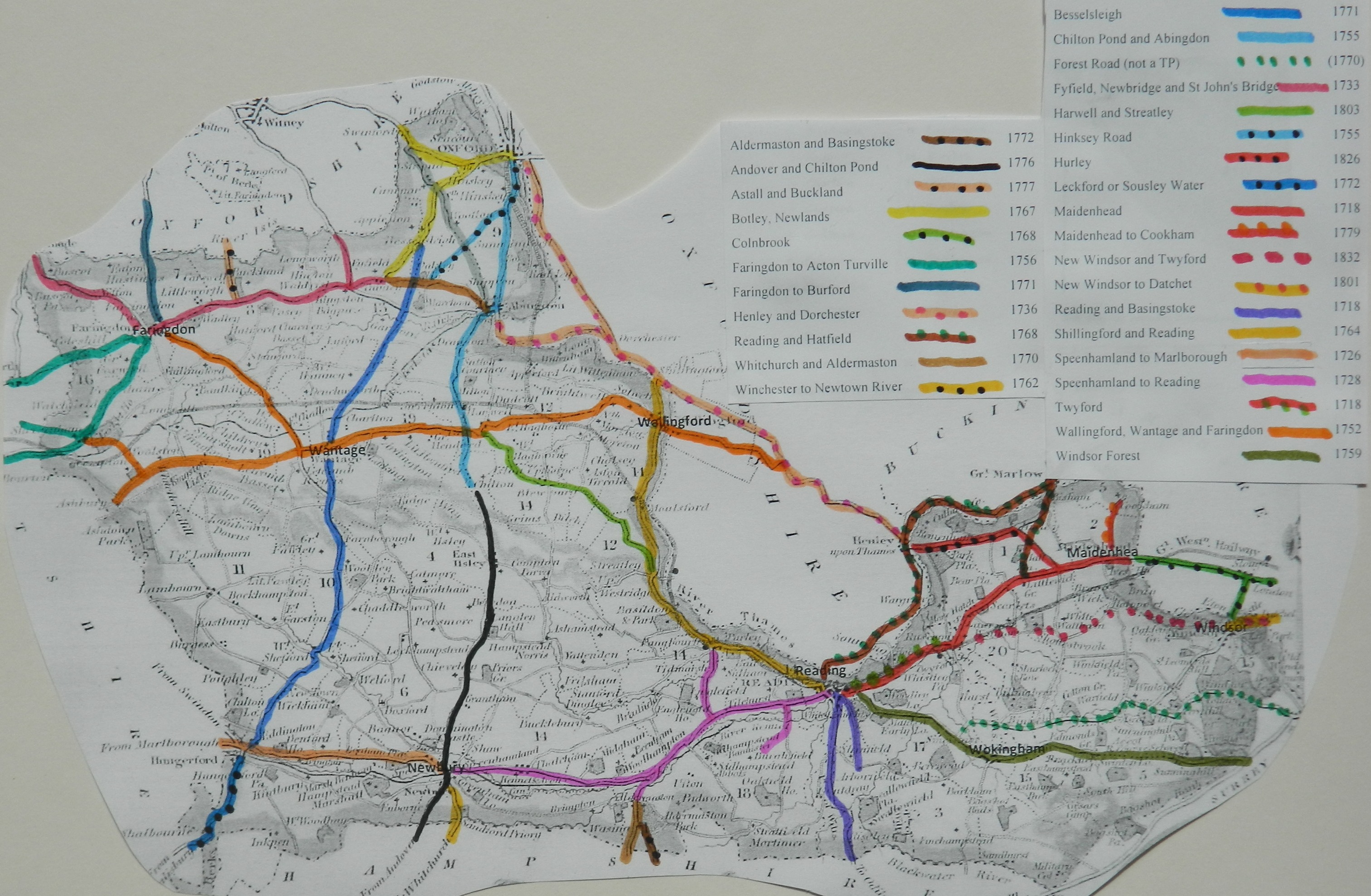
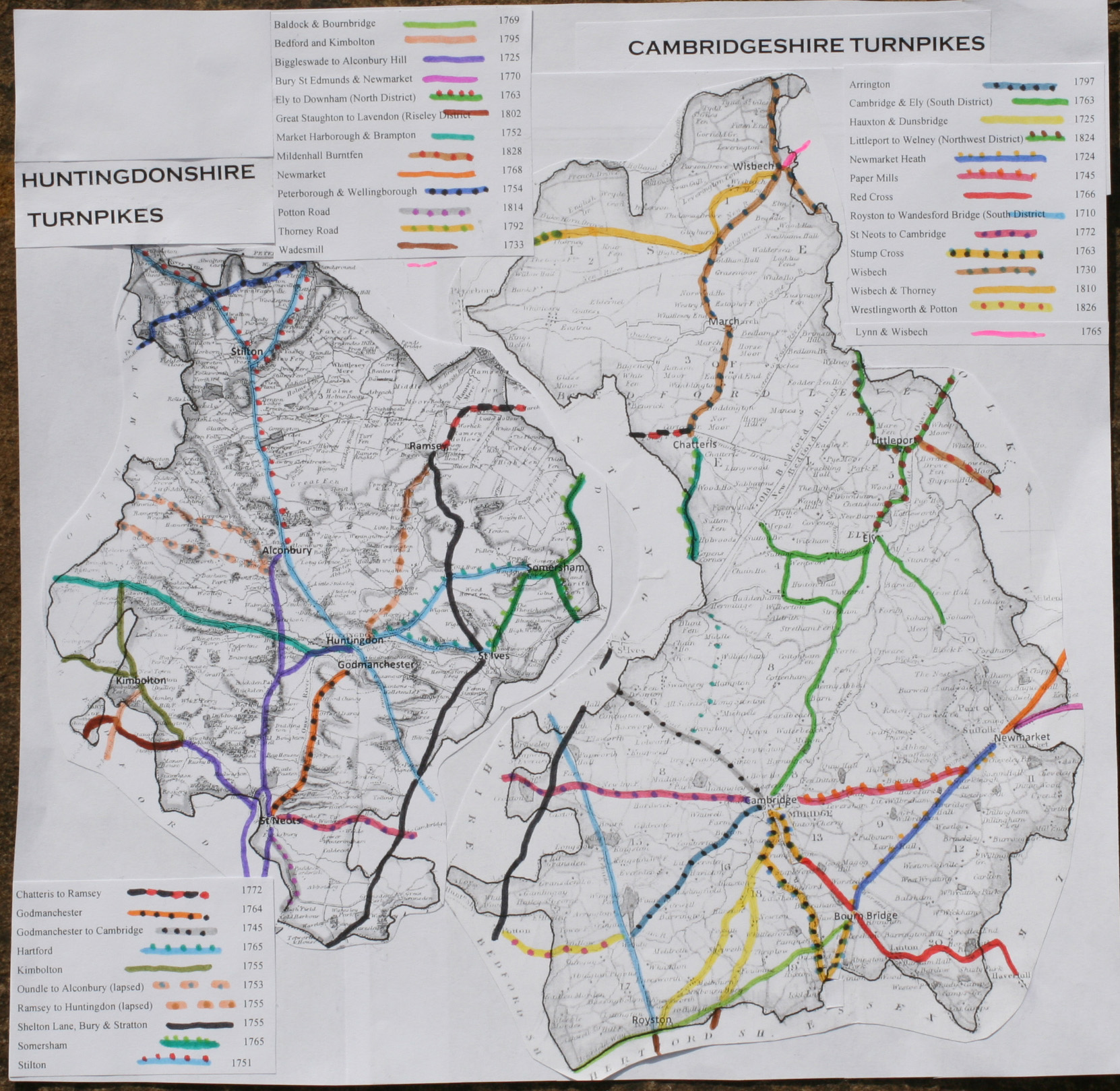
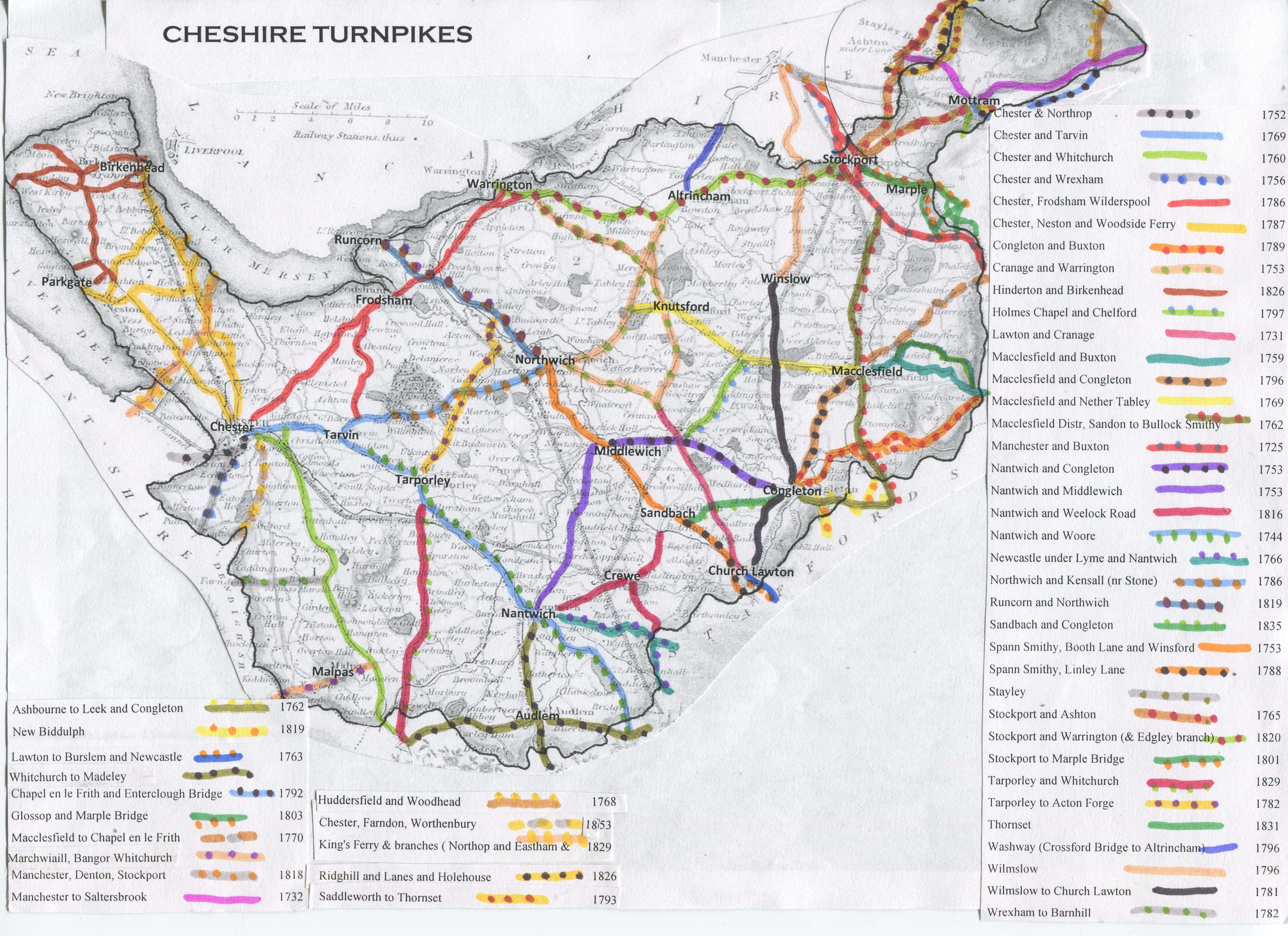
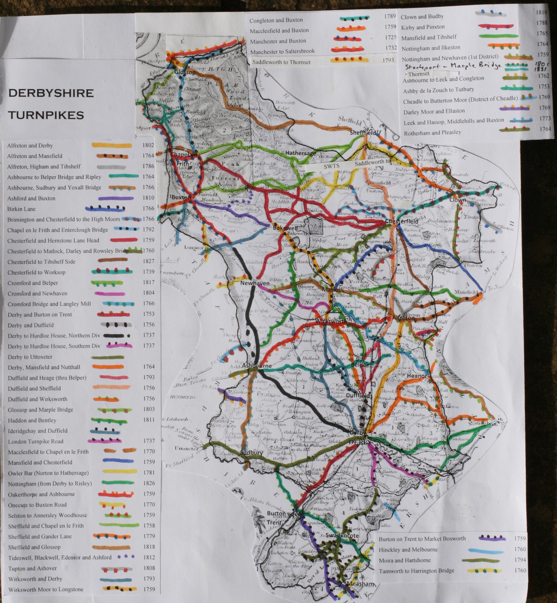
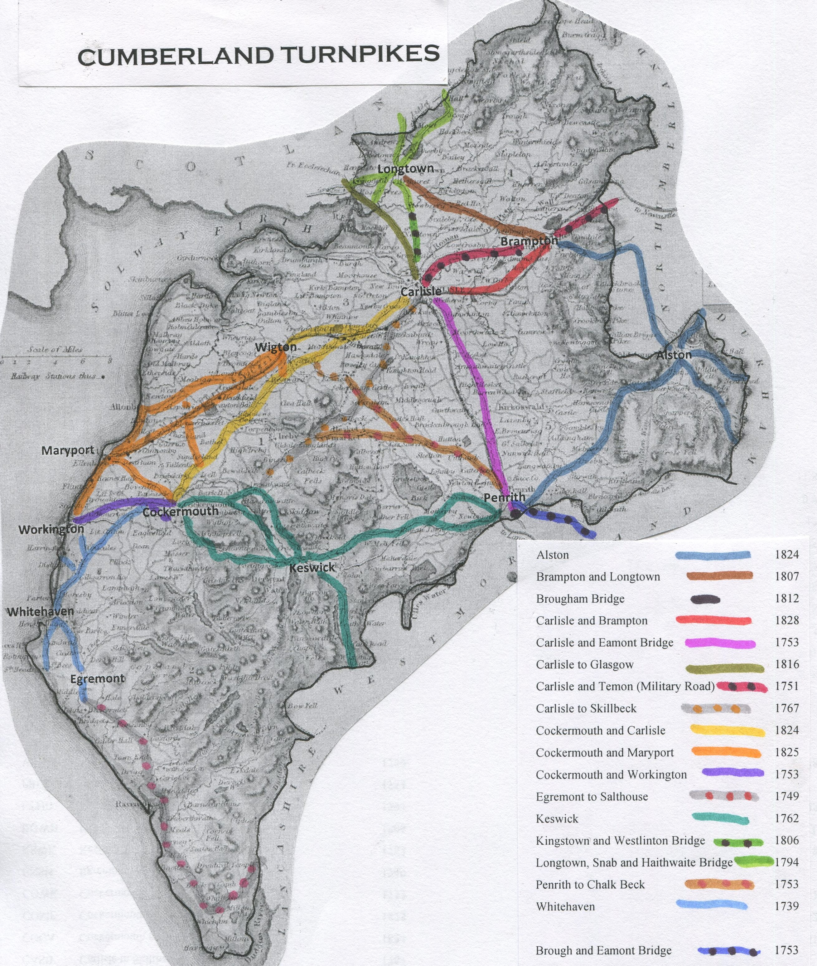
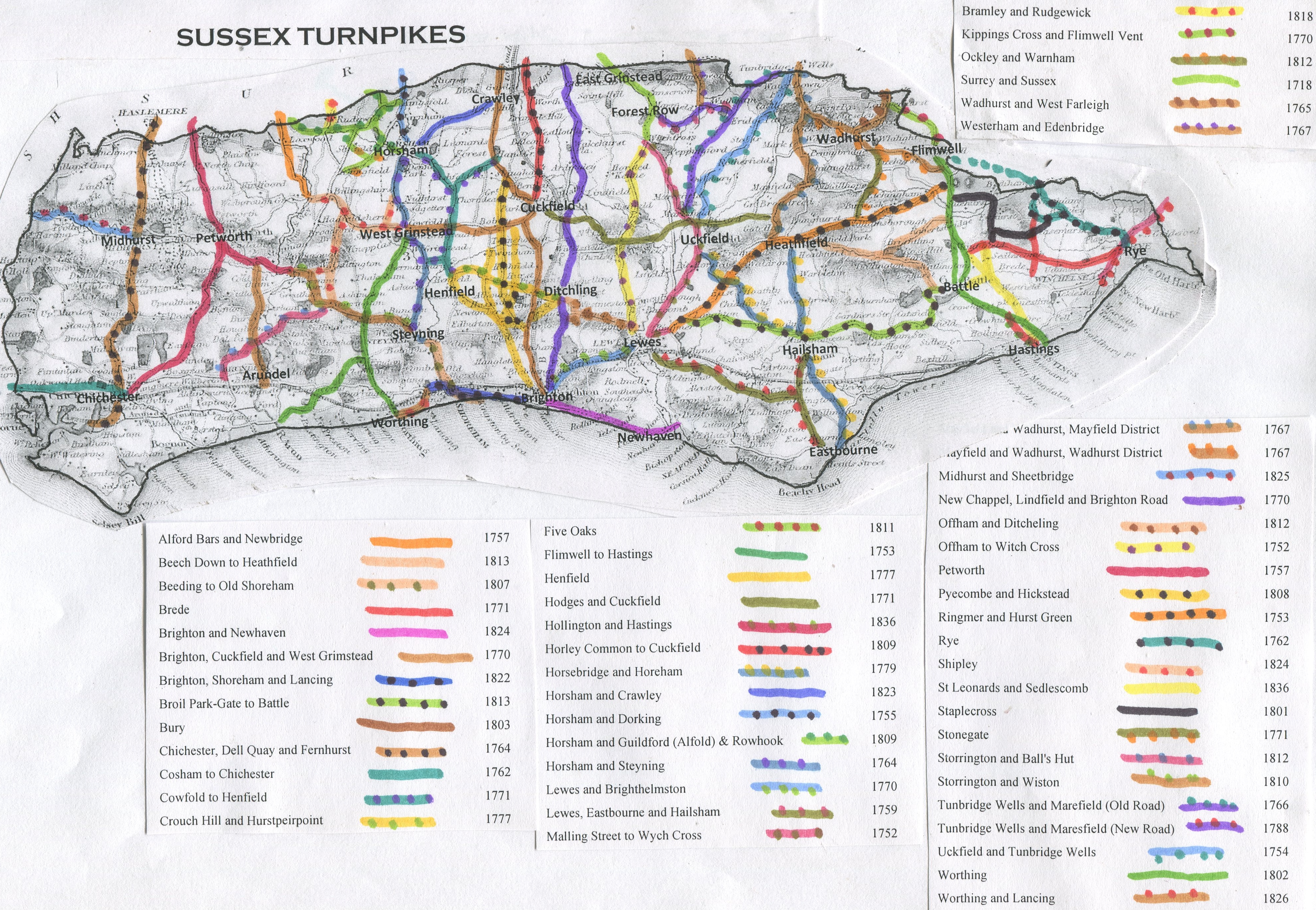
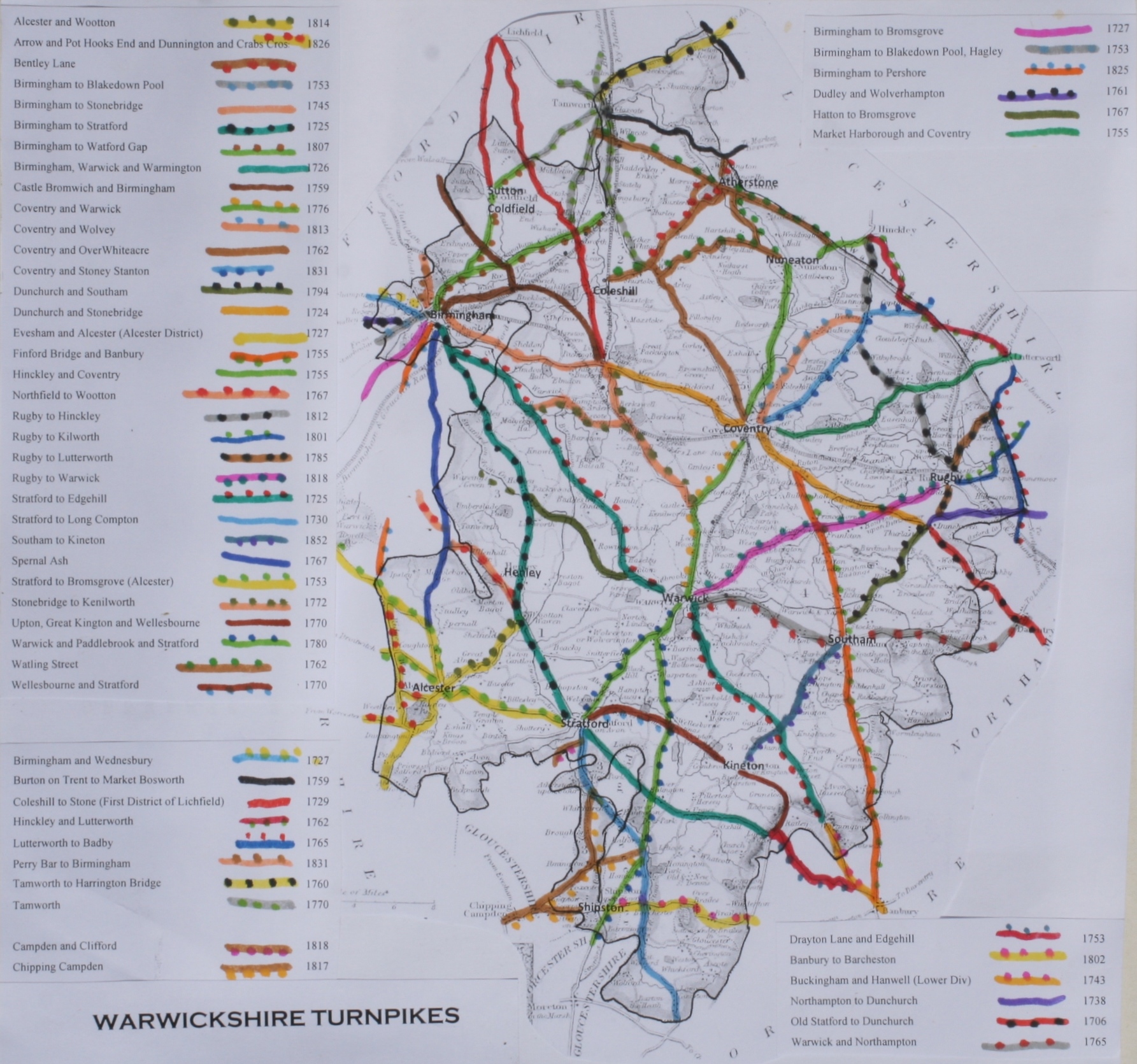
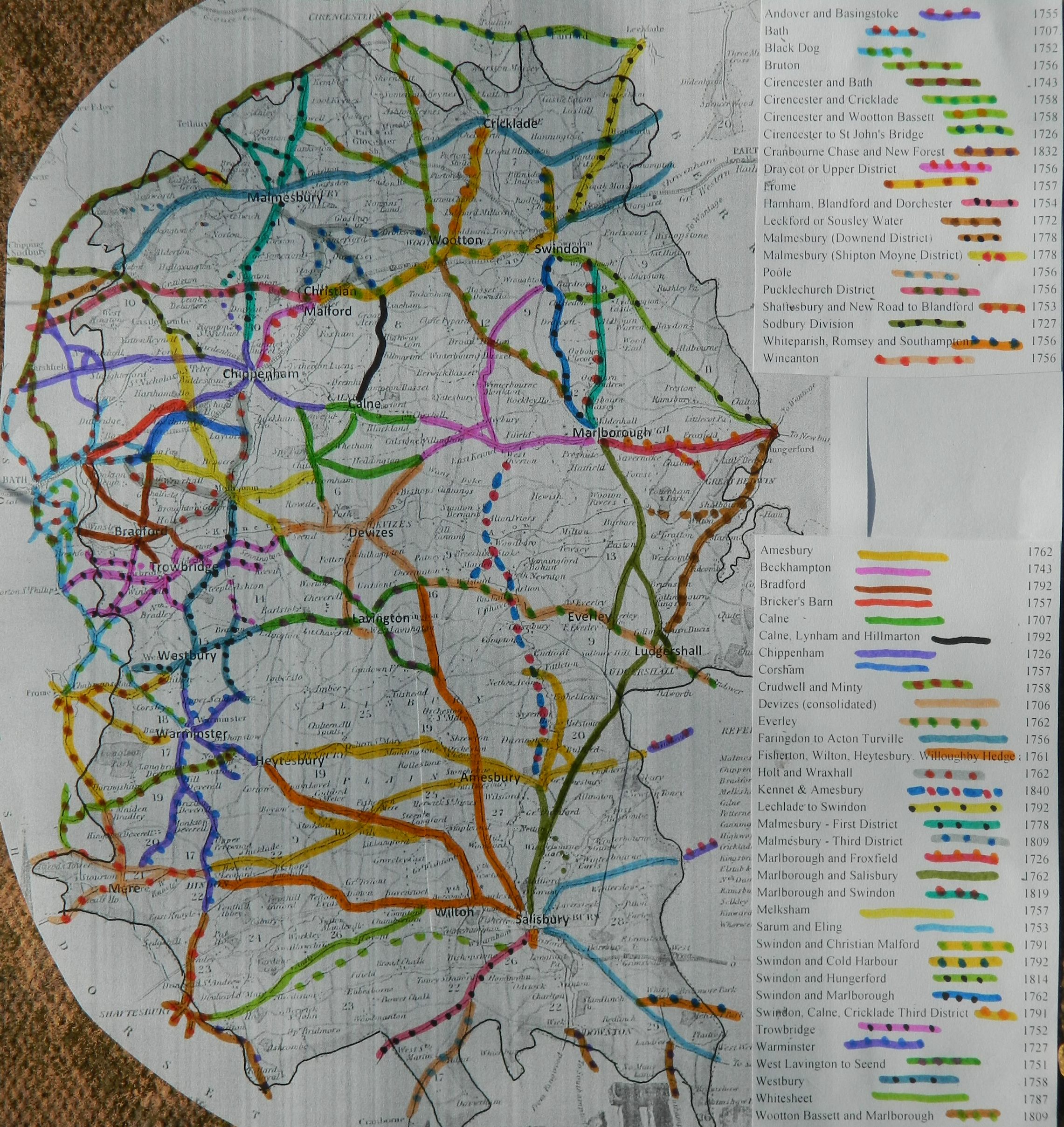
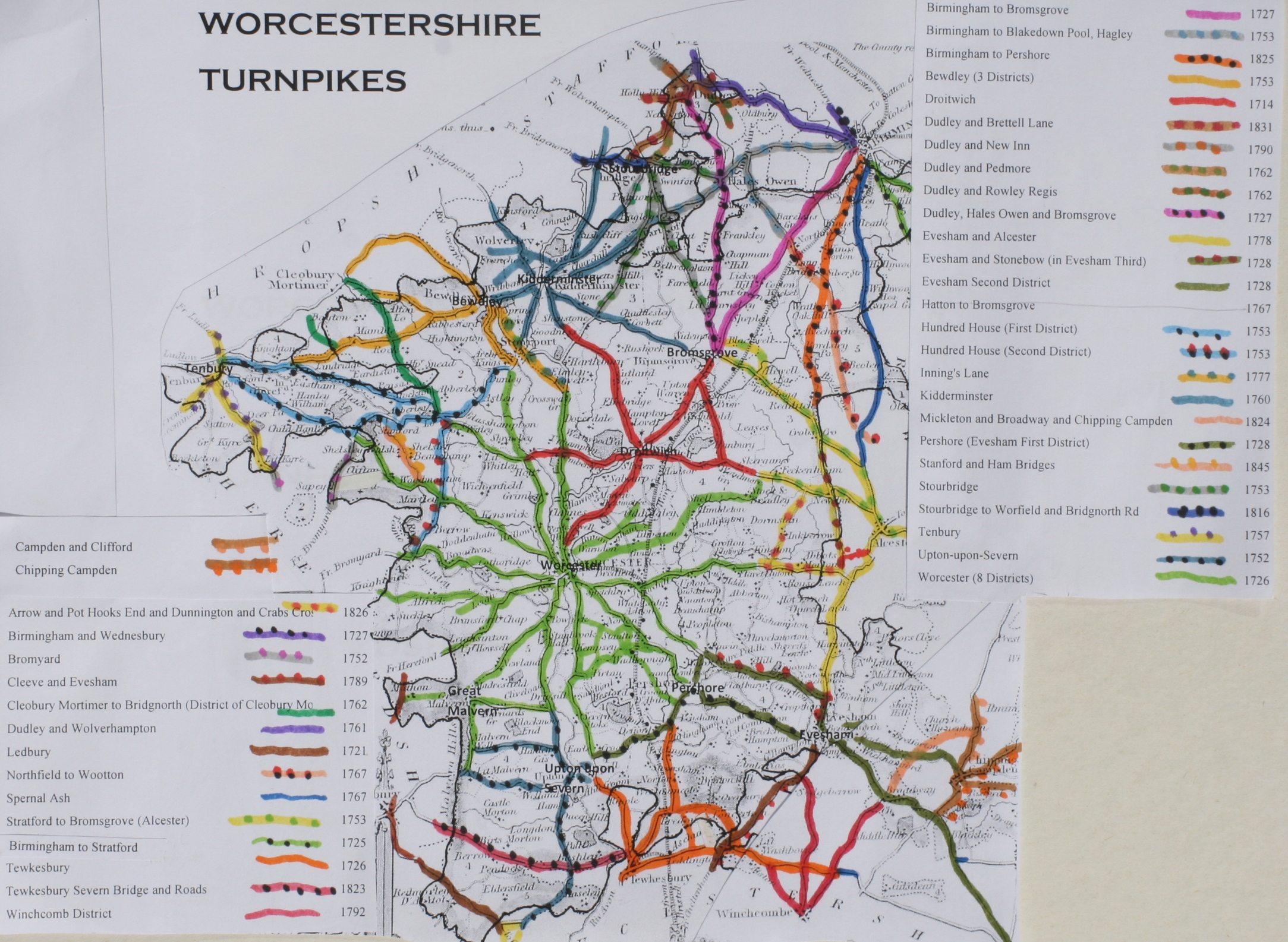
a) List of Turnpike Trusts in England
& Turnpike Trusts in Wales and the equivalent modern
road
b) List of Toll Bridges & ferries
(19th cent)
c)
Town Improvement and Paving
Commissions
d)
Tollhouse and
Turnpike Data for English Counties
|
Turnpike gates & Tollhouses by
county * |
|
supplemented by |
|
FG Emmison (1936); |
||
|
|
||
|
|
||
|
|
||
|
|
||
|
|
||
|
|
||
|
|
||
|
|
||
|
report by R Good |
||
|
|
||
|
P. Taylor (2010) |
||
|
map by Gloucs RO |
||
|
D Viner (1969); |
||
|
|
||
|
H Hurley (1992) |
||
|
|
||
|
A Cossons (2003) |
||
|
|
||
|
S Benntt (1993) |
||
|
|
||
|
P. Taylor (2009 |
||
|
A Cossons (1946) |
||
|
|
||
|
A Cossons (1994) |
||
|
|
||
|
|
||
|
JB Bentley & BJ Murless (1985) |
||
|
report by J. Higgins (2008) |
||
|
P. Taylor (2009). |
||
|
|
||
|
B Austin (2005-8) |
||
|
A Cossons (1946); |
||
|
|
||
|
Victorian History of Wiltshire, (1959) |
||
|
Worcestershire |
Worcestershire |
Scaplehorn & Swann ((2008) |
|
Macmahon (1964) |
||
|
|
||
|
|
*There was not necessarily a tollhouse at each gate –
side, check and chain gates in particular may have had no residential
accommodation beside them.
e)
Tollhouse and
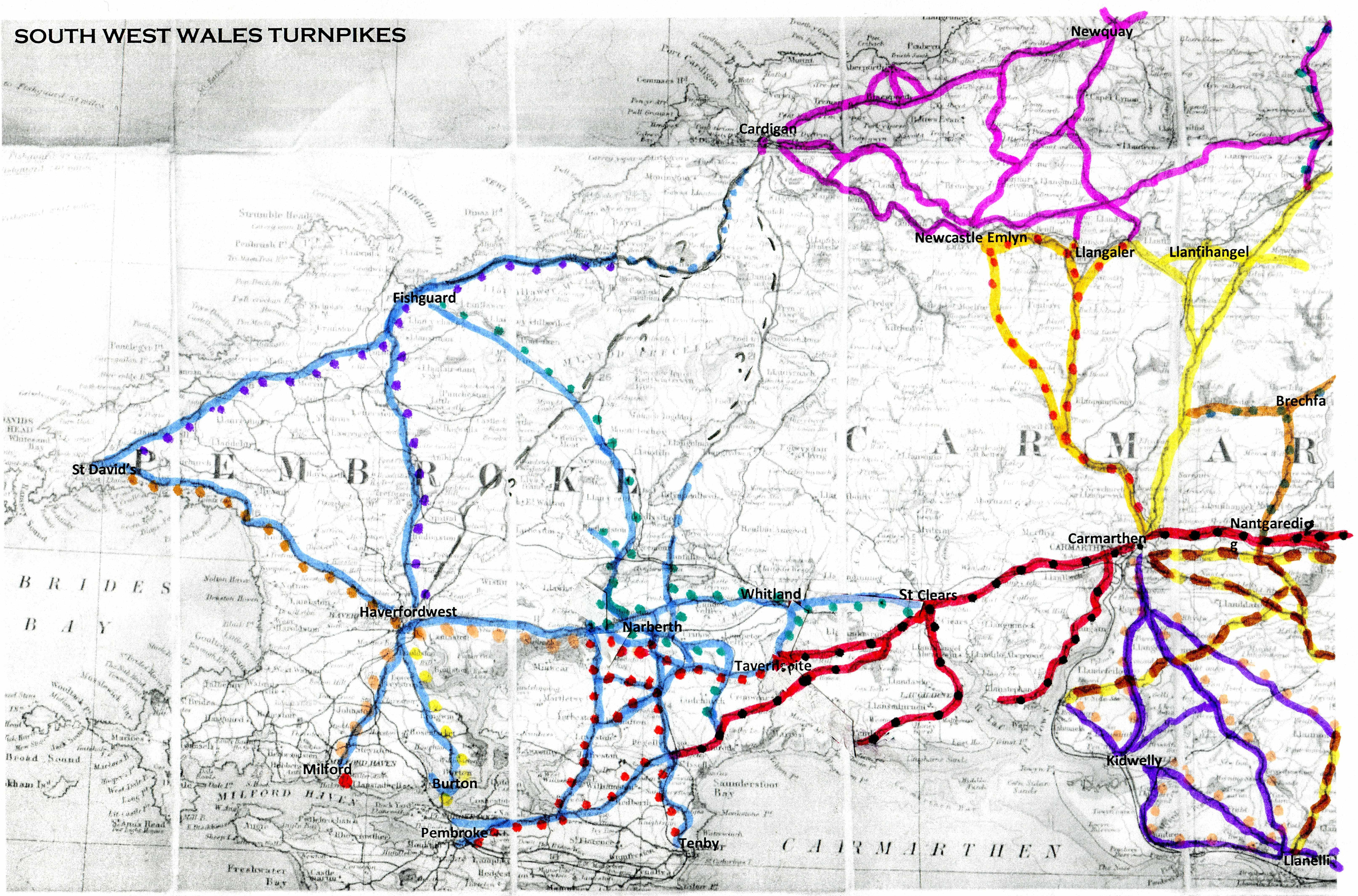
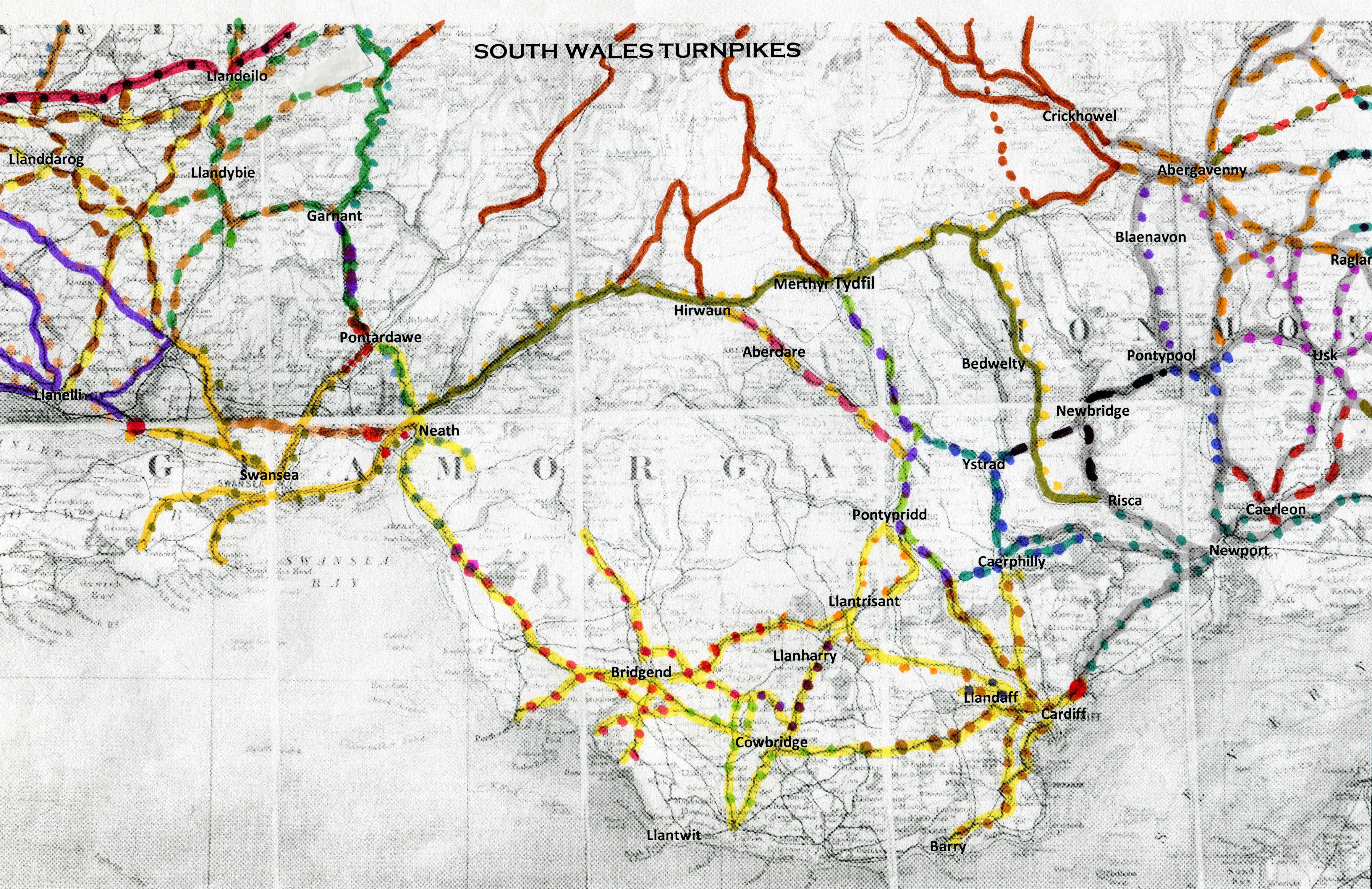
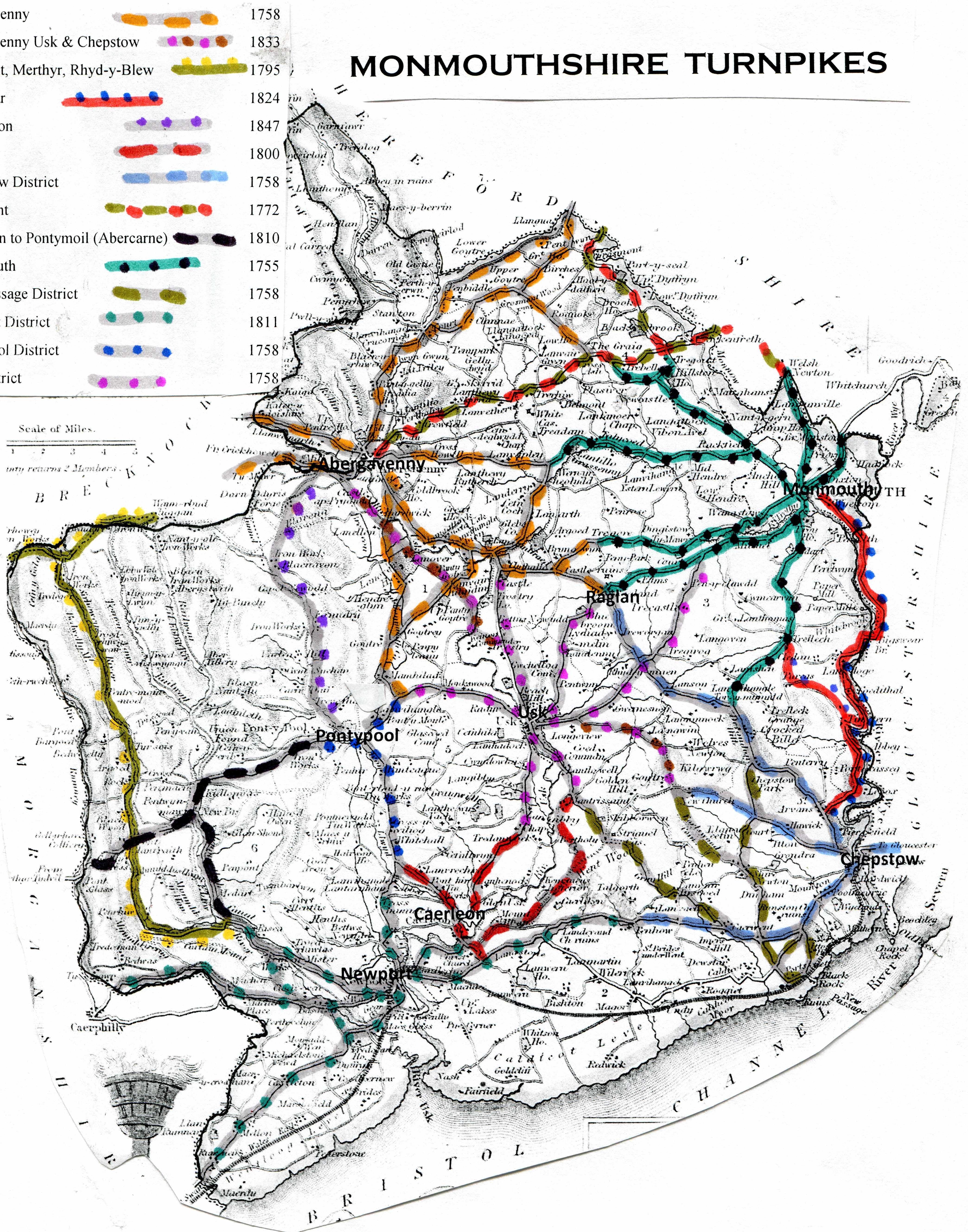
Turnpike Data for Welsh Counties
The data on Welsh tollgates has been reviewed and augmented by information in a dedicated database created by Chris Woodard. Thanks to Chris for sharing this.
|
Turnpike gates by area |
|
|
|
|
|
|
|
|
|
|
|
|
%20turnpikes.jpg)
%20turnpikes.jpg)
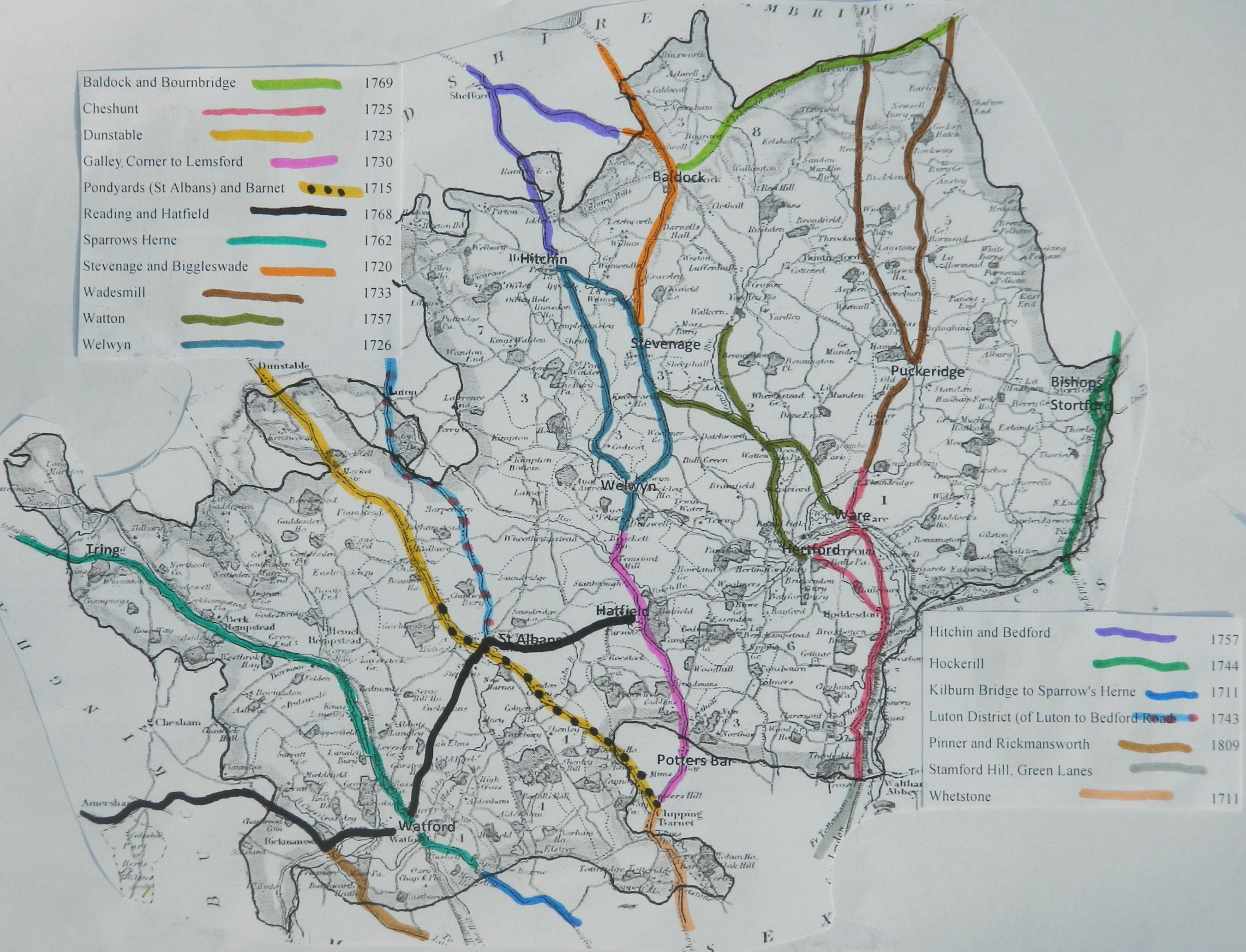
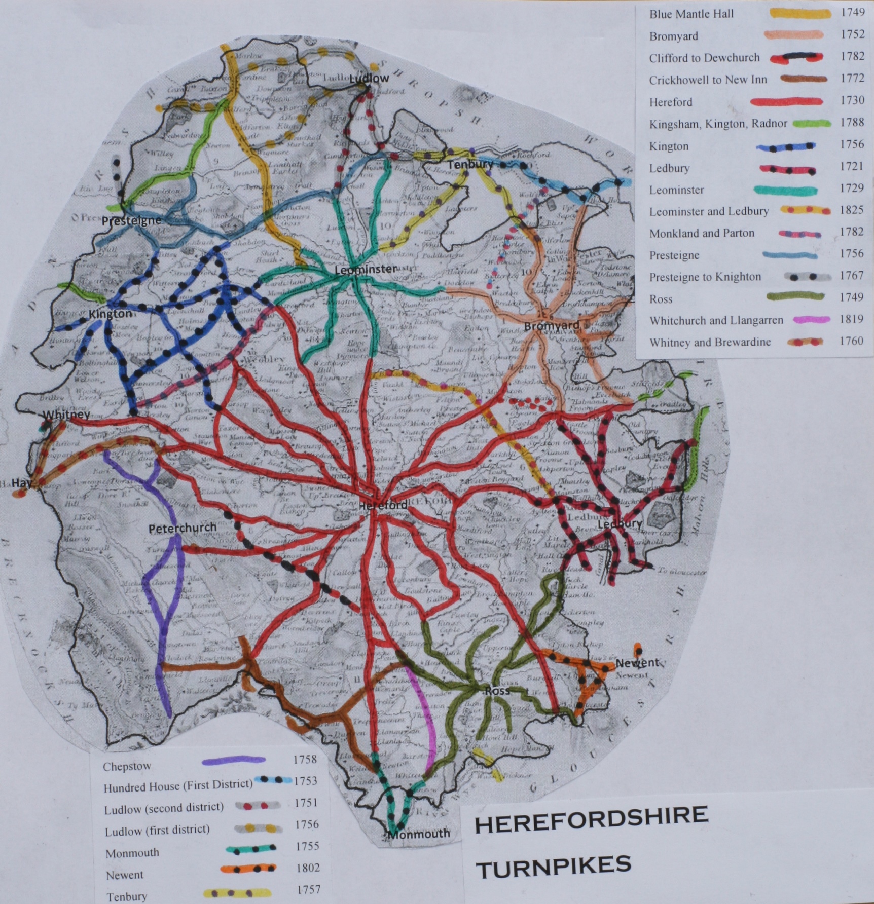
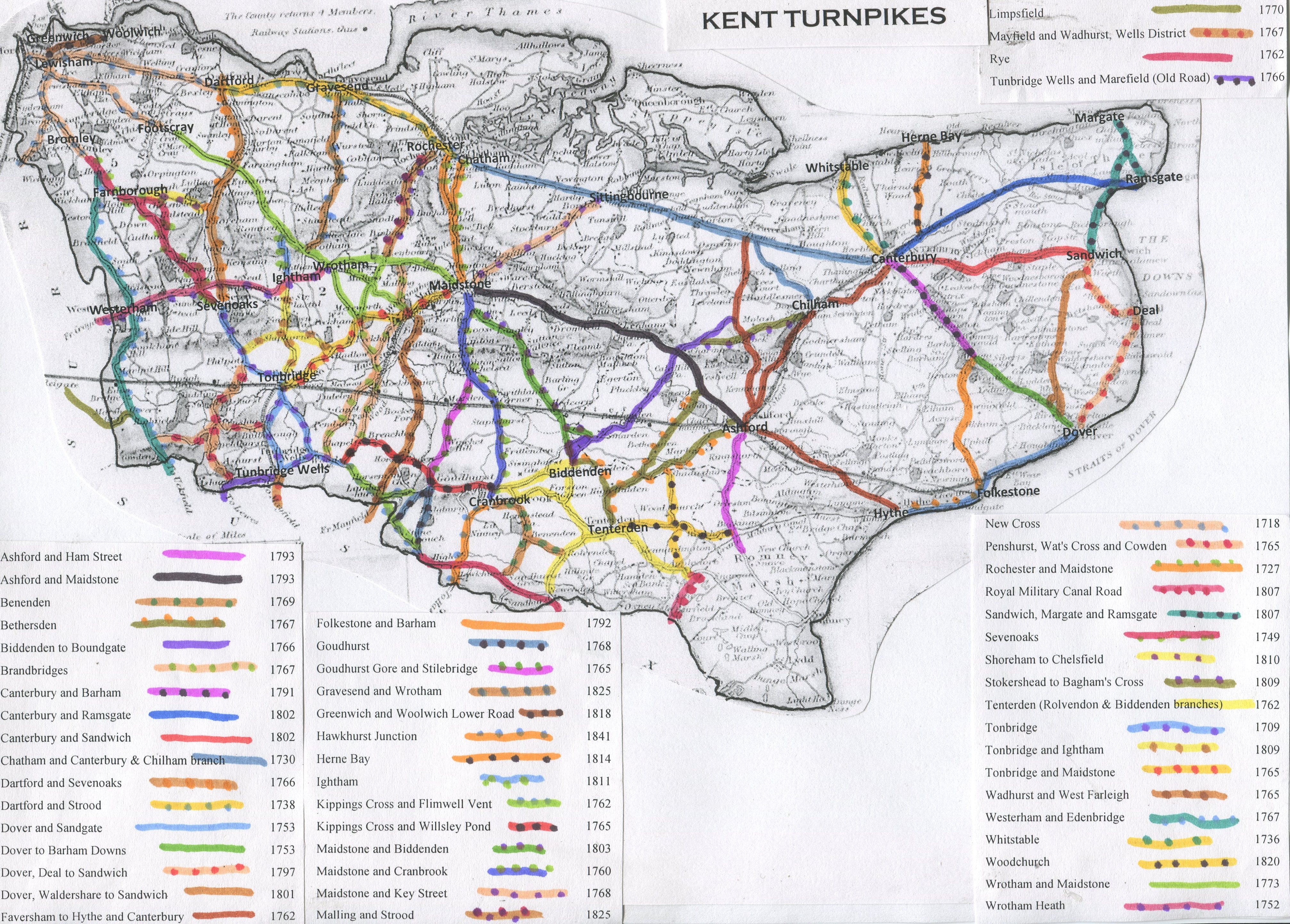
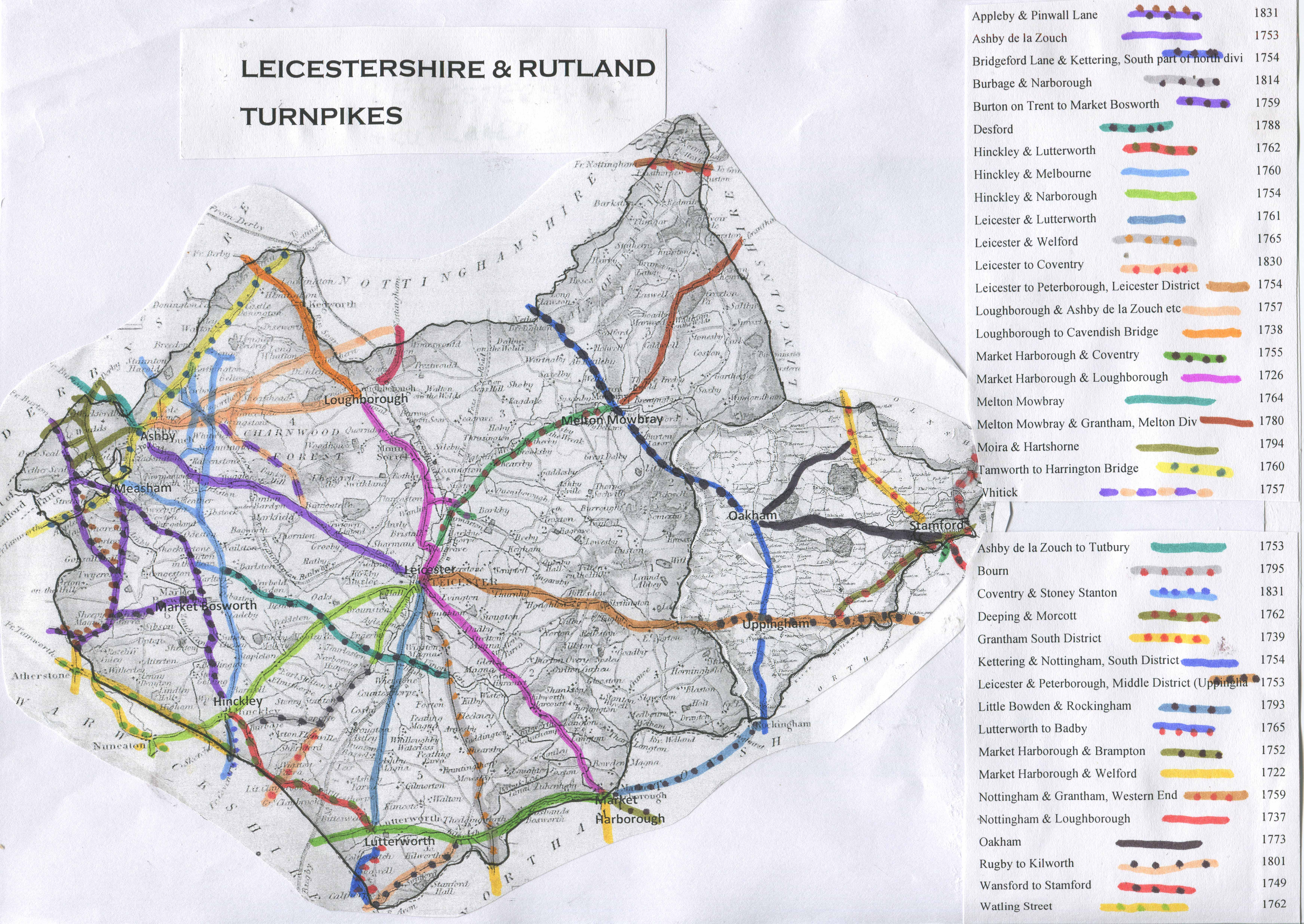
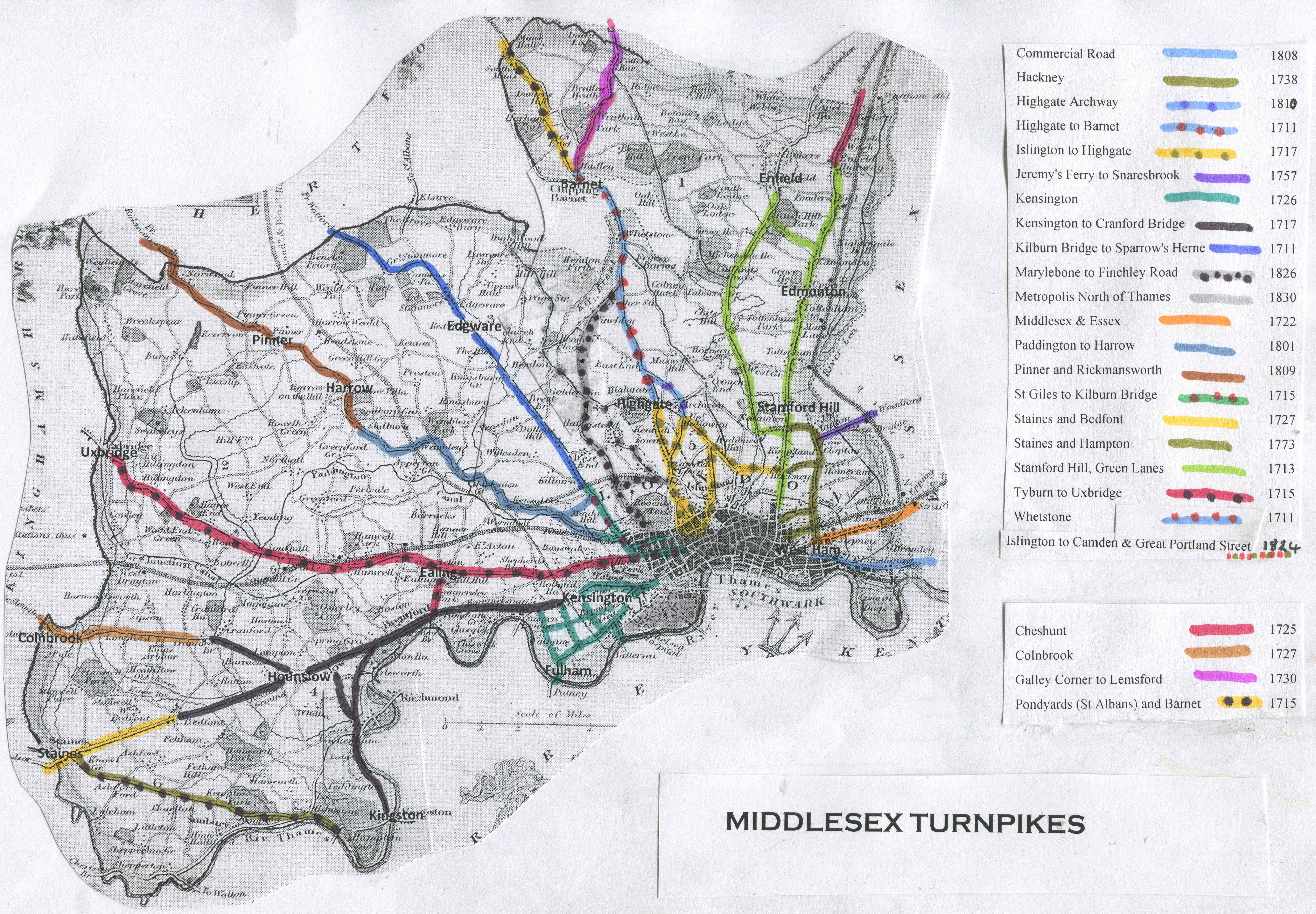
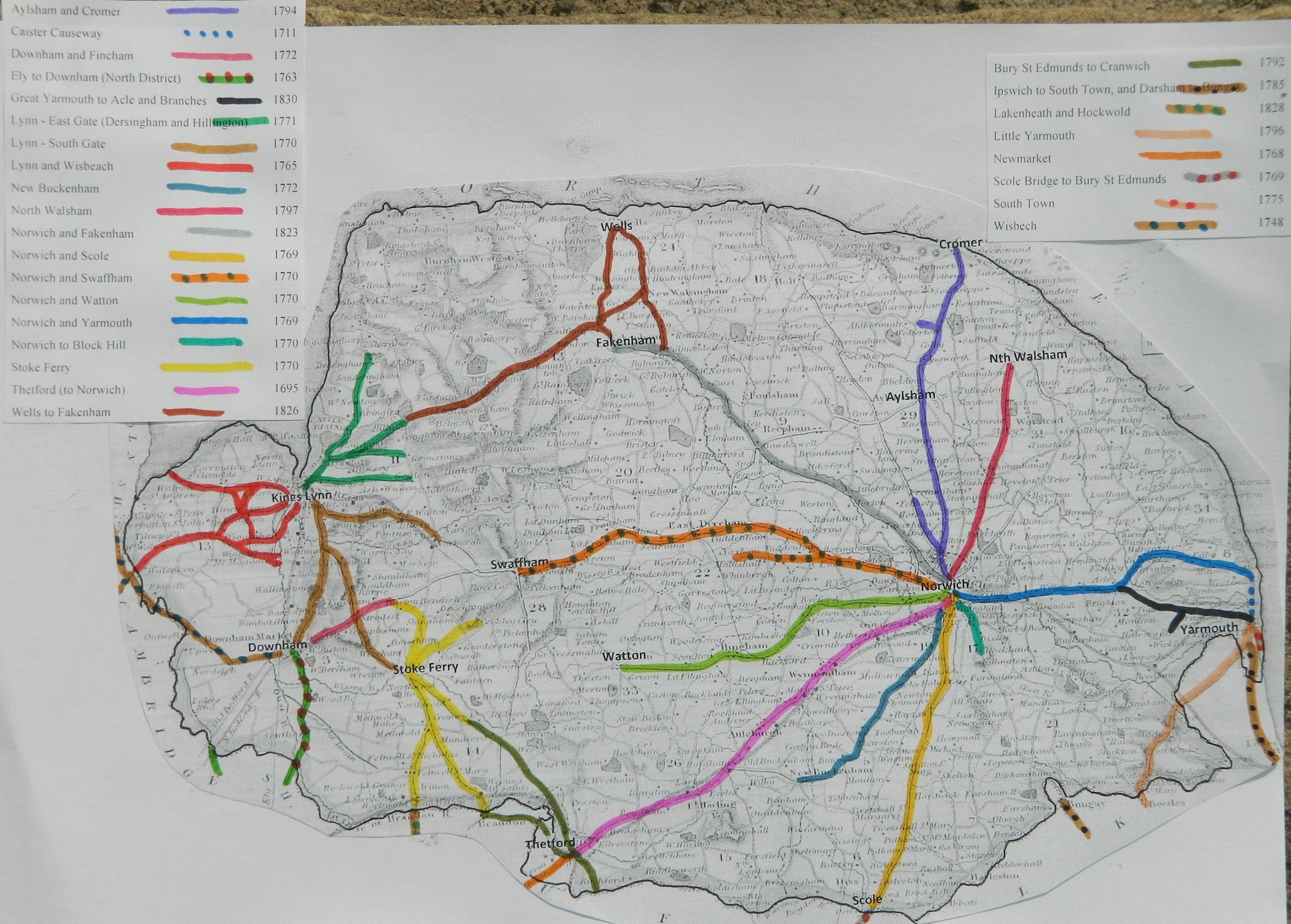
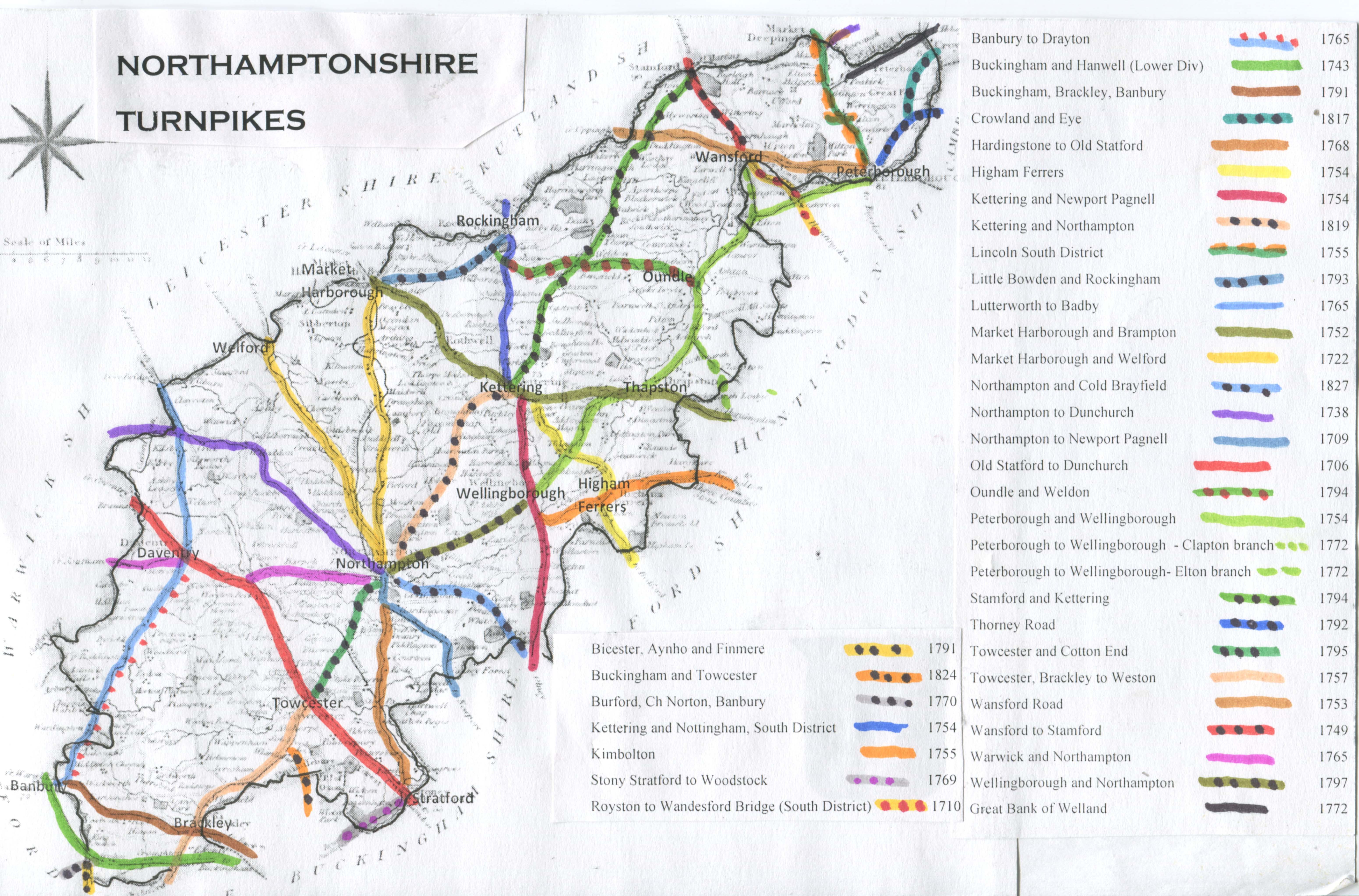
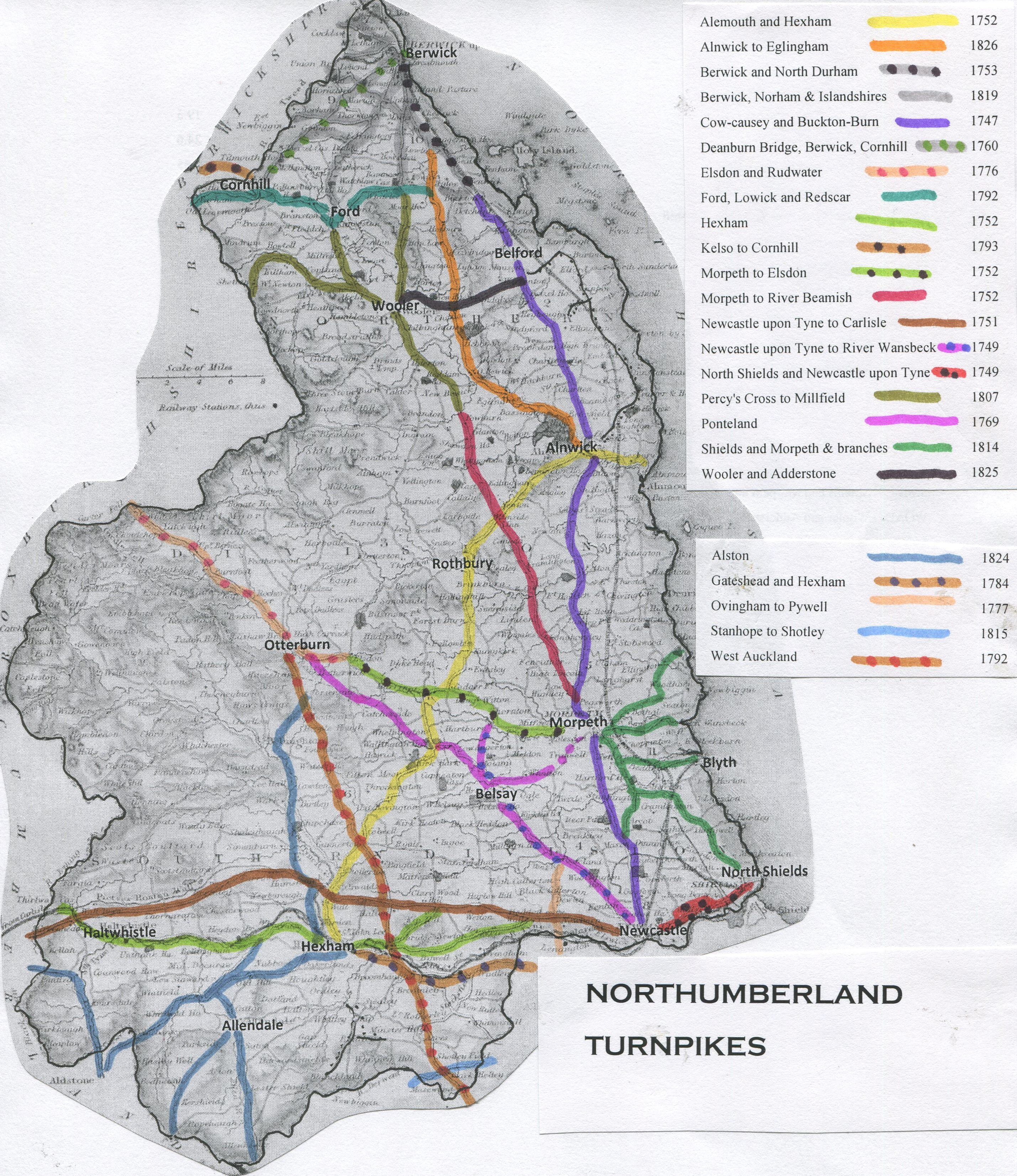
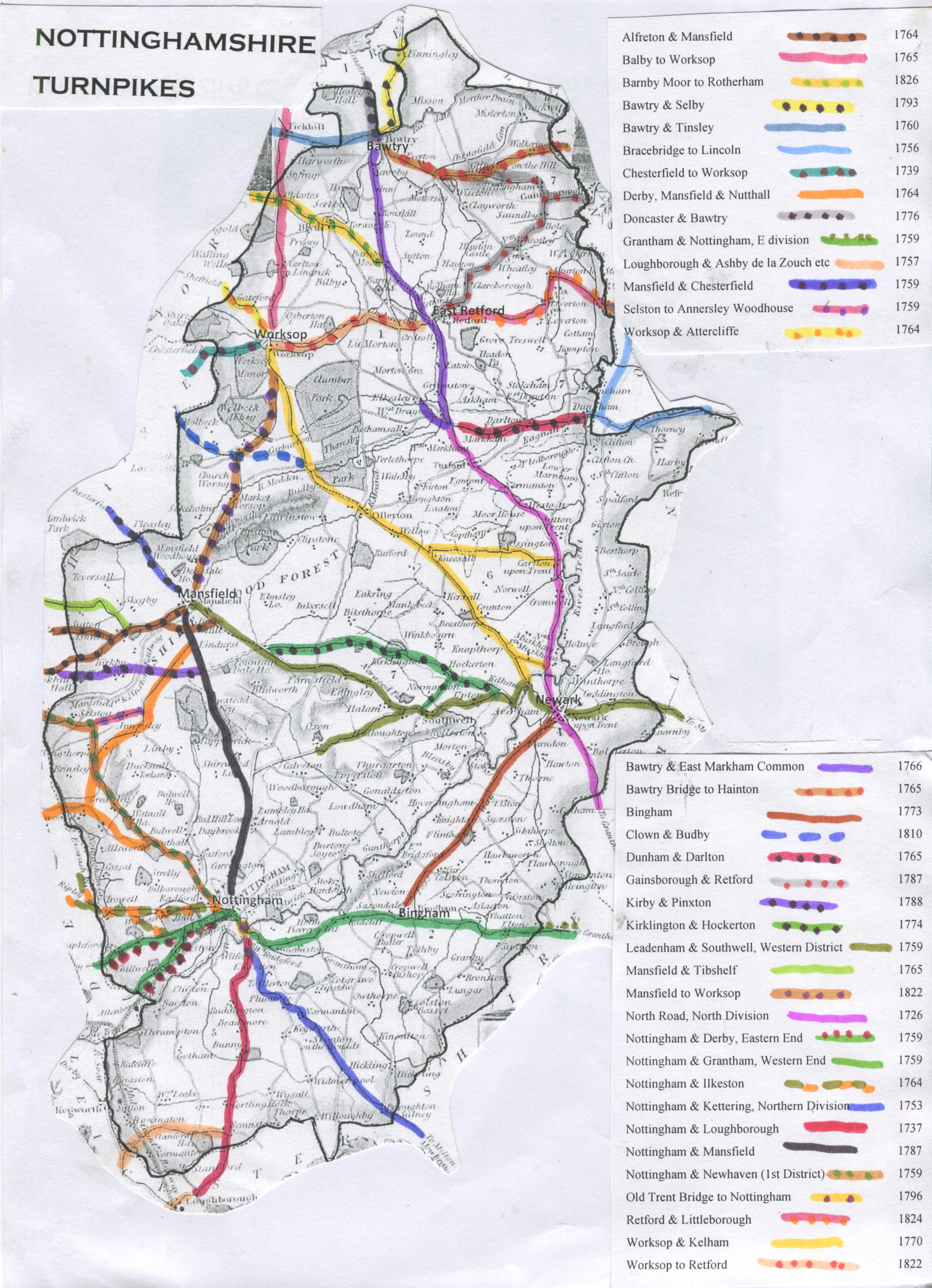
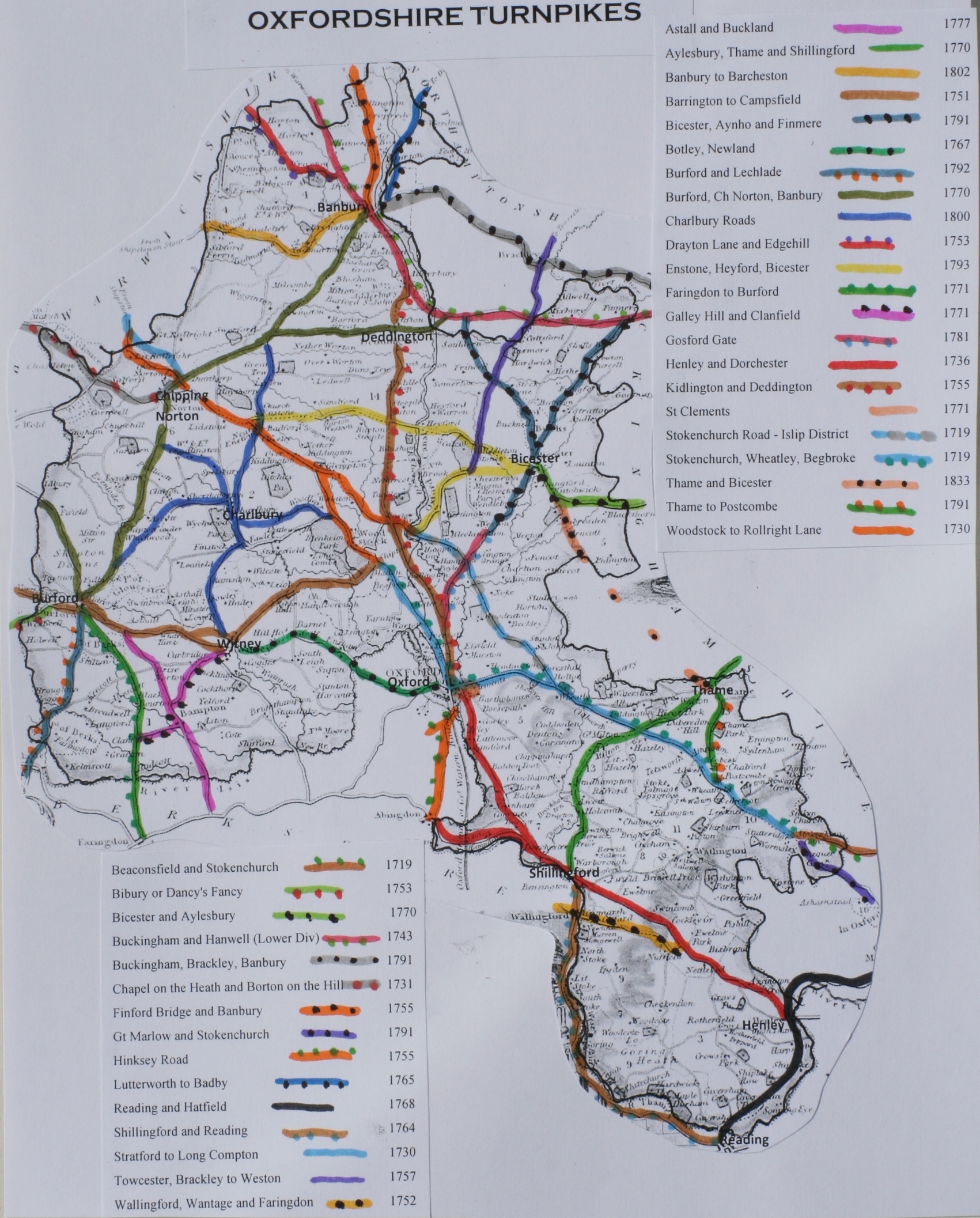
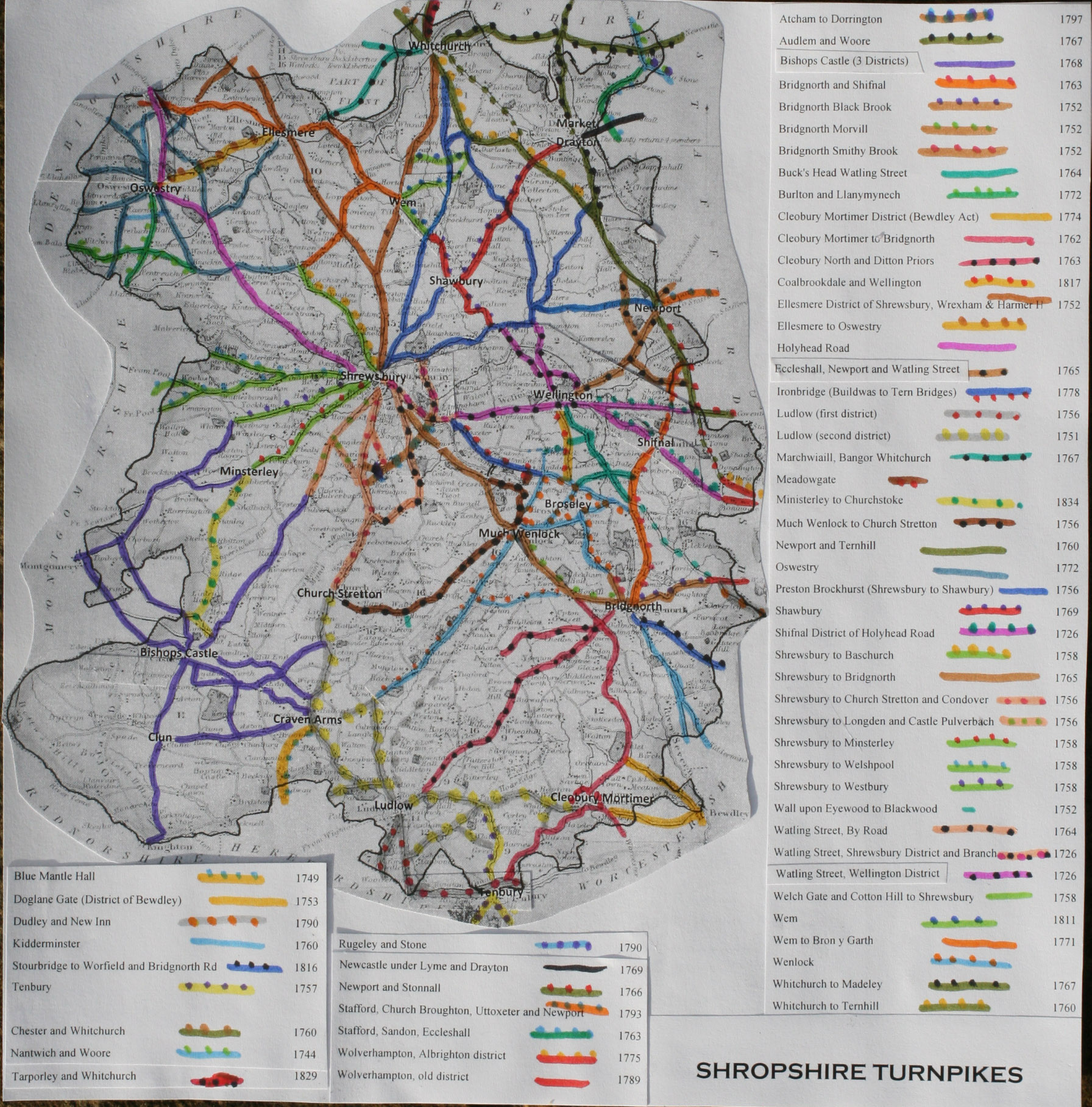
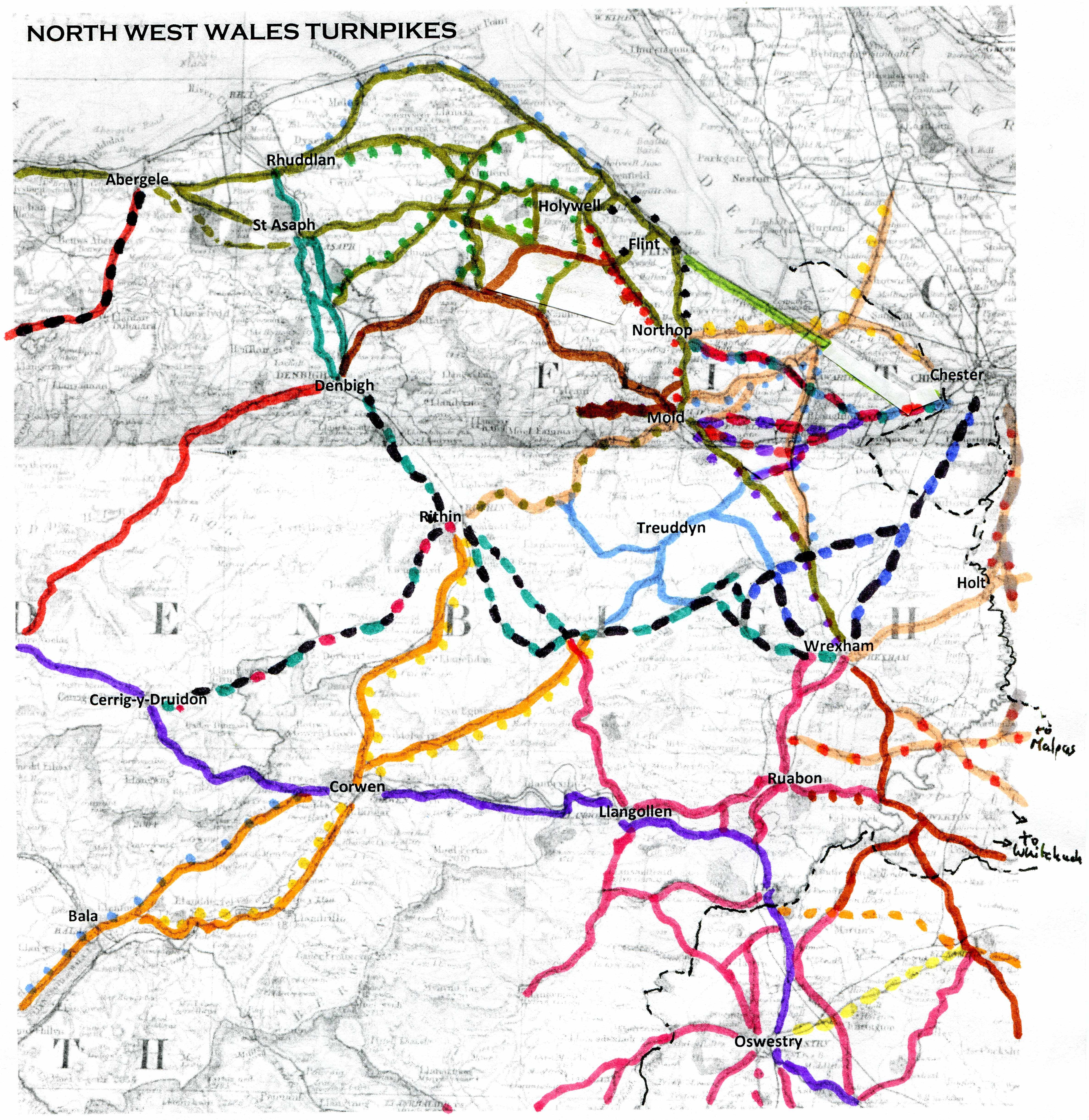
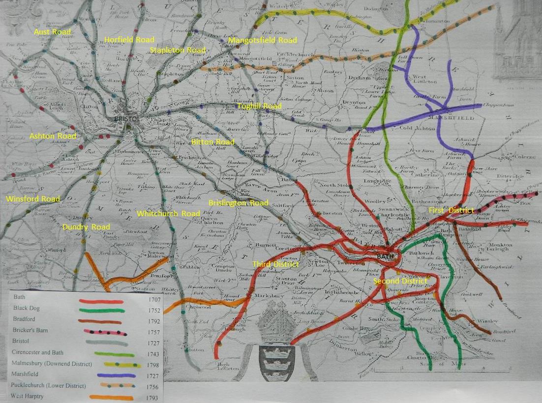
f) Detailed maps of turnpike roads/tollhouse sites in specific areas
·
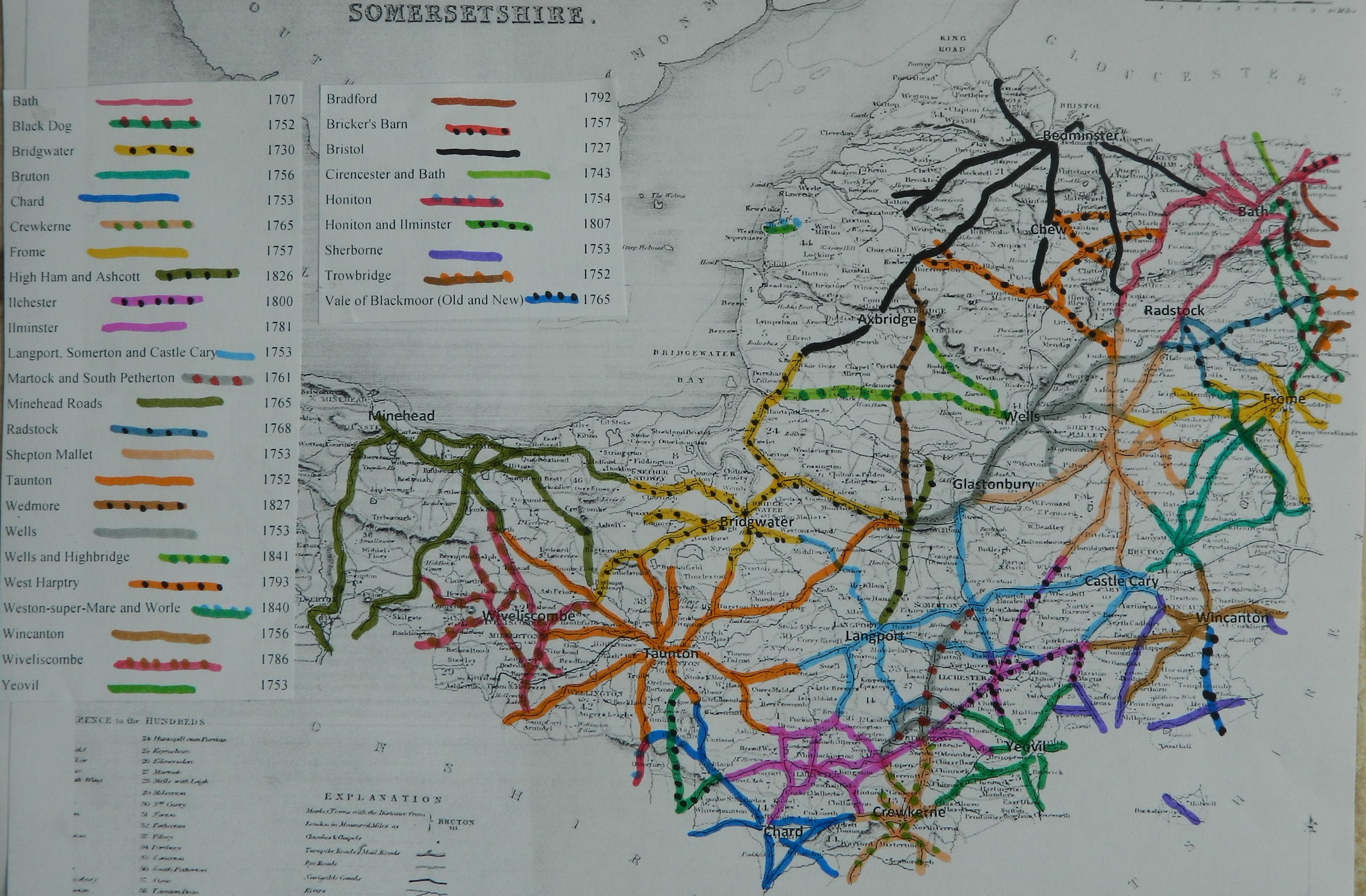
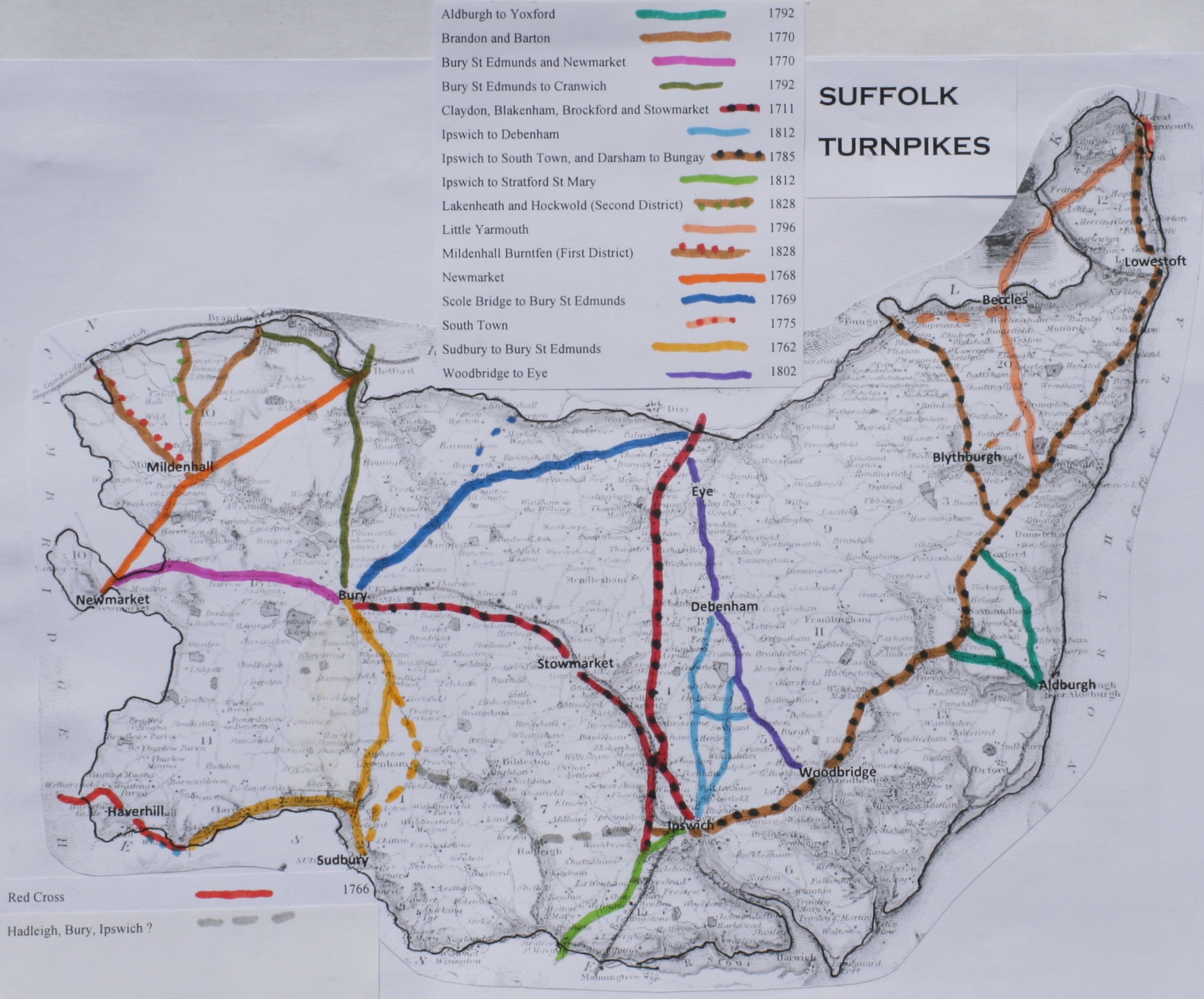
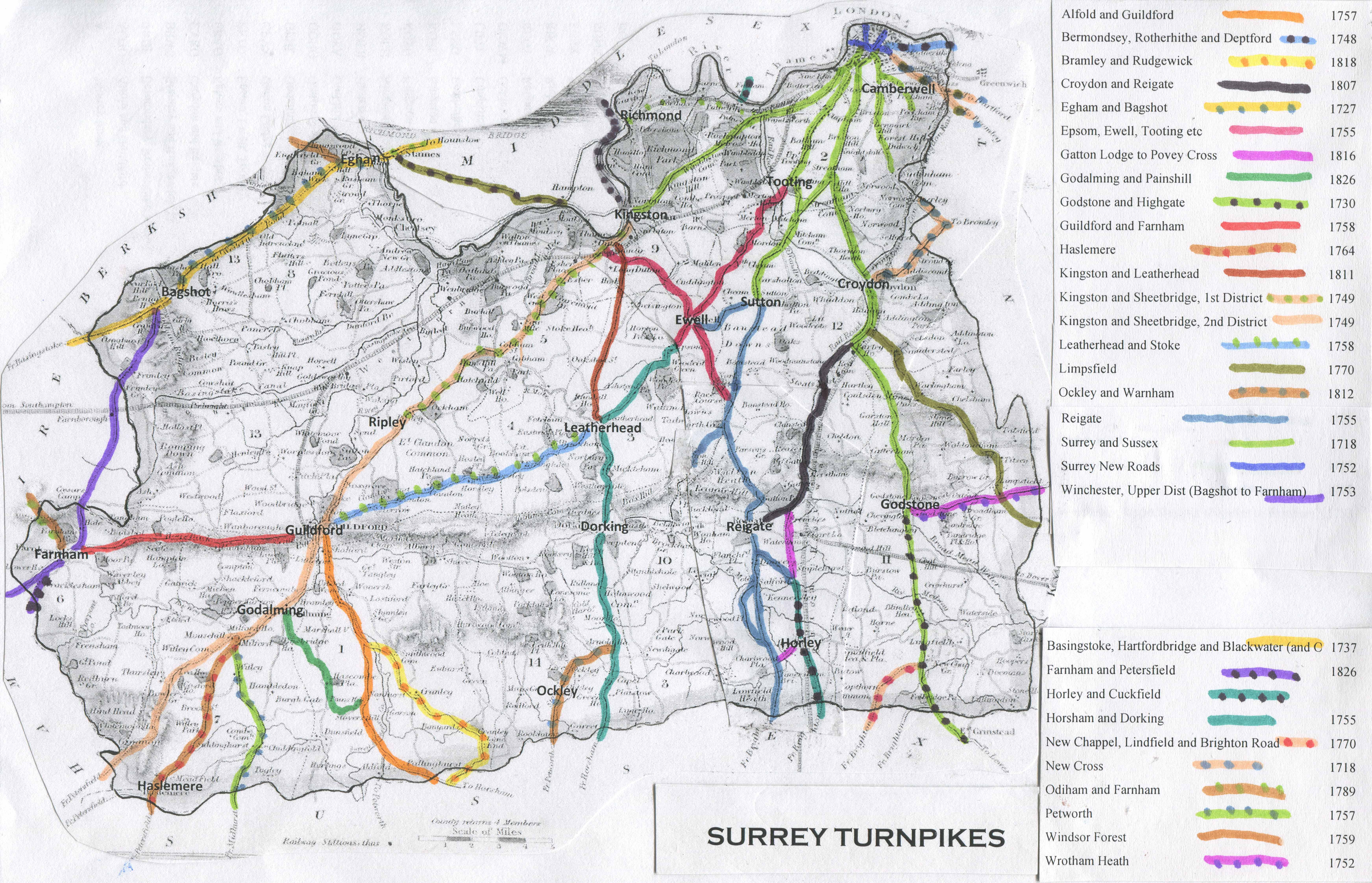
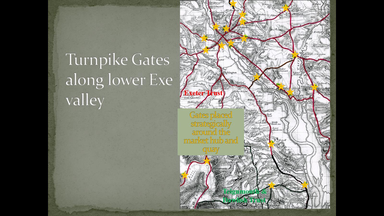
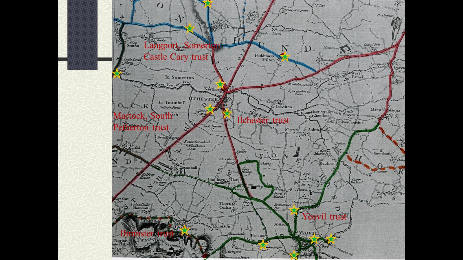
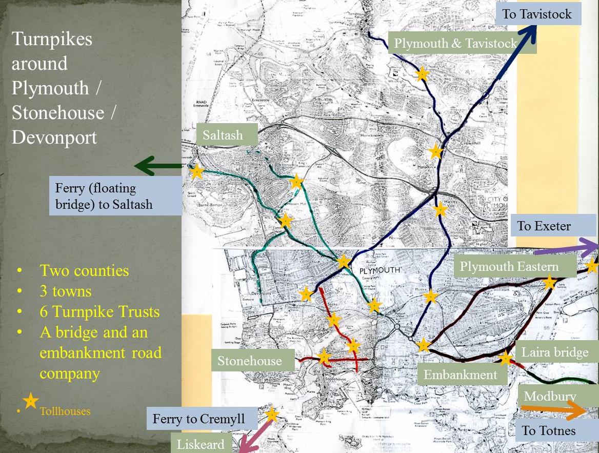
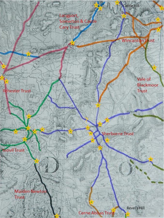
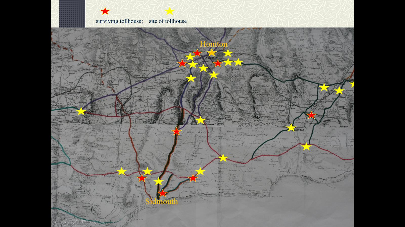
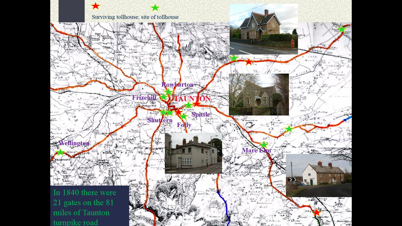
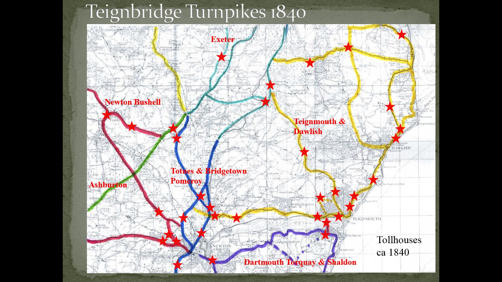
Bristol and Bath, Exeter, Ilchester, Plymouth, Sherborne, Sidmouth, Taunton, Teignmouth (with tollhouses)
·
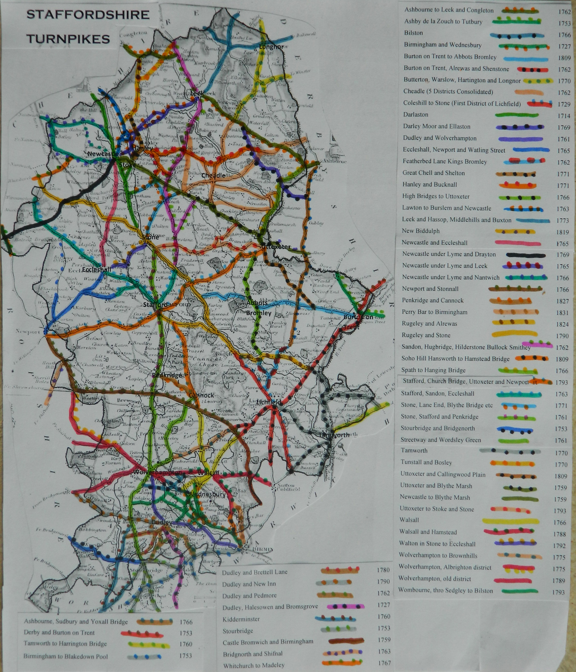
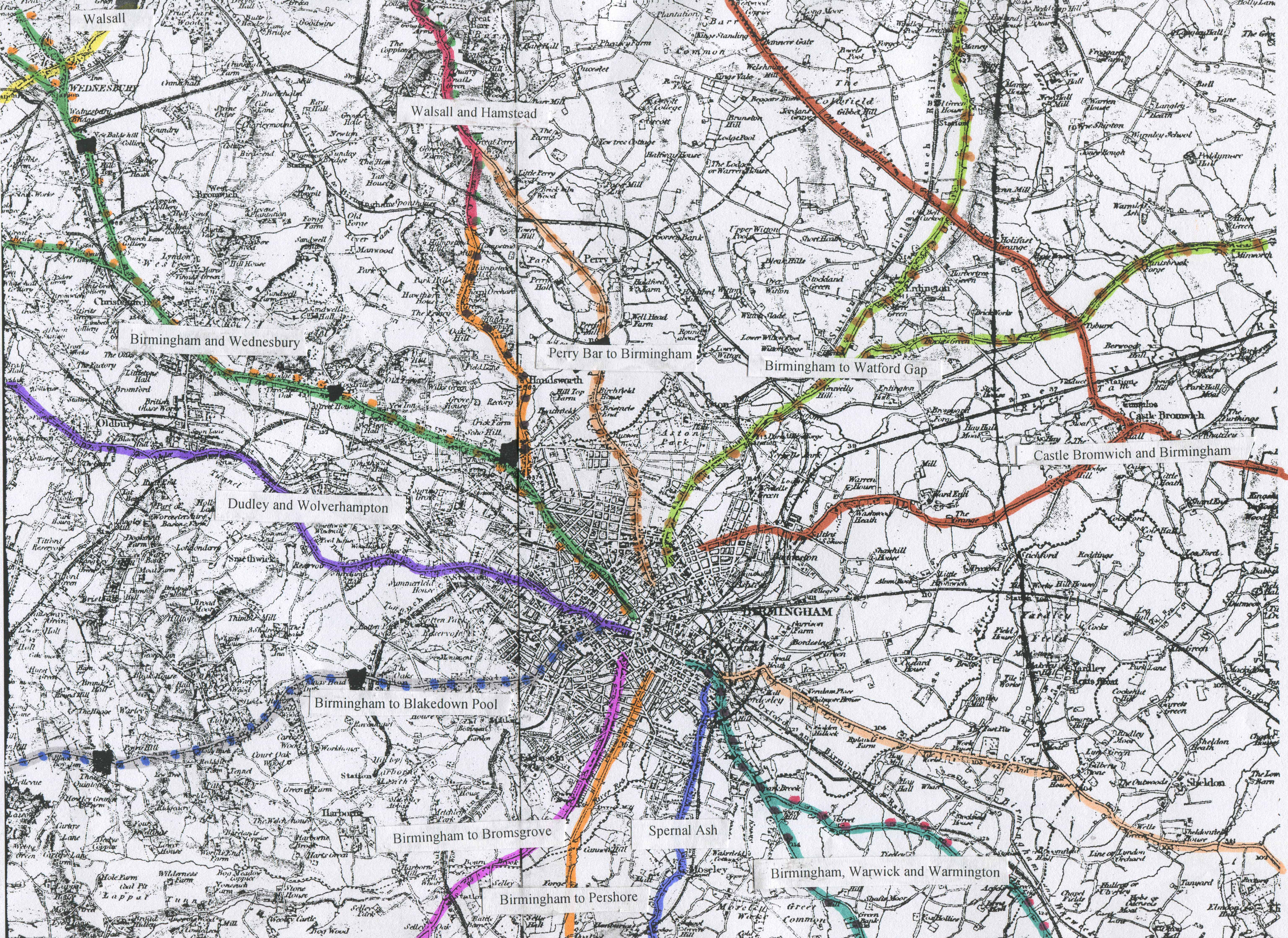
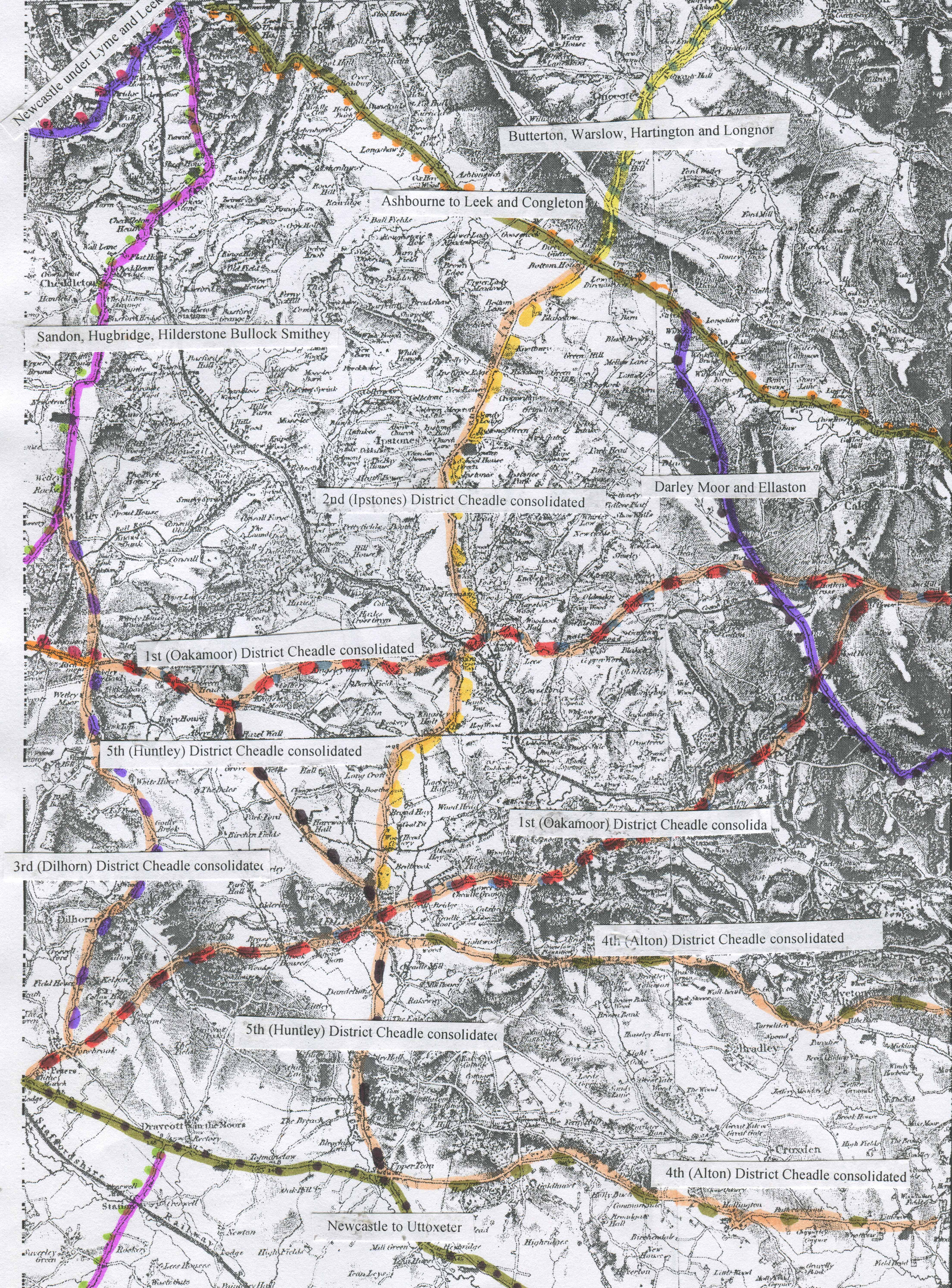
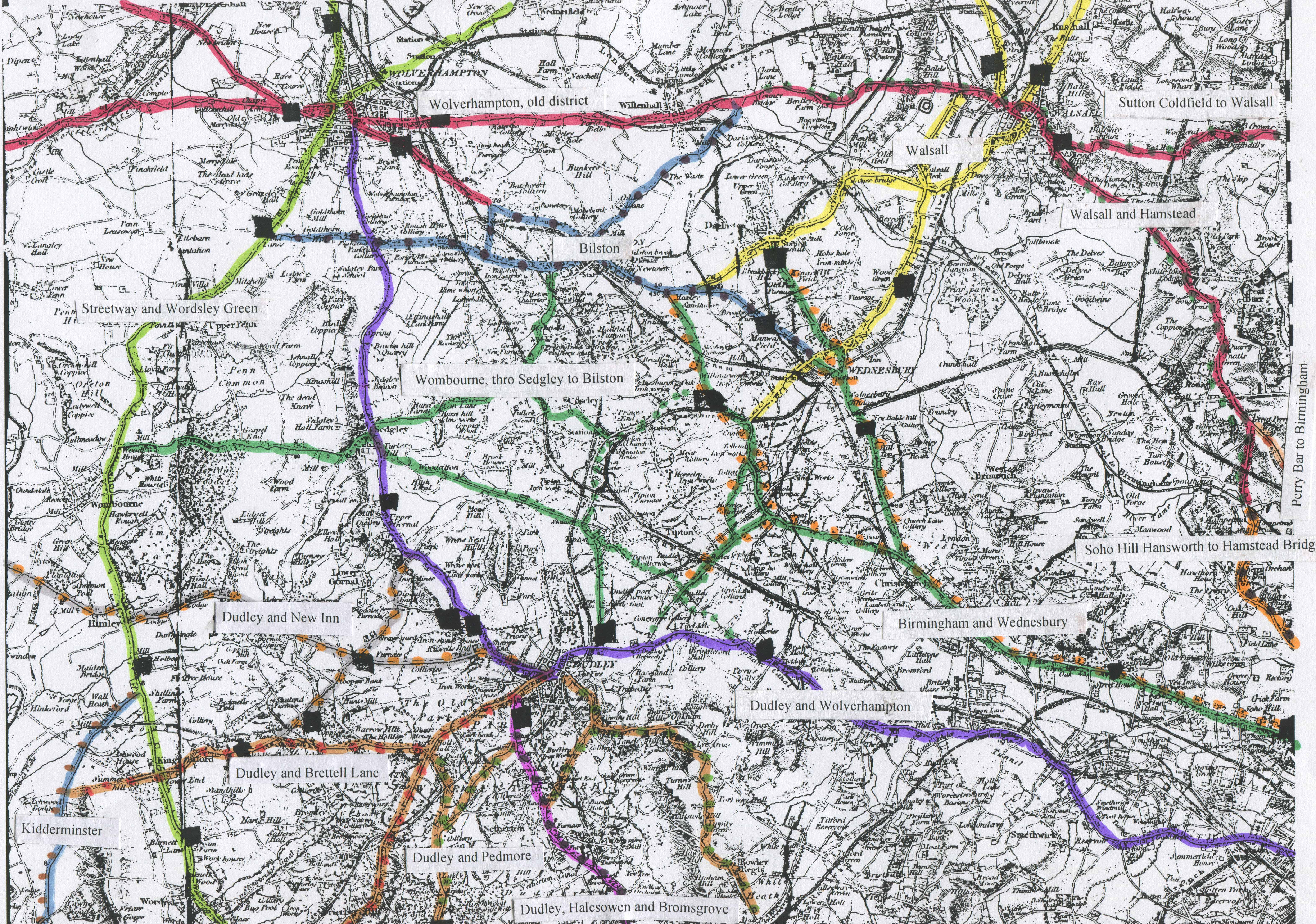
Areas of Staffordshire roads;
Birmingham, The Staffordshire
Potteries, Cheadle, The Black Country (W of
Birmingham)
·
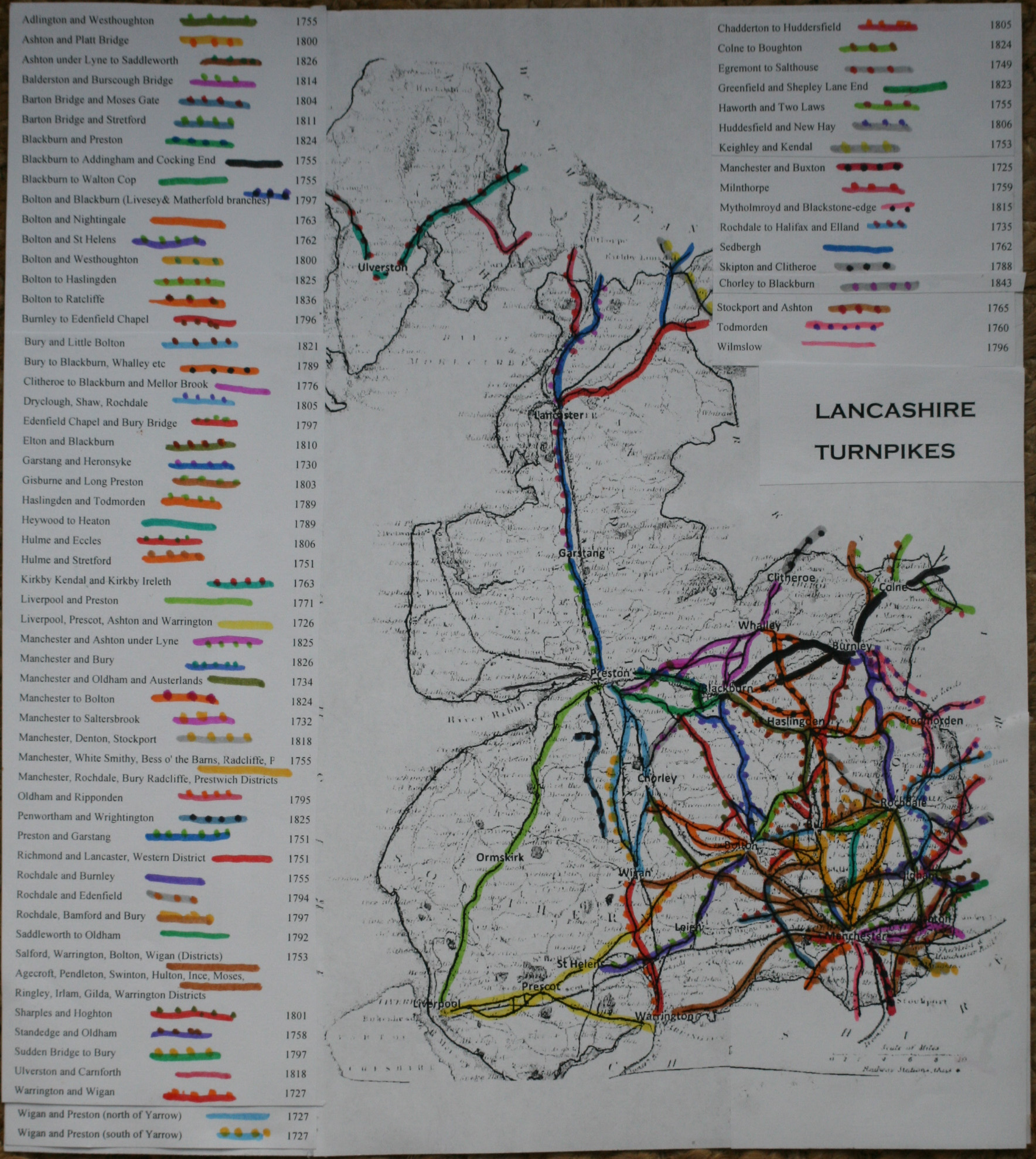
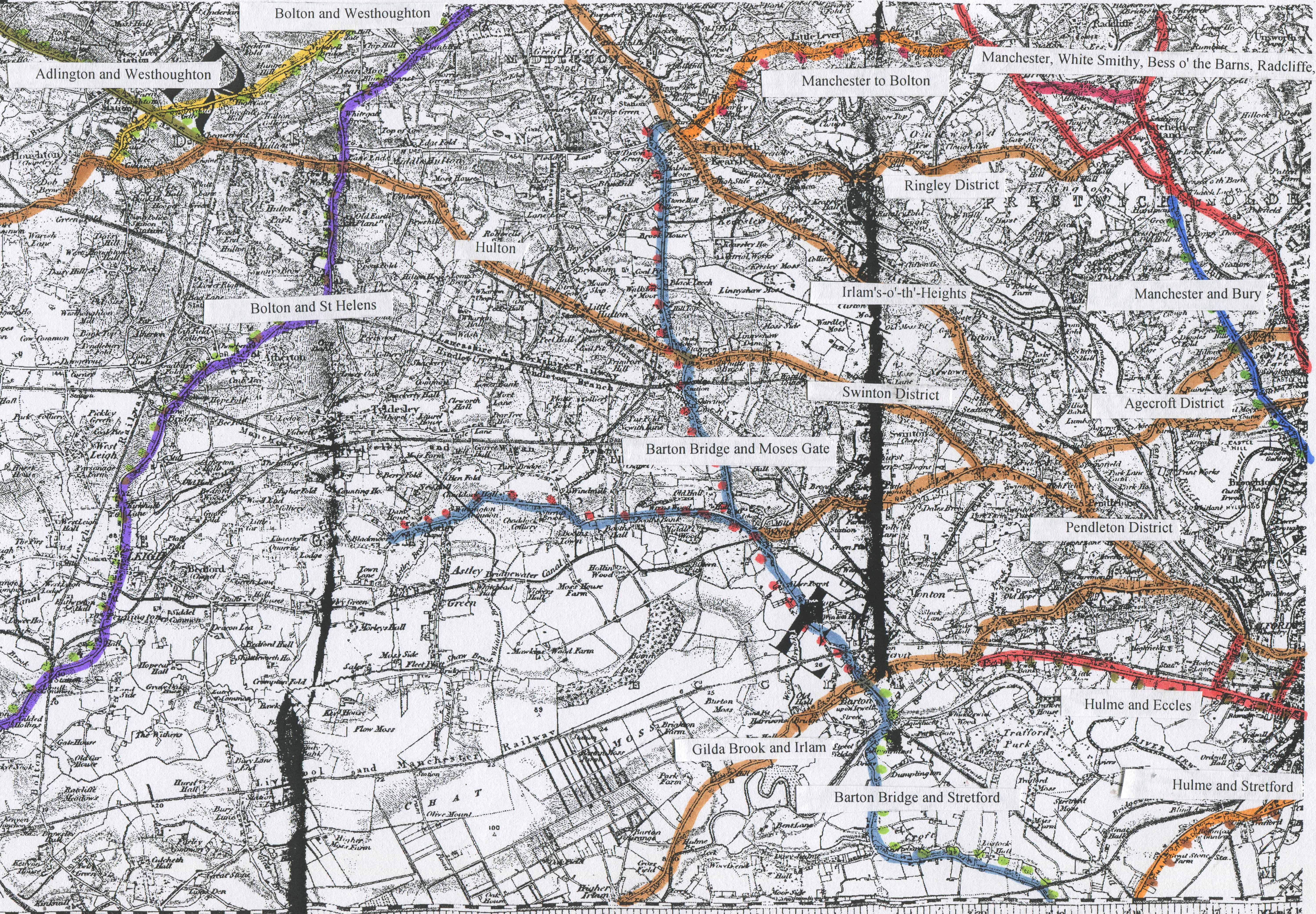
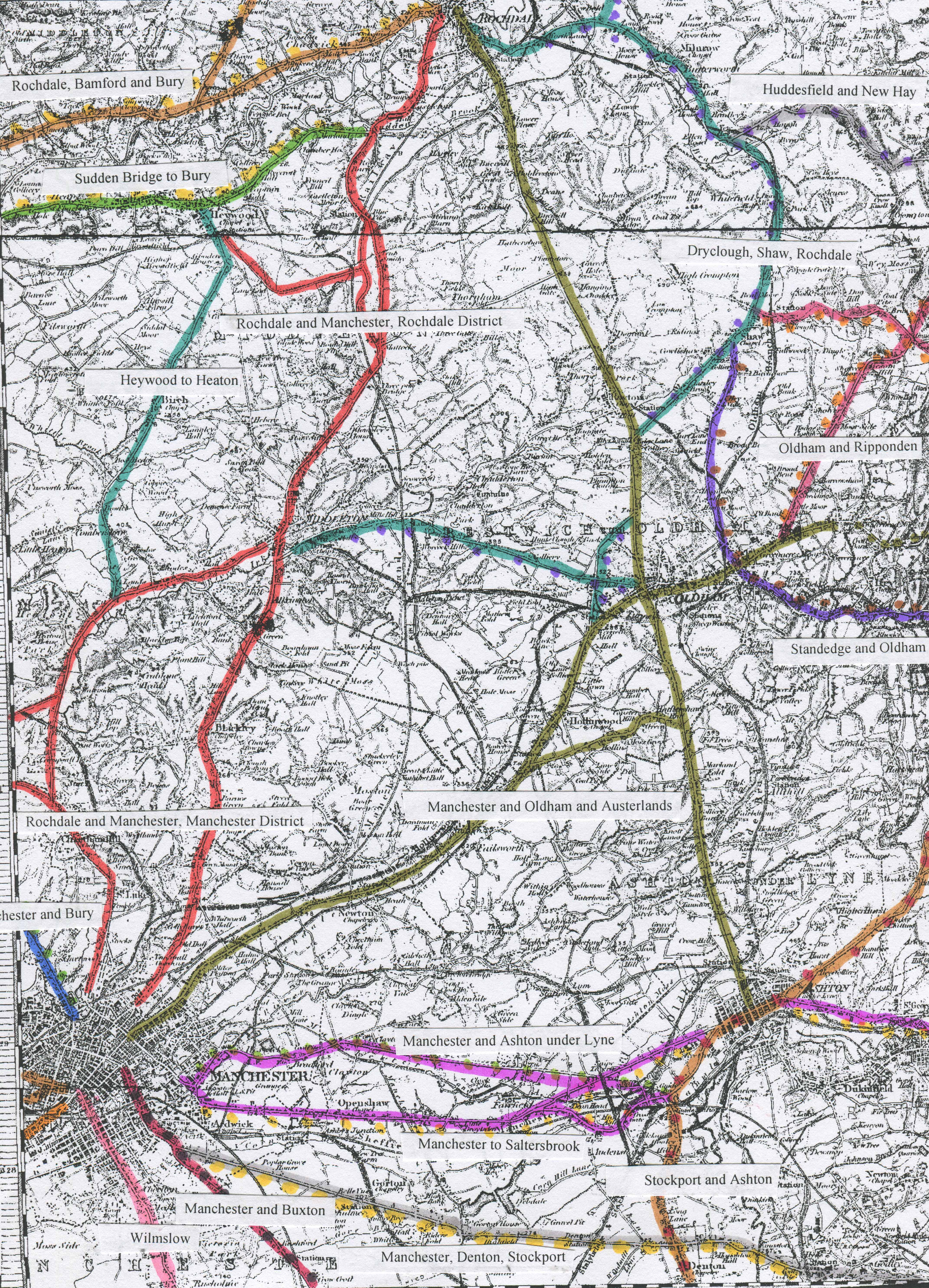
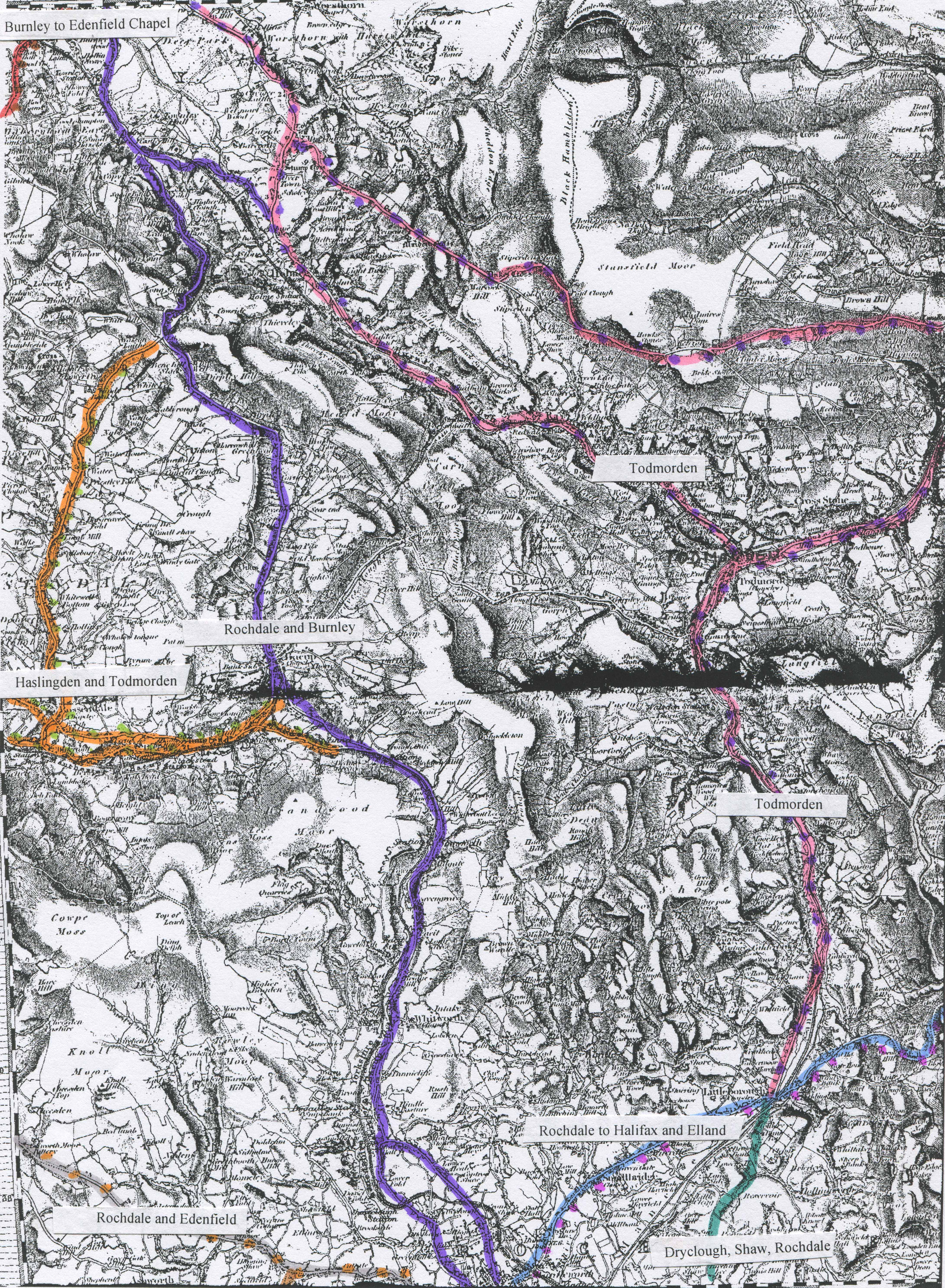
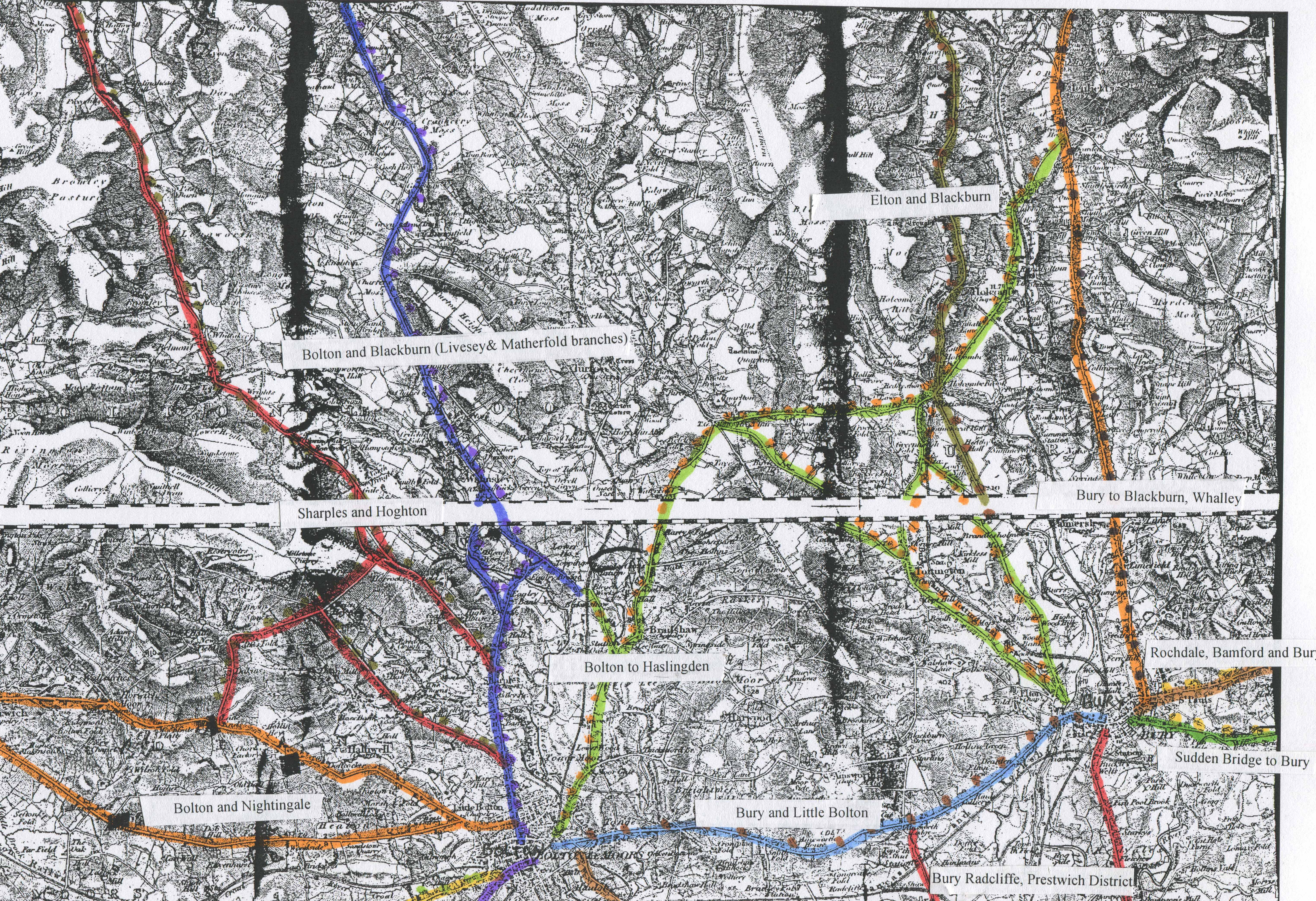
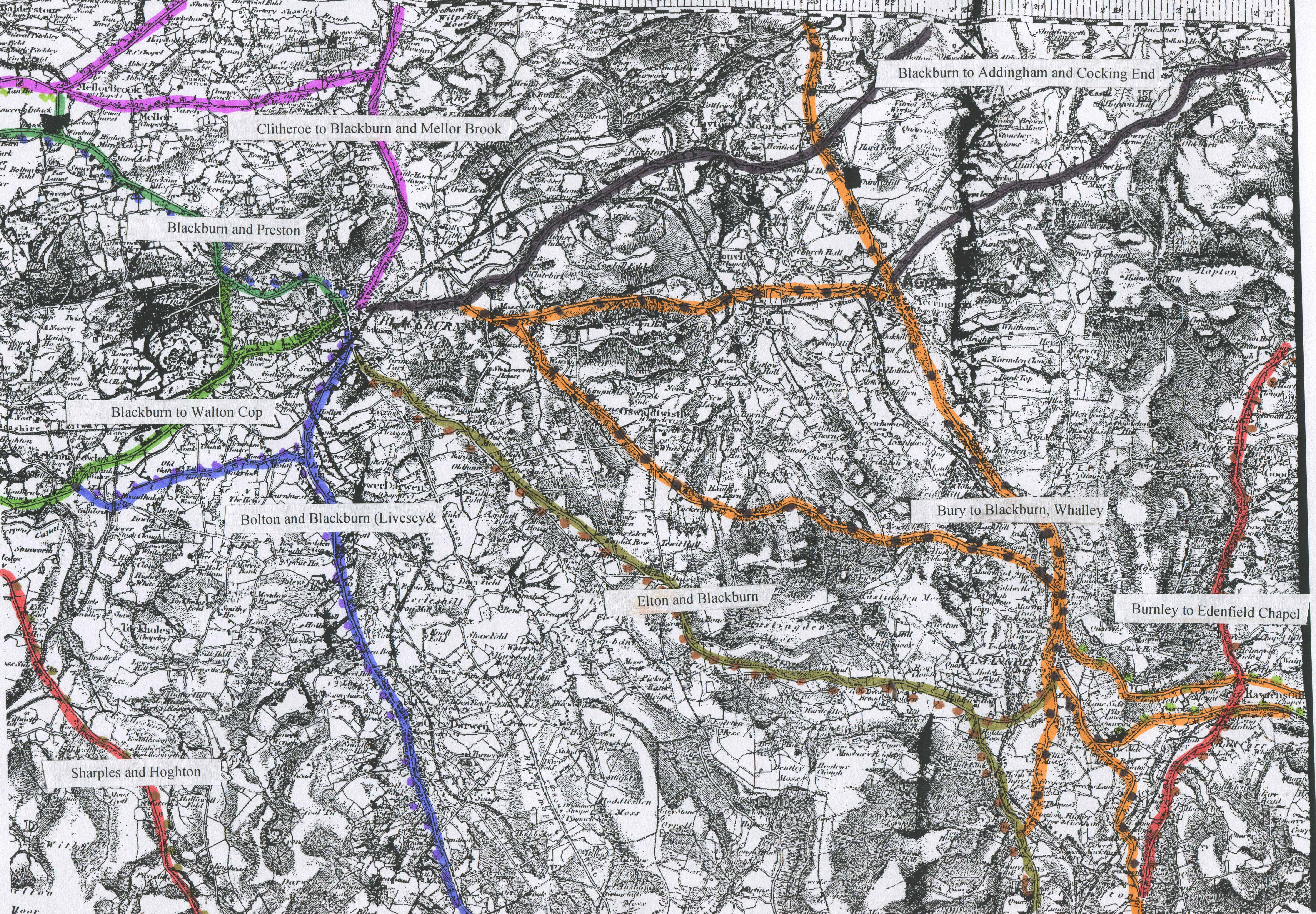
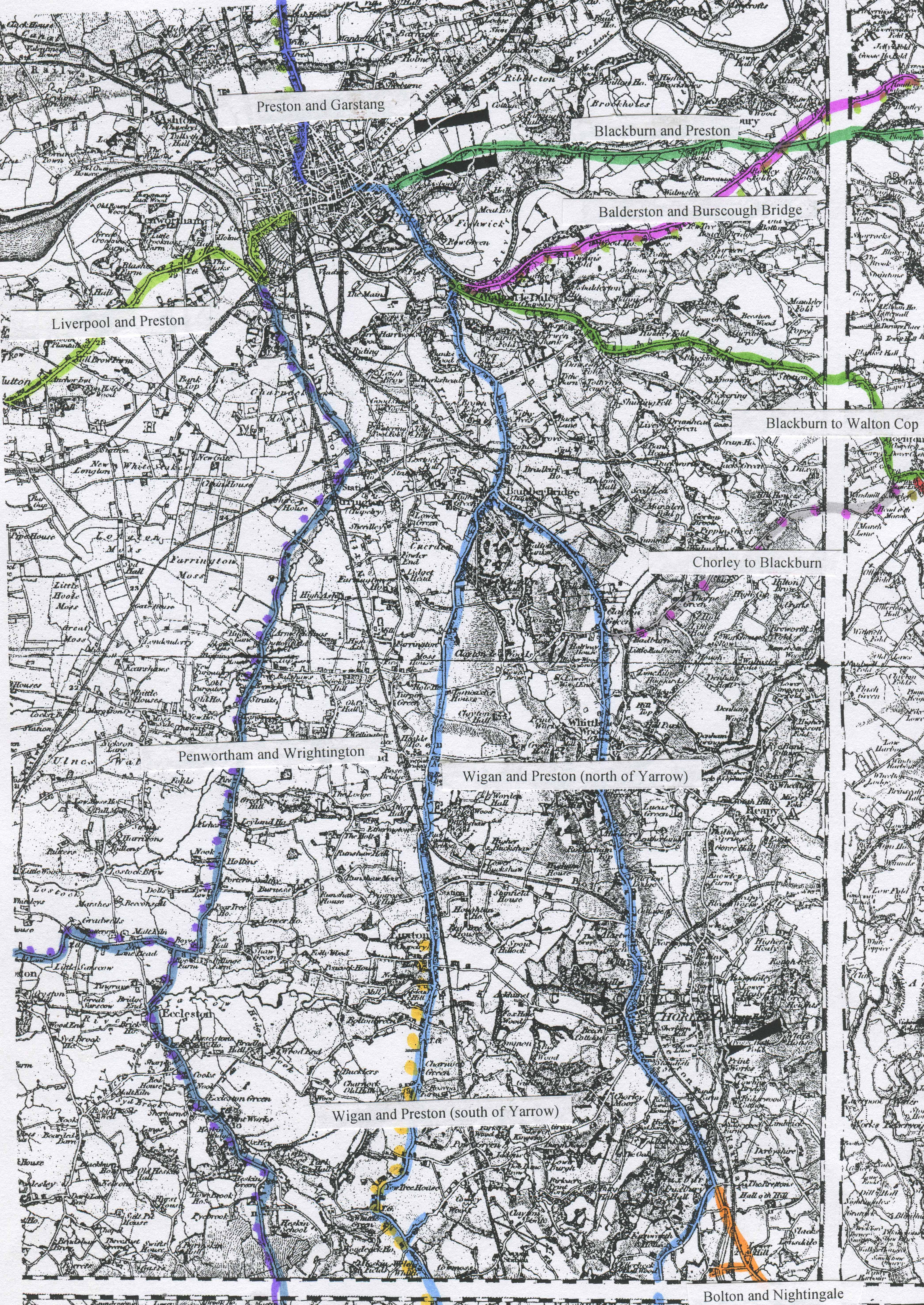
Areas of Lancashire roads; W of Manchester,
E of Manchester,
Burnley/Rochdale,
Bury/Bolton, Blackburn/Haslingden,
Preston/Wigan.
·
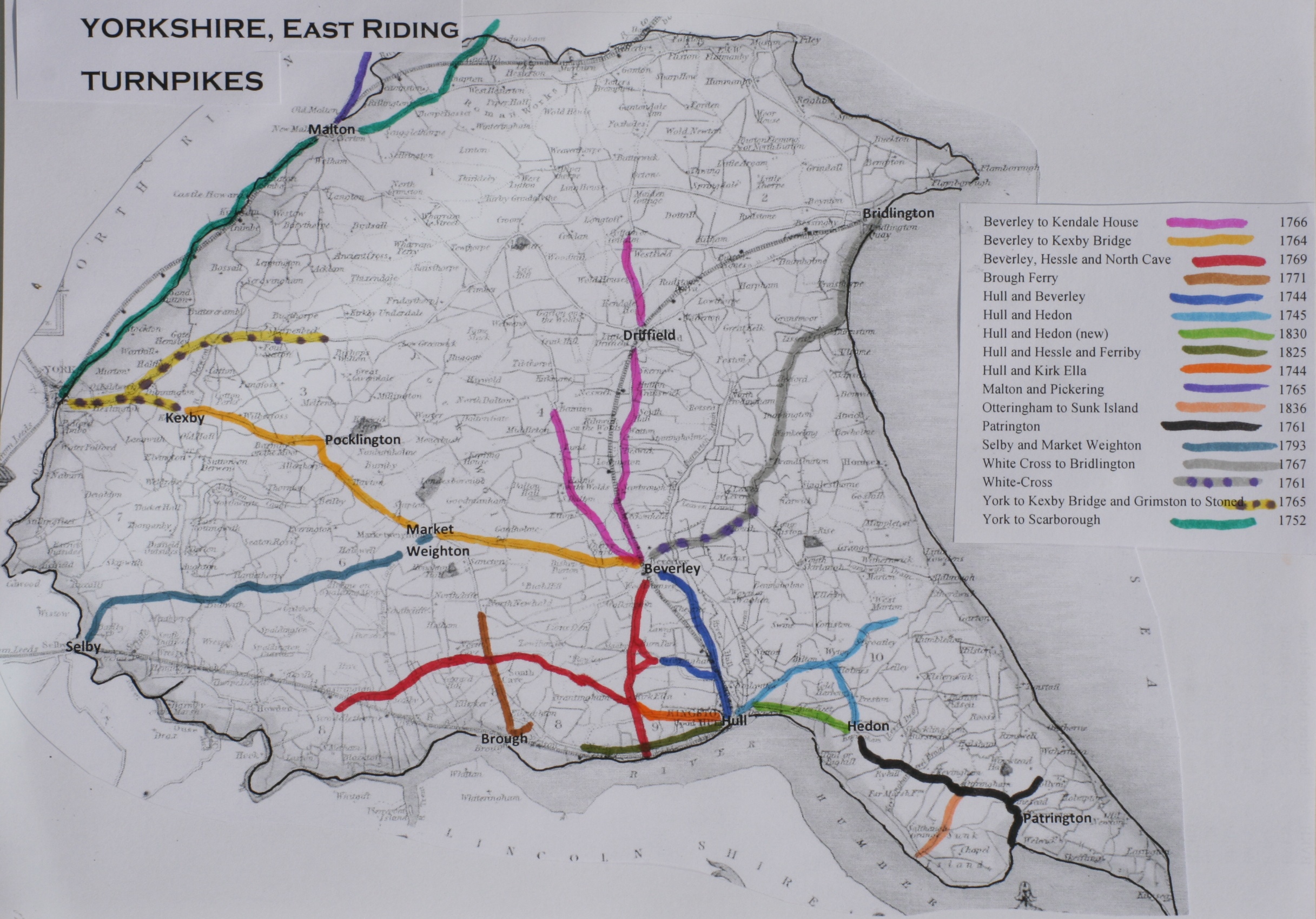
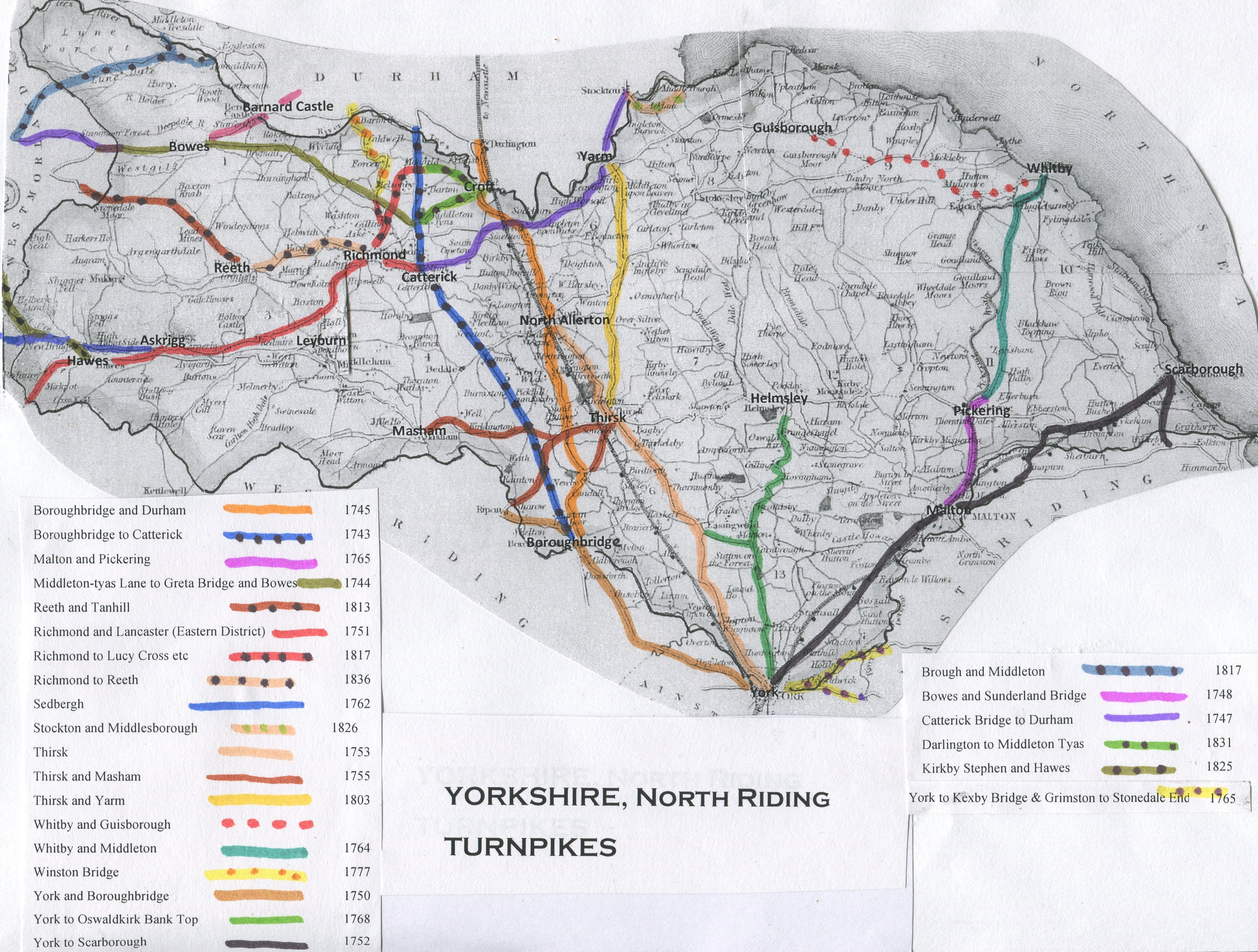
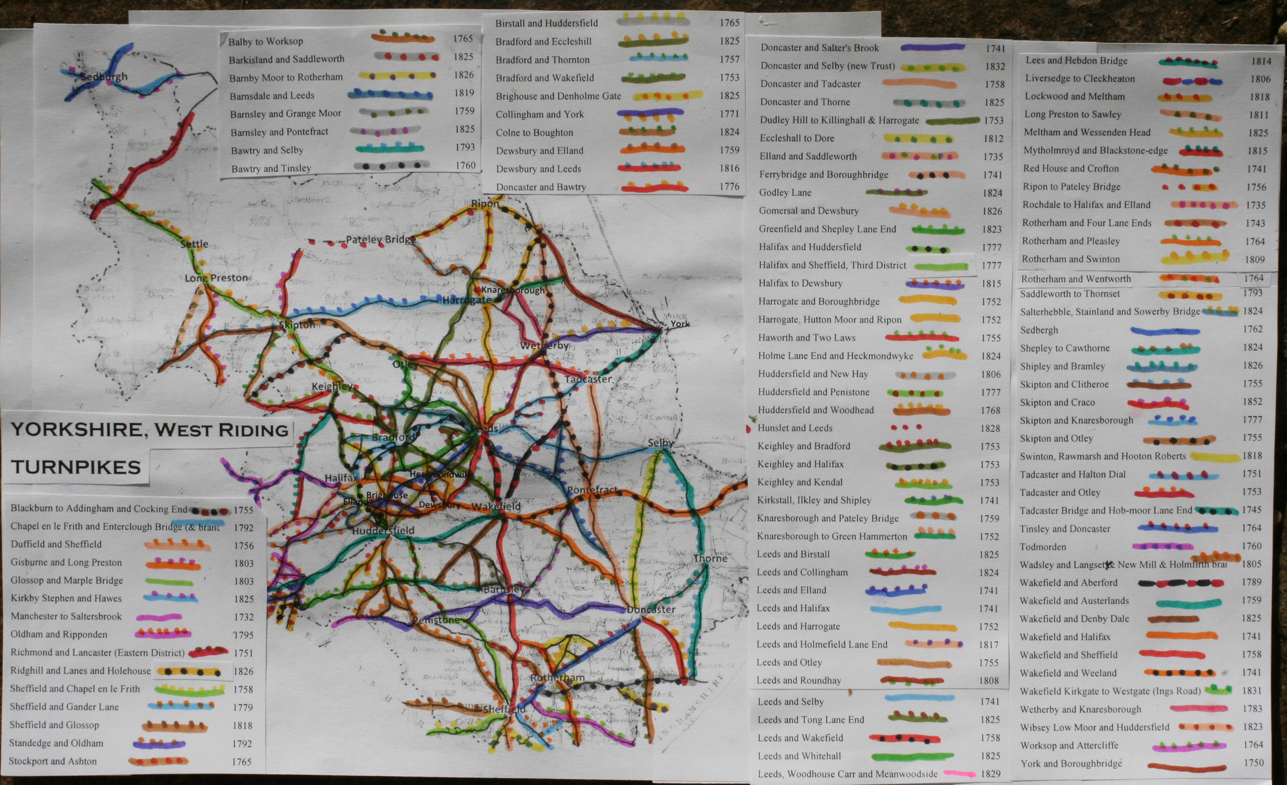
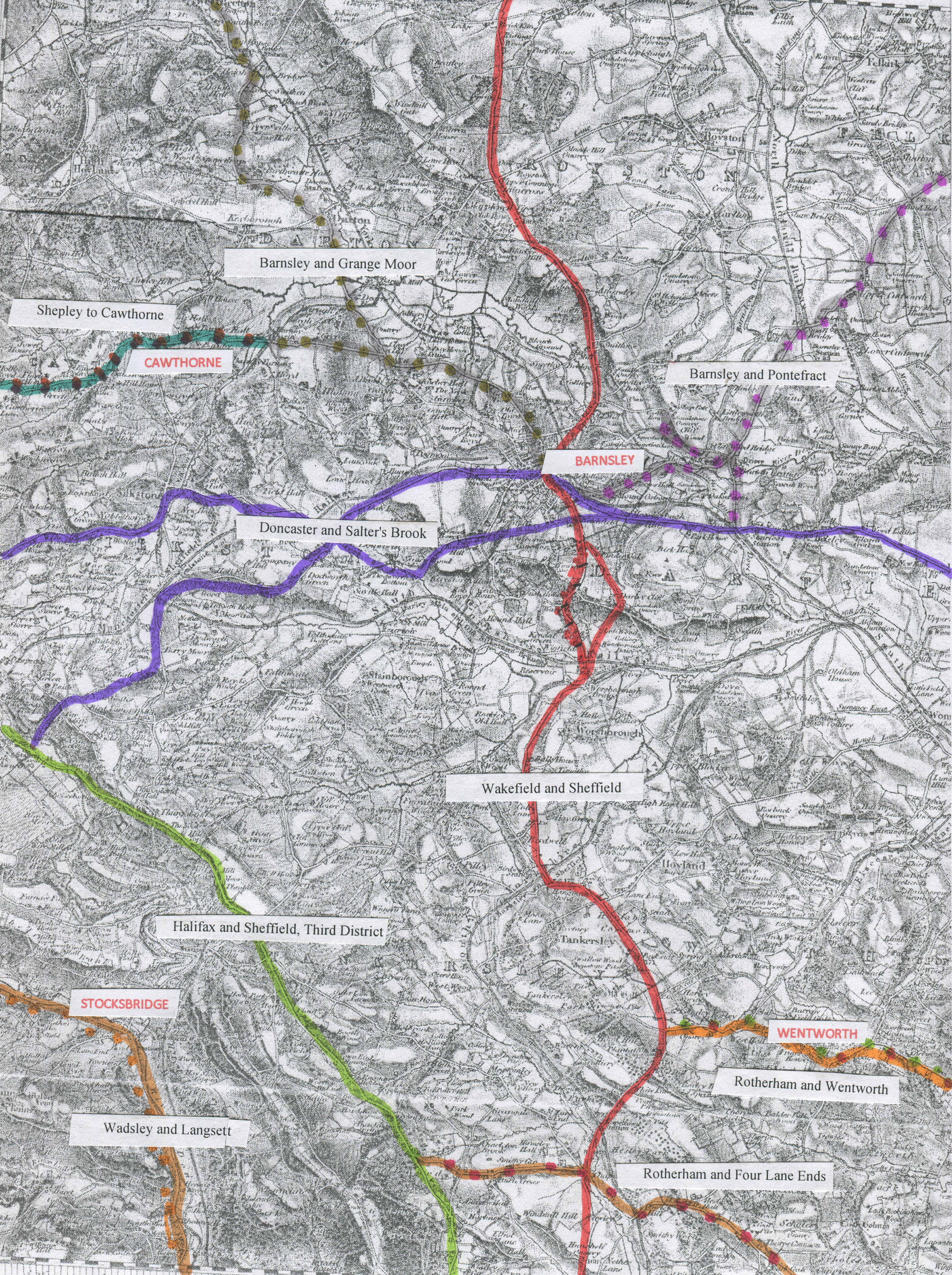
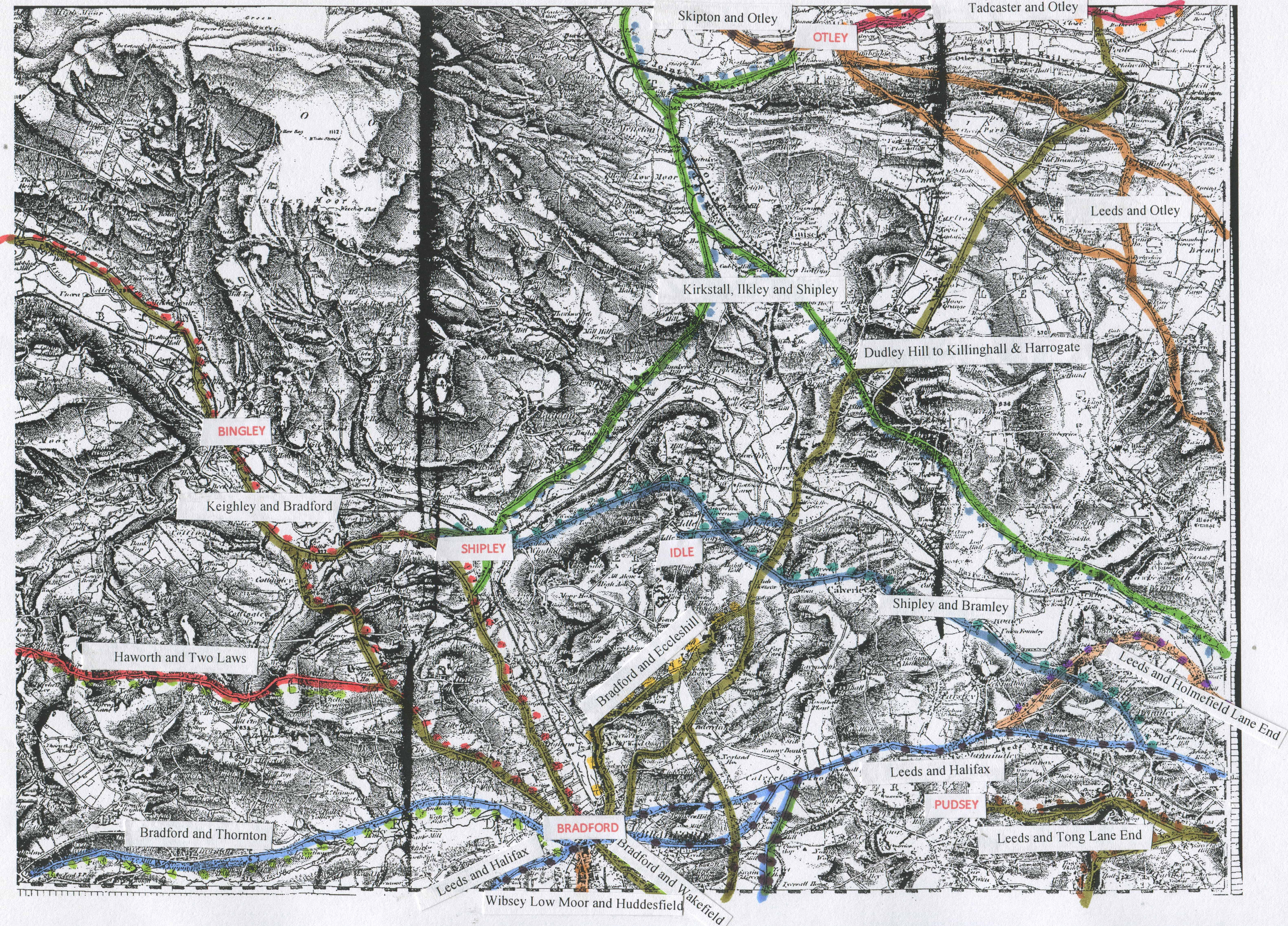
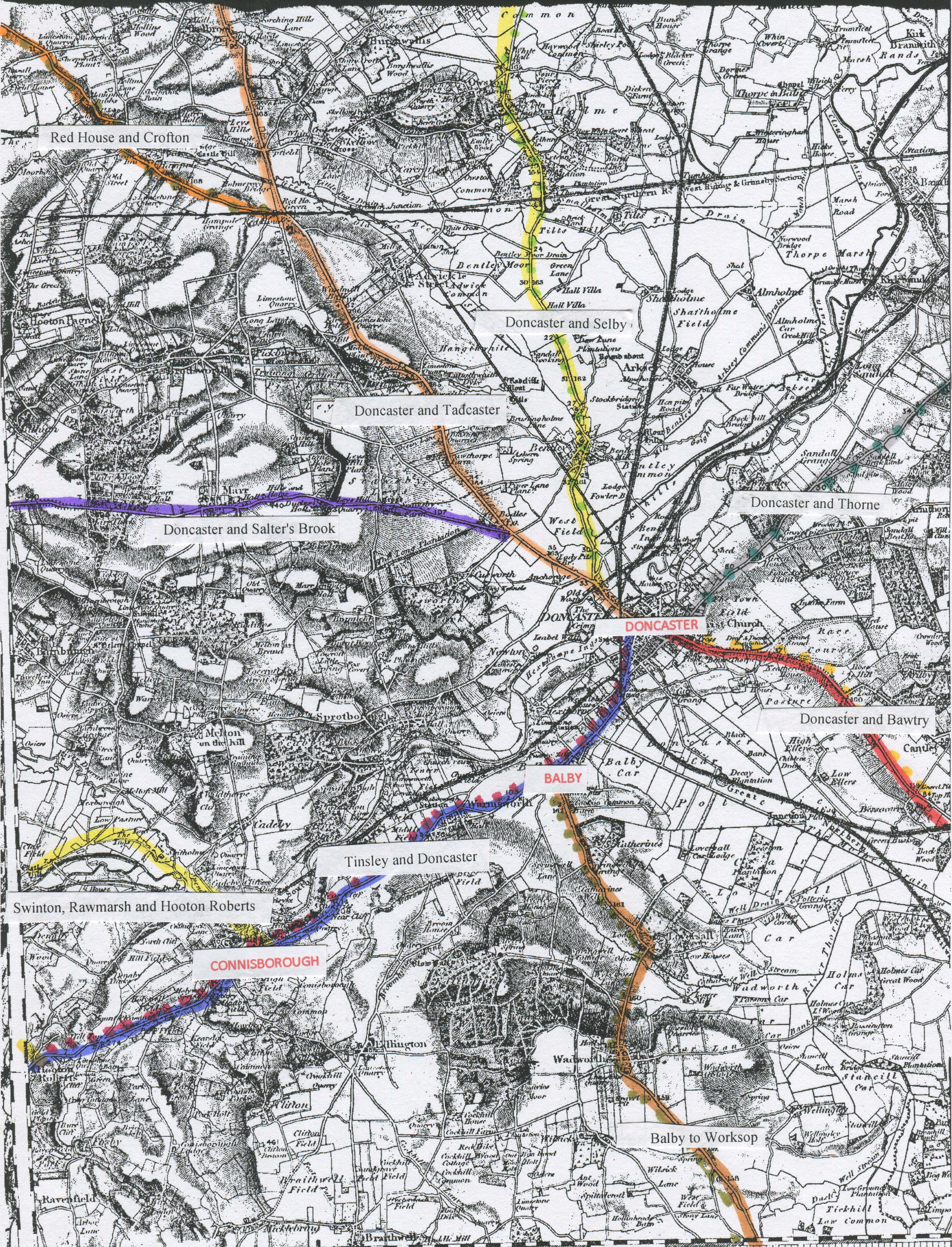
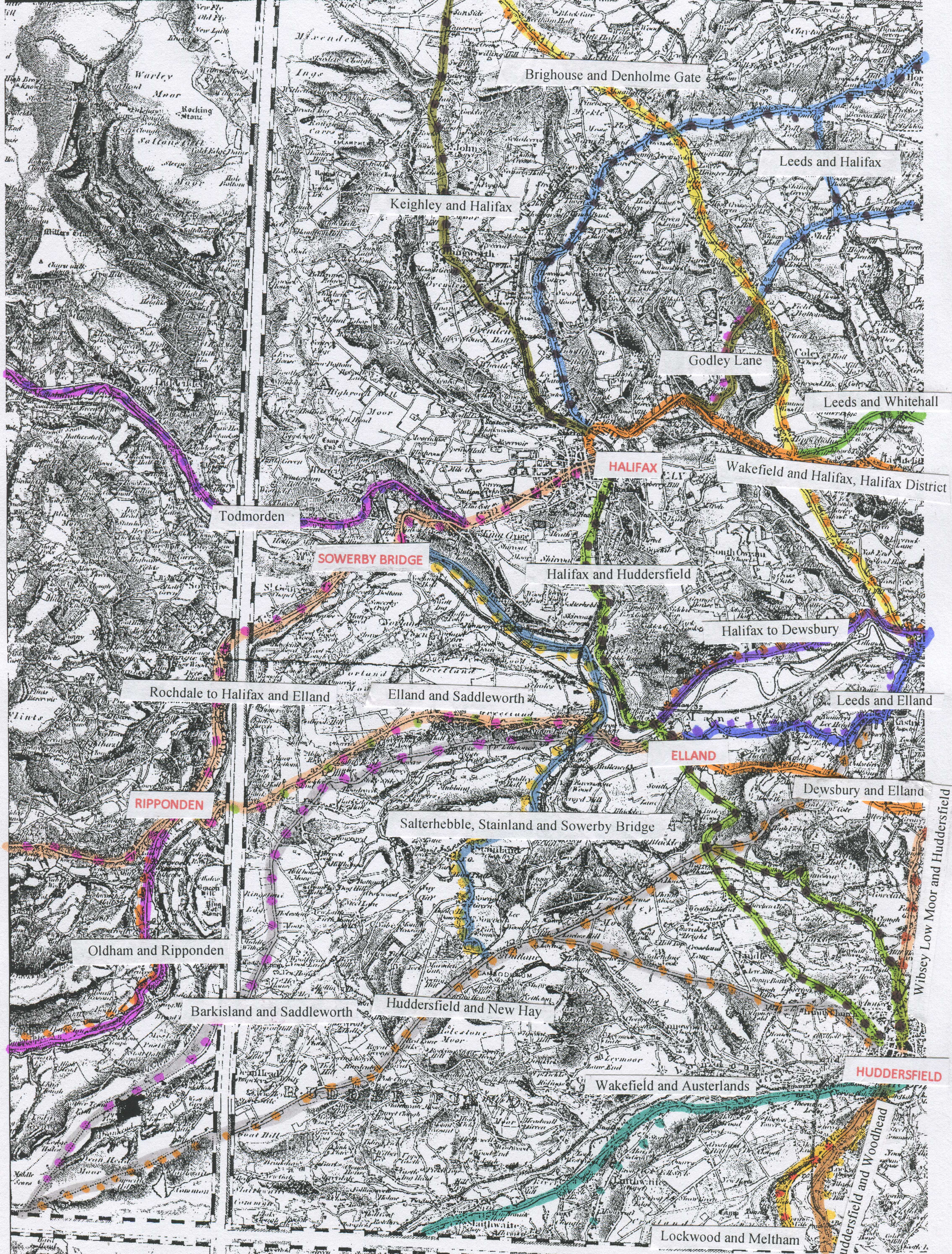
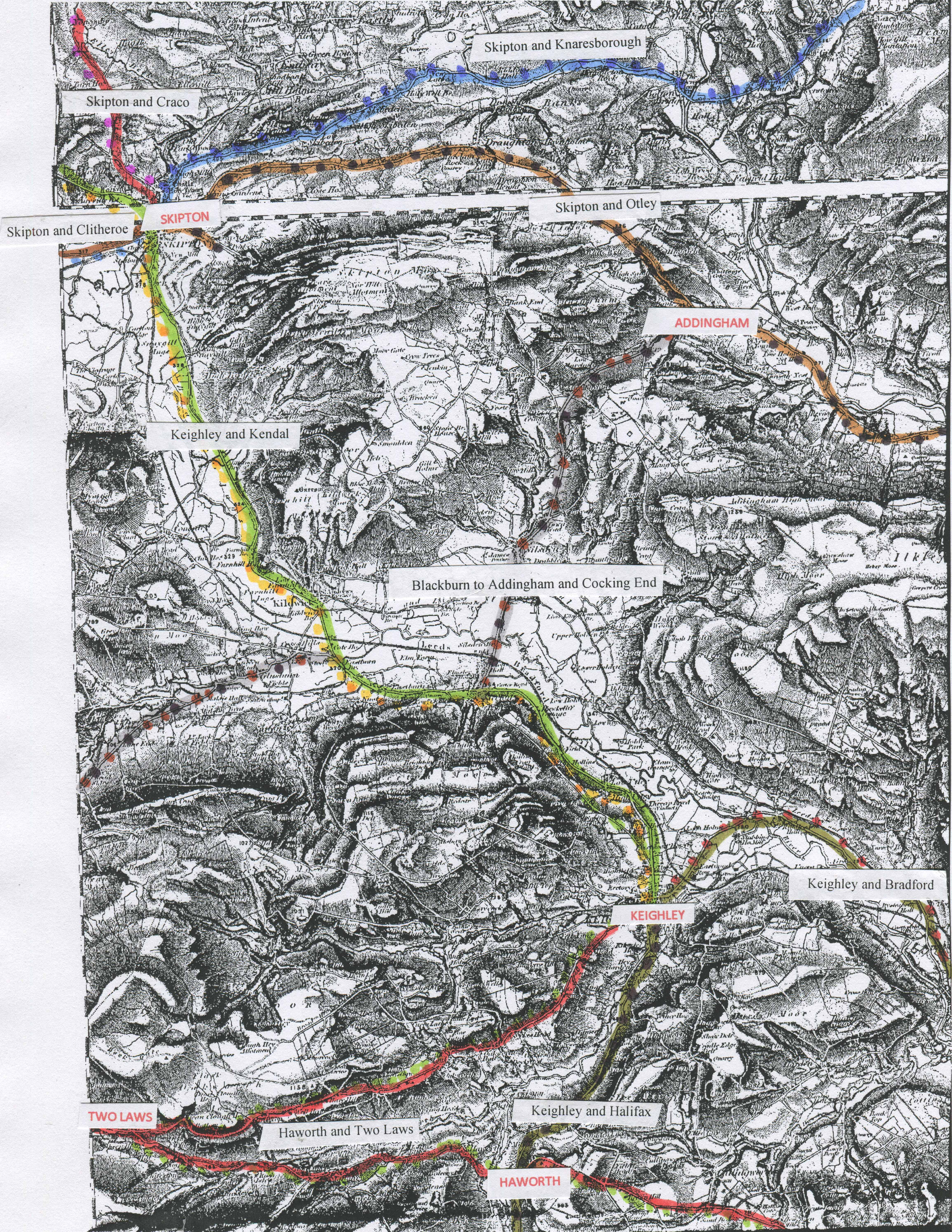
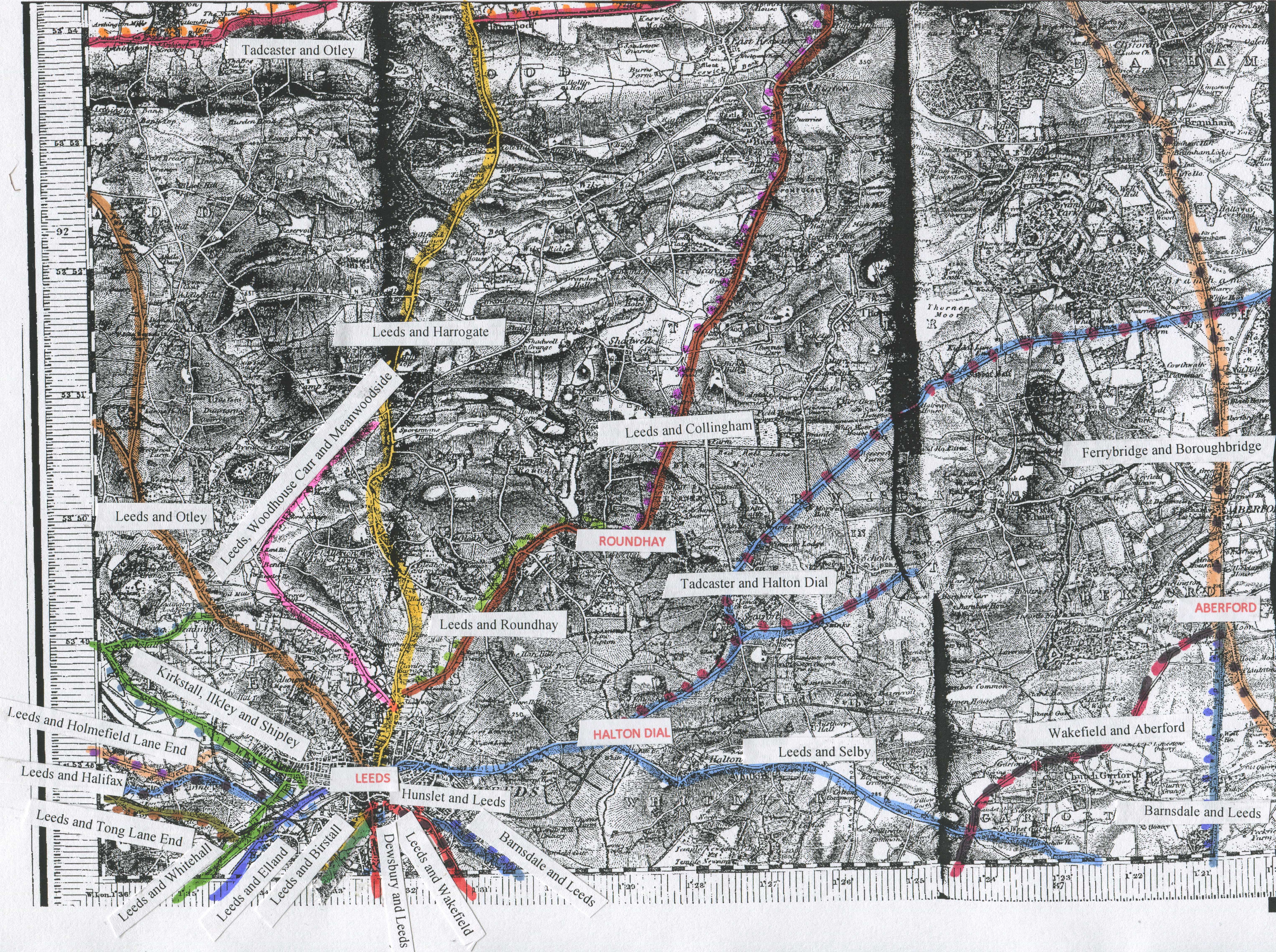
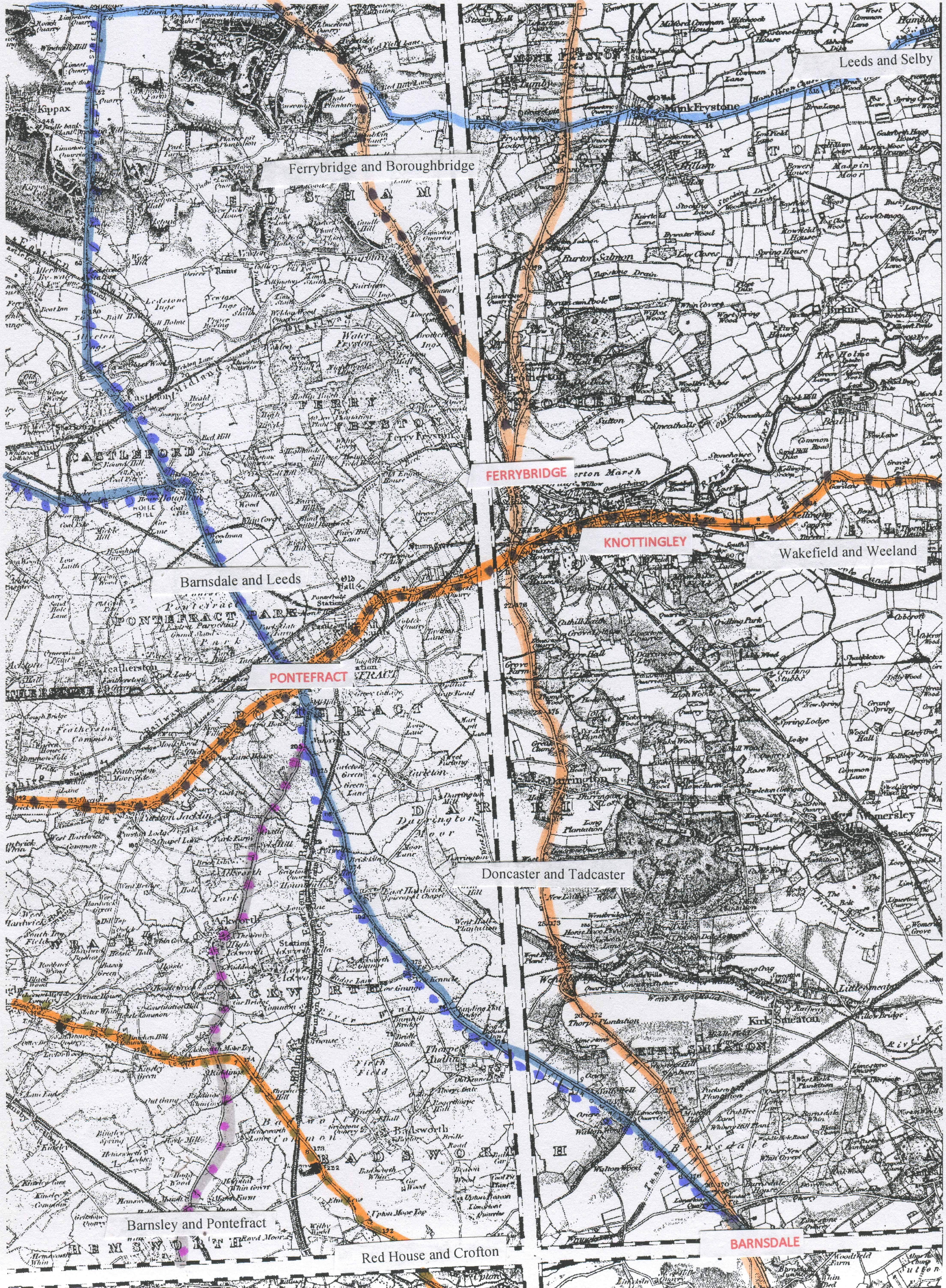
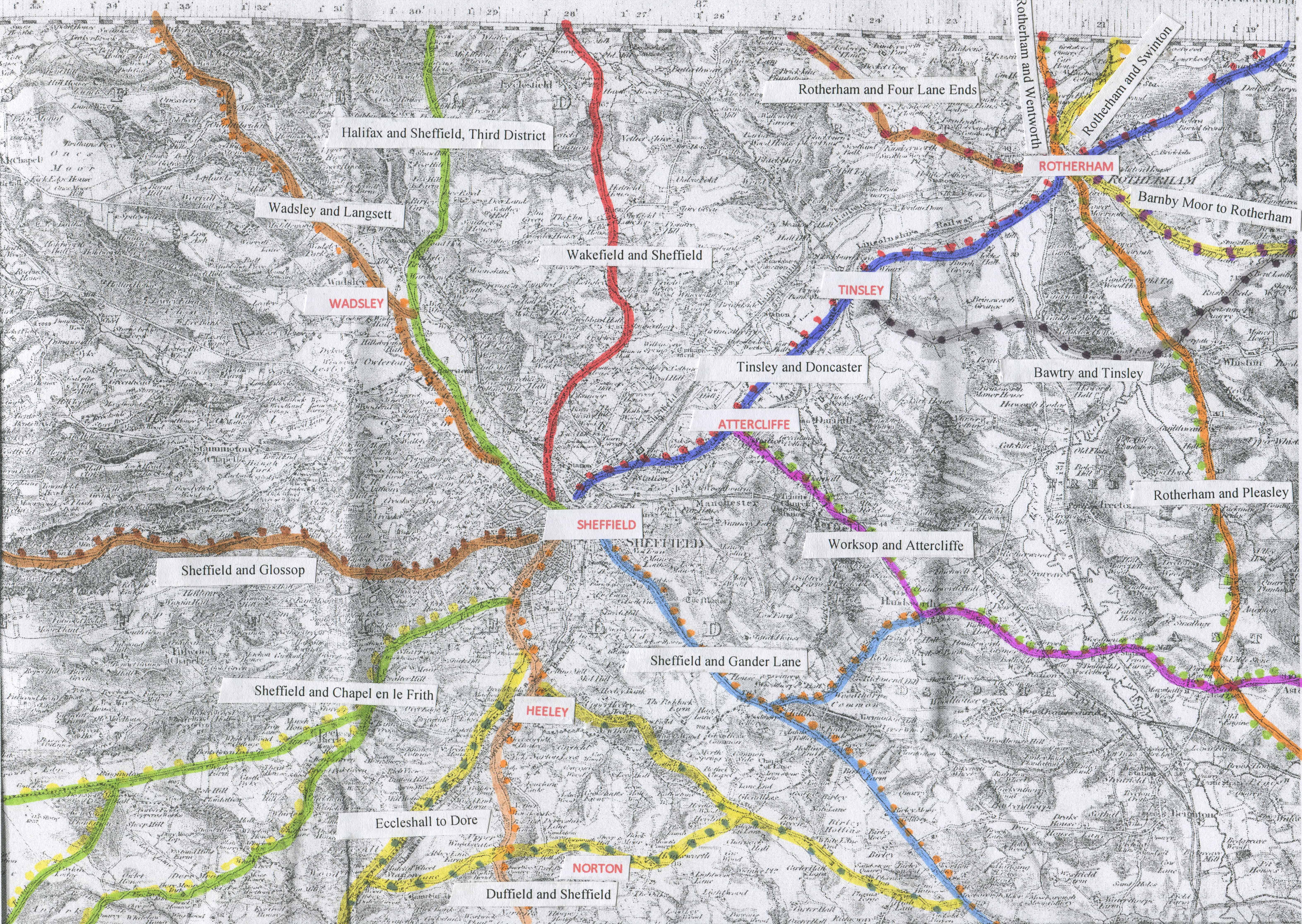
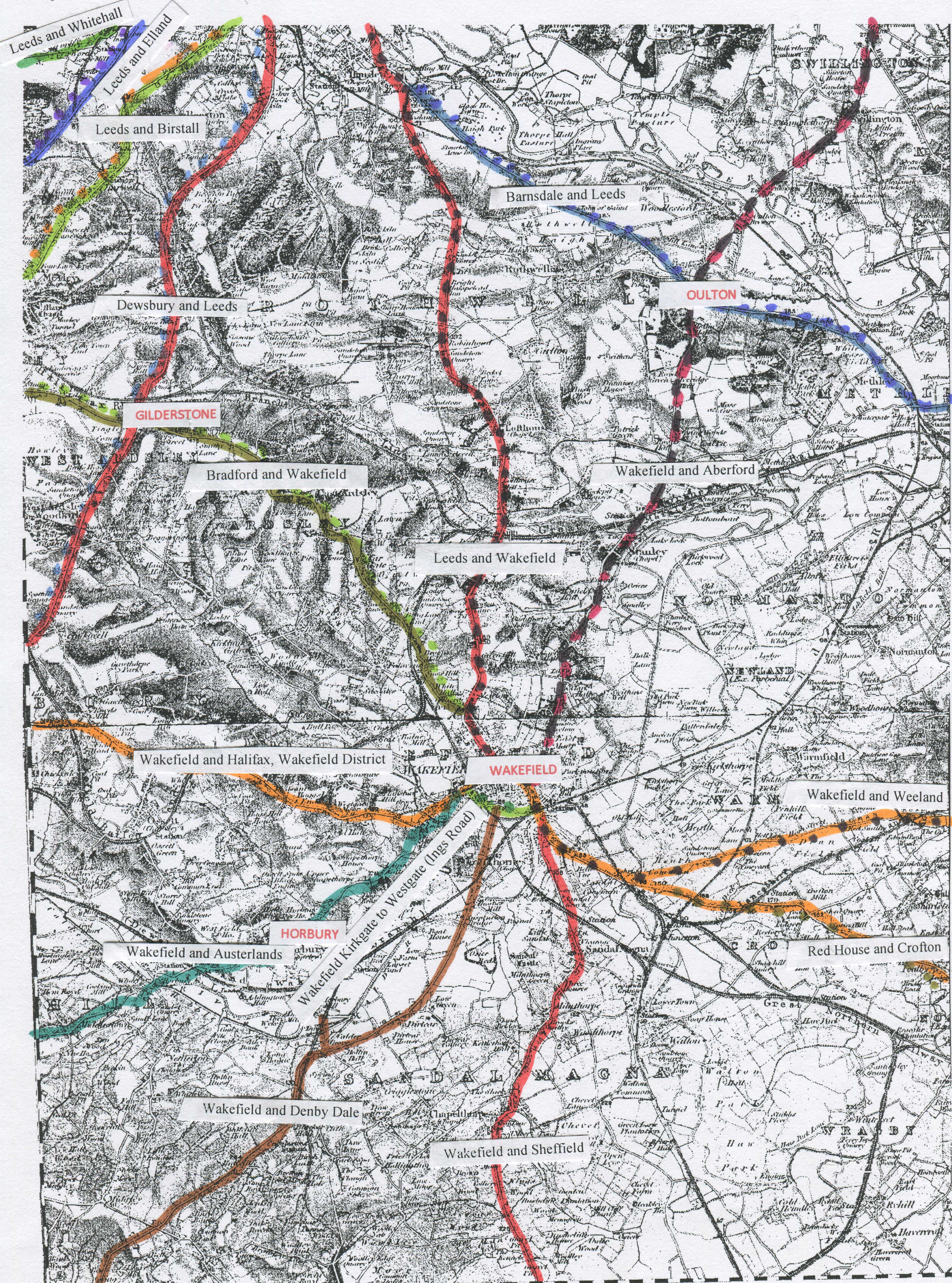
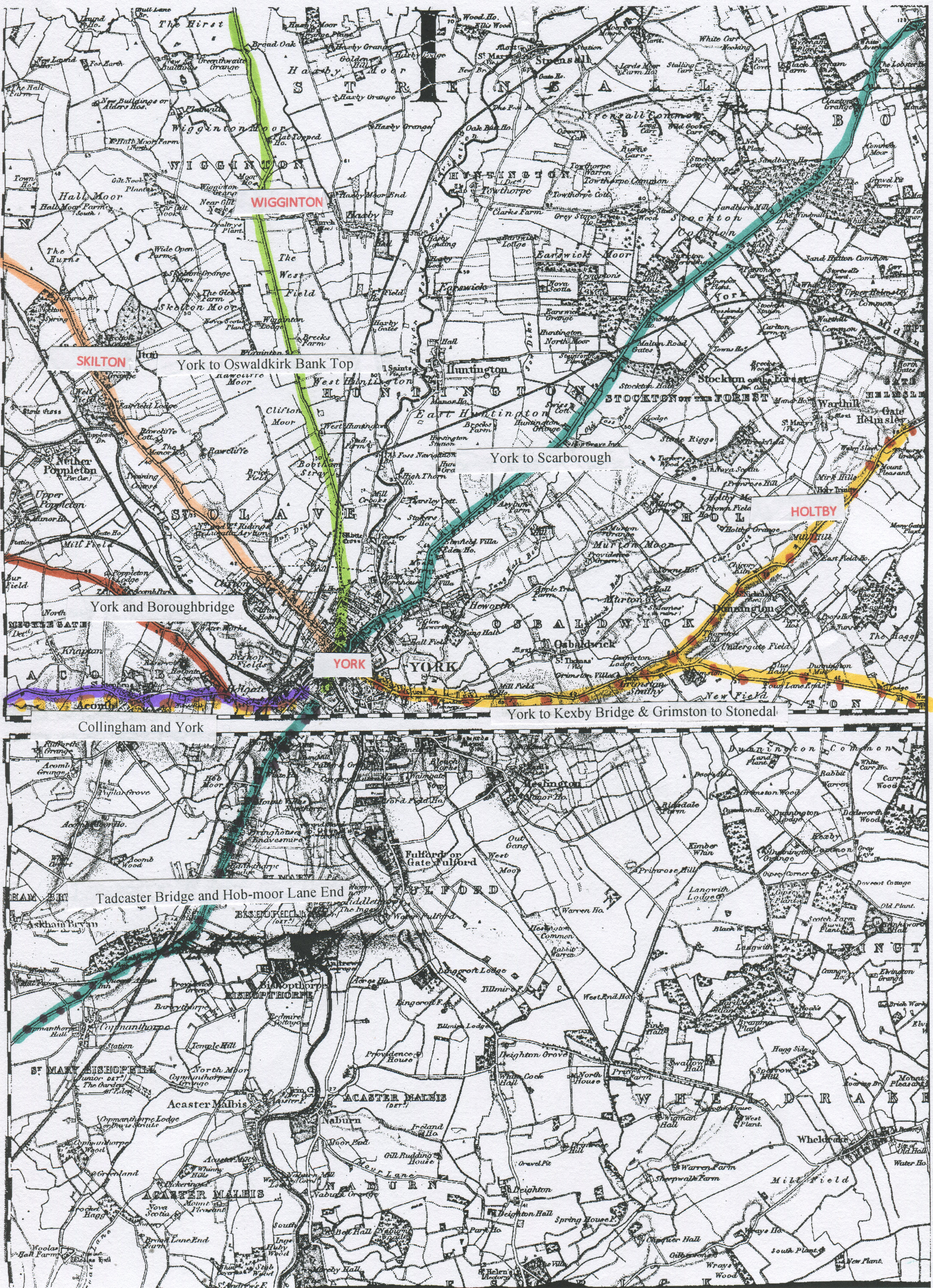
Areas of West Riding of Yorkshire roads; Barnsley, Bradford, Doncaster, Halifax/Elland,
Holmfirth,
Huddersfield/Brighouse,
Keighley/Skipton,
Leeds, Pontefract,
Saddleworth,
Sheffield/Rotherham,
Wakefield,
York.
g)
Details
of surviving tollhouses, displayed on Google Earth,
These
can be downloaded from the Milestone Society database http://www.msocrepository.co.uk/.
h) Material relating to specific turnpike trusts
|
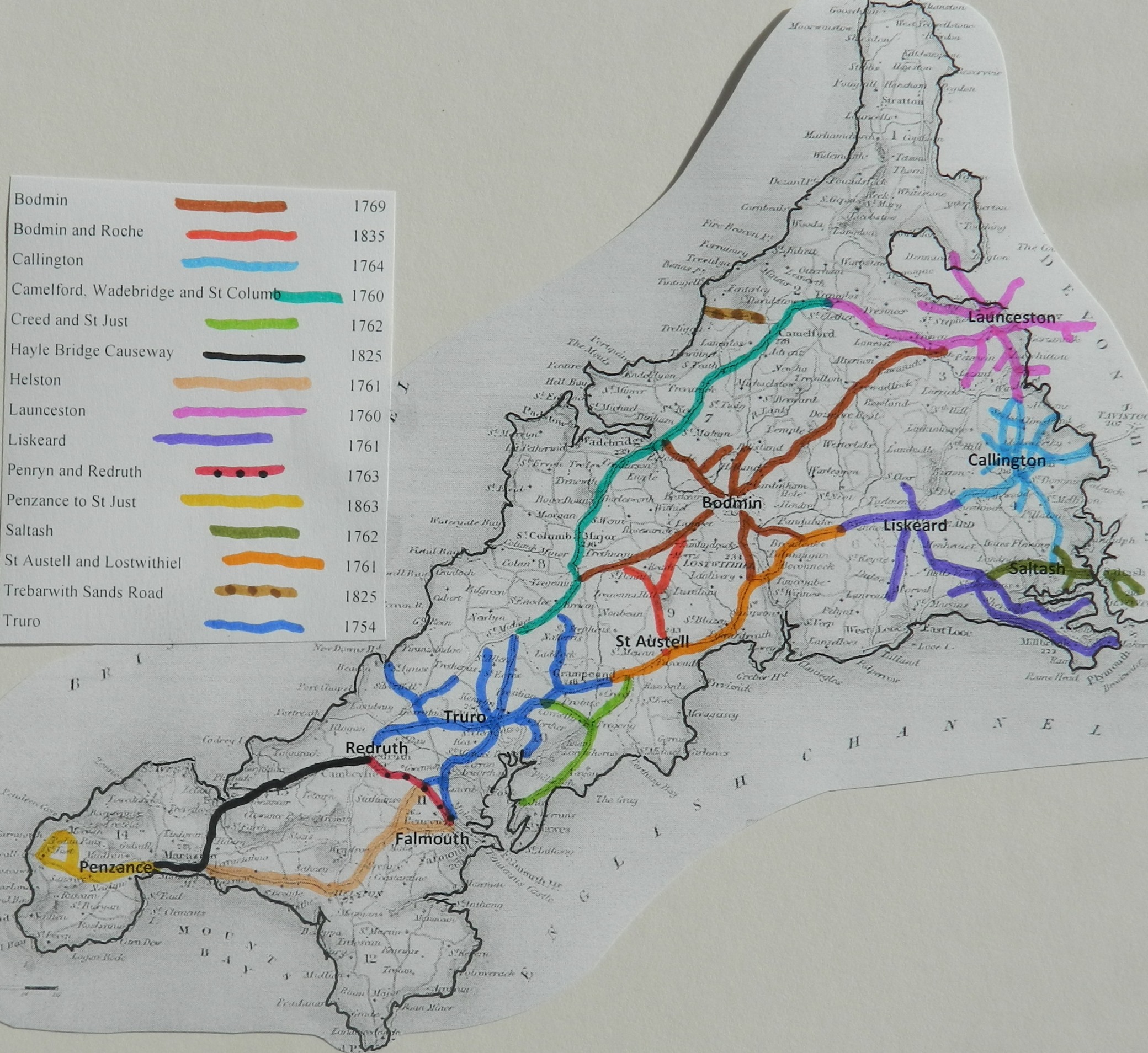
Cornwall Roads |
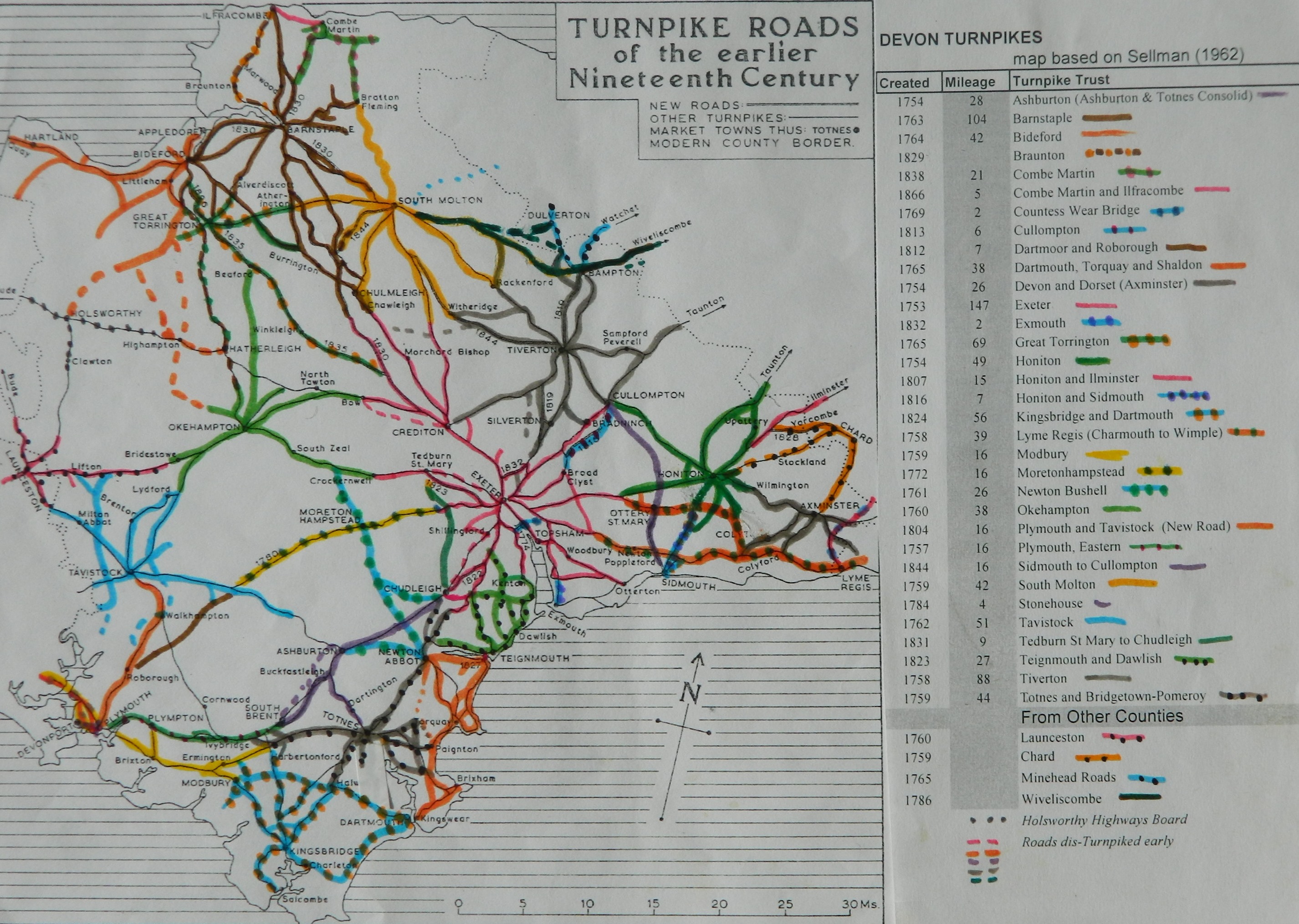
Devon Roads |
Somerset Roads |
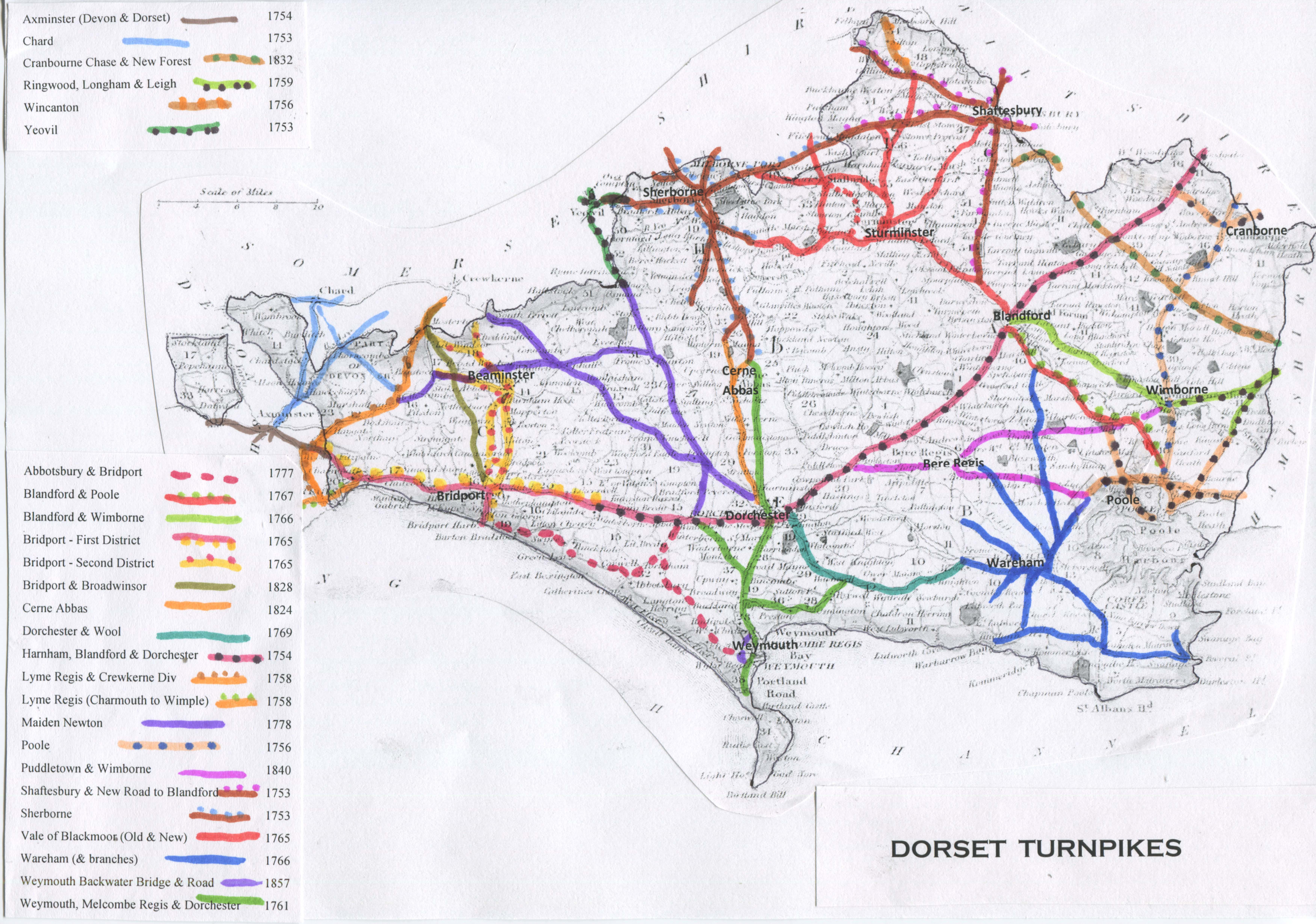
Dorset Roads |
|
Haleworthy, Camelford, Wadebridge and St Columb |
Dartmouth, Torquay and
Shaldon Lyme Regis (Charmouth to
Whimple) Plymouth
and Tavistock (New
Road) Trusts based in other counties |
Black Dog (Bath and
Warminster) Langport,
Somerton and Castle Cary Trusts from Other Counties Trowbridge |
|
2. An Index of
Pages on this web site
click on the coloured links below to go directly to a page
a) Turnpike
Roads - general
Turnpikes;
overview of county differences
Details of the turnpikes road in counties
of; Berkshire; Cornwall, Devon; Dorset; Somerset.
b)
Turnpike Roads -
Local Studies
·
The text of a booklet on the Turnpikes around Oxford
·
The text of a booklet on the Turnpikes around Banbury
·
The text of a booklet on the Turnpikes around Abingdon
·
The text of a booklet on the
Turnpikes around Wantage (Besselsleigh,
Faringdon, Wantage & Wallingford, Fyfield St Johns Bridge)
·
A study of Turnpike roads around Reading, Berkshire and notes on Roman Roads near Reading
·
A study of the Turnpike roads around Nantwich, Cheshire by Keith Lawrence.
·
Some Oxfordshire Turnpike Trustees
·
Some Cheshire Turnpike Trustees
c) Tollhouses – general notes
Tollhouse Design a review of the styles
Devon Tollhouses; A gazetteer by John Kanefsky
d) Milestones – an overview
Non-Turnpike Milemarkers - a discussion of those markers that were erected before and after the turnpike era
e)
Early Way Markers – an overview
Ancient Stone Crosses in Devon - a detailed assessment of the stone crosses that survive in Devon, including Dartmoor
·
List
of Ancient Stone Crosses surviving in Cornwall and Devon and elsewhere
·
A
distribution map of Wayside Crosses in Devon
f) Road Users. - the traffic on the turnpikes
London Carriers and Inns – historic records
g) River Crossings Ferries and bridges over English rivers
 Photographs are stored on Flickr, not on this website. Go to the Tollhouses page and follow the
click-links.
Photographs are stored on Flickr, not on this website. Go to the Tollhouses page and follow the
click-links.
Pictures of
wayside crosses, milestones and road structure are sets off the main
photostream; http://www.flickr.com/photos/tollhouses/
If you have any questions or more information about particular turnpikes or tollhouses,
please contact me at rosevear1@aol.com.
This page created Jan 11th 2008 by Alan
Rosevear (Tollhouse Alan)
Last revised 29st March 2023