St Austell and Lostwithiel Turnpike Trust (updated 24th Sept
2013)
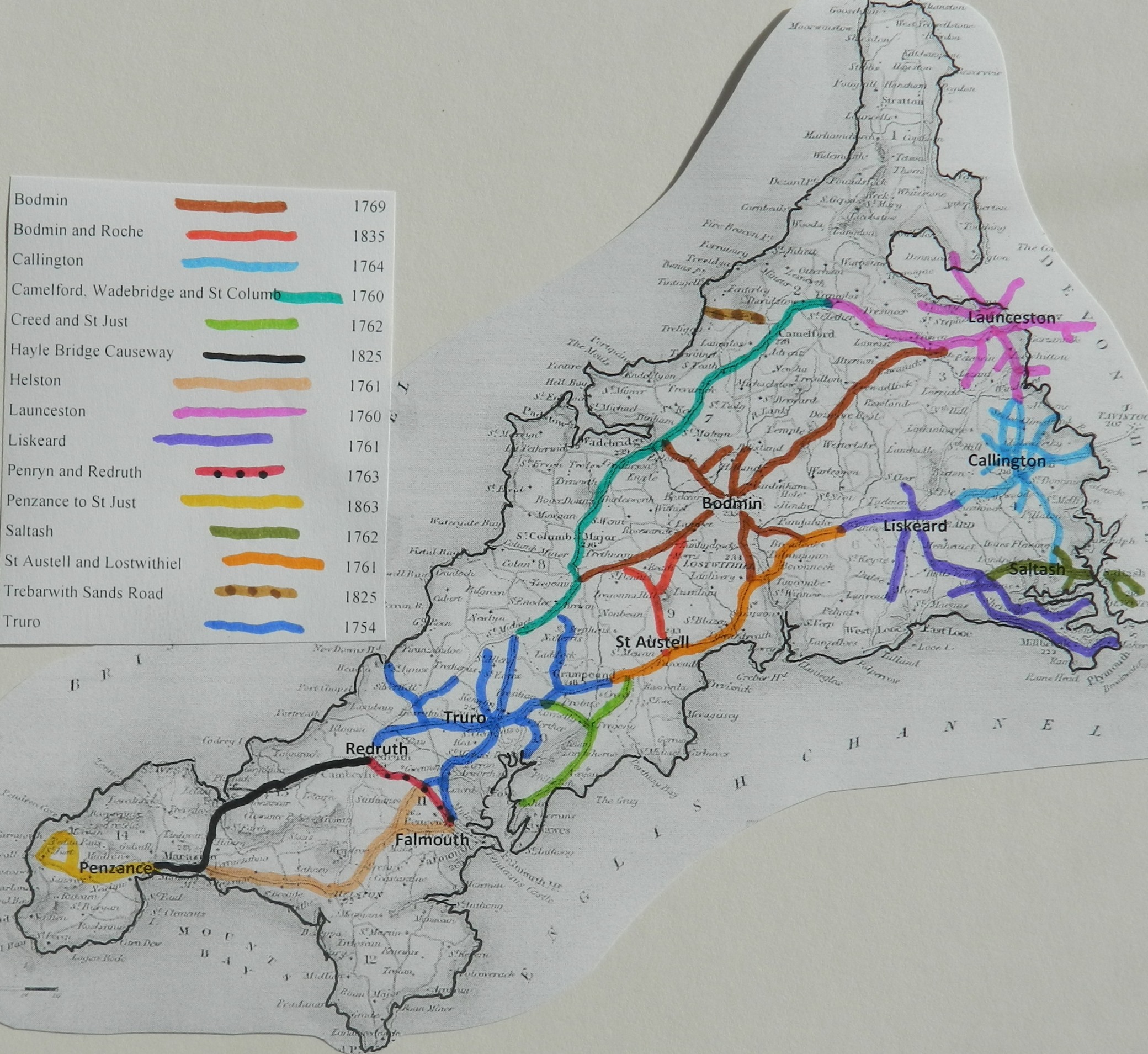
This trust was created in 1761 to turnpike the main highway between the Liskeard Roads (turnpiked in the same year) and the Truro Roads. It was responsible for the coast road beside the china clay workings.
List of
Acts
|
St Austell and
Lostwithiel |
Grampound to |
1 Geo3 c27 |
1761 |
|
|
St Austell and
Lostwithiel |
|
21 Geo3 c90 |
1781 |
|
|
St Austell and
Lostwithiel |
|
43 Geo3 c63 |
1803 |
|
|
St Austell and
Lostwithiel |
|
5 Geo4 c85 |
1824 |
|
|
St Austell and
Lostwithiel |
|
6&7 Wil4 c62 |
1836 |
|
Grampound to St Austell 1803
An Act for continuing the Term, and altering and enlarging the Powers of Two Acts, passed in the First and Twenty-first Years of the Reign of His present Majesty, for repairing and widening the Road leading from the Eastern End of the Borough of Grampound, in the County of Cornwall, through the Towns of Saint Austell and Lostwithiel, and thence to the East End of the Western-Taphouse-Lane, in the said County. [11th June 1803.]
An Act for more effectually repairing and improving the Road leading from
the Eastern End of the Borough of Grampound in the
Select Committee on State of Roads 1840
Philip Wheeler of St Austell (clerk to the trust) reported
There are 18 miles of road thru 9 parishes – all repaired by the
trustees
4 toll gates and 4 side bars
The roads are stated to be in “good” condition – no part under
indictment for want of repair.
List of Roads
St Austell Road; A390 from Grampound, eastwards
through St Austell and Lostwithiel to West Taphouse to join the Liskeard
turnpike (about 18 miles)
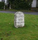 Typical St Austell & Lostwithiel Milestone
of a design referred to as St Austell Roman stone. This one is at Crewell, nr
Lanivet, just north of the old Pelyn Tollhouse
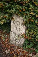
Typical St Austell & Lostwithiel Milestone
of a design referred to as St Austell Roman stone. This one is at Crewell, nr
Lanivet, just north of the old Pelyn Tollhouse
Click
here for a map
of Cornwall Turnpike Roads
Click
here to return to Turnpikes
Home
Return to Turnpikes in Cornwall general
page