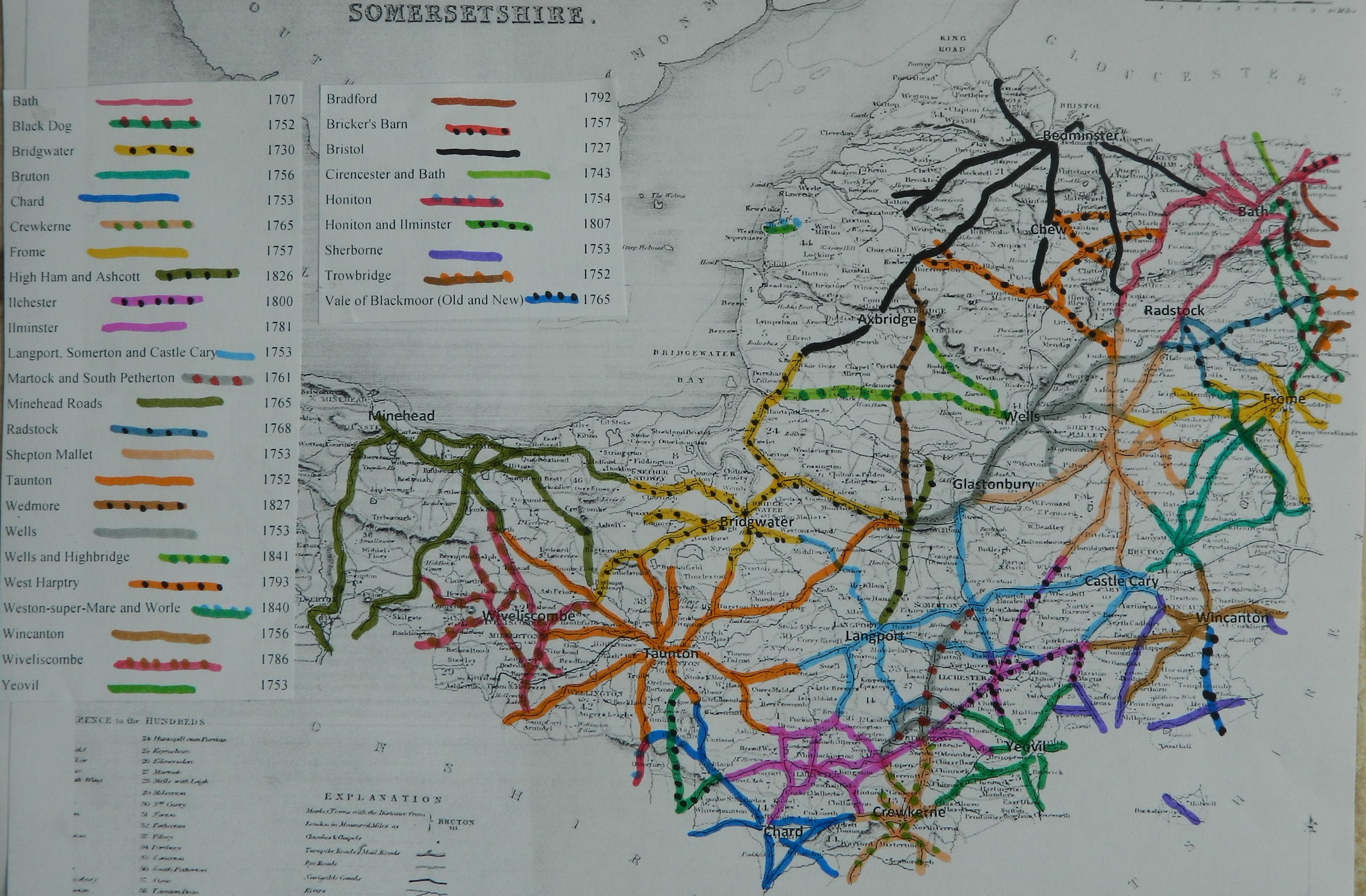
This trust was created
in 1841, late in the turnpike era. Its
main responsibilities were two roads running west from Wells across the
Somerset Levels towards the
|
Wells and
Highbridge |
Wells, Highbridge
& Cheddar |
4&5 Vic c98 |
1841 |
|
|
|
|
|
|
|
|
|
Expired |
|
|
1870 |
In “Return of length of road in each Turnpike
Trust in
Trust reported 23
miles 6 furl. 209 yds (
List of Roads
(roads identified and mapped in “Somerset Roads
– the Legacy of Turnpike, by Bentley and Murless 1985”)
B3139 Wells to Highbridge
A371 Cheddar
to Wells
Click
here for a map of Somerset Turnpike Roads
Click
here to return to Turnpikes
Home
Return to Turnpikes in Somerset general page
|
Road
Classification Number |
Route |
GATE NAME |
OS Grid Ref-
Prefi |
Easting |
Northing |
District |
Civil Parish |
Location (Name or
Number) |
Road or Street
(see across) |
Position |
Evidence |
Revised 23rd Sept
2013 |
|
B3139 |
Wells to
Highbridge |
Mark |
ST |
3794 |
4790 |
SOSG |
MARK |
Tollhouse |
Church
Street |
jct with
Kingsway |
; ; ; |
In the Milestone
Society Database, no milestones are identified along this road. Based on the mileage reported
by the Trust in 1840, would expect 25.