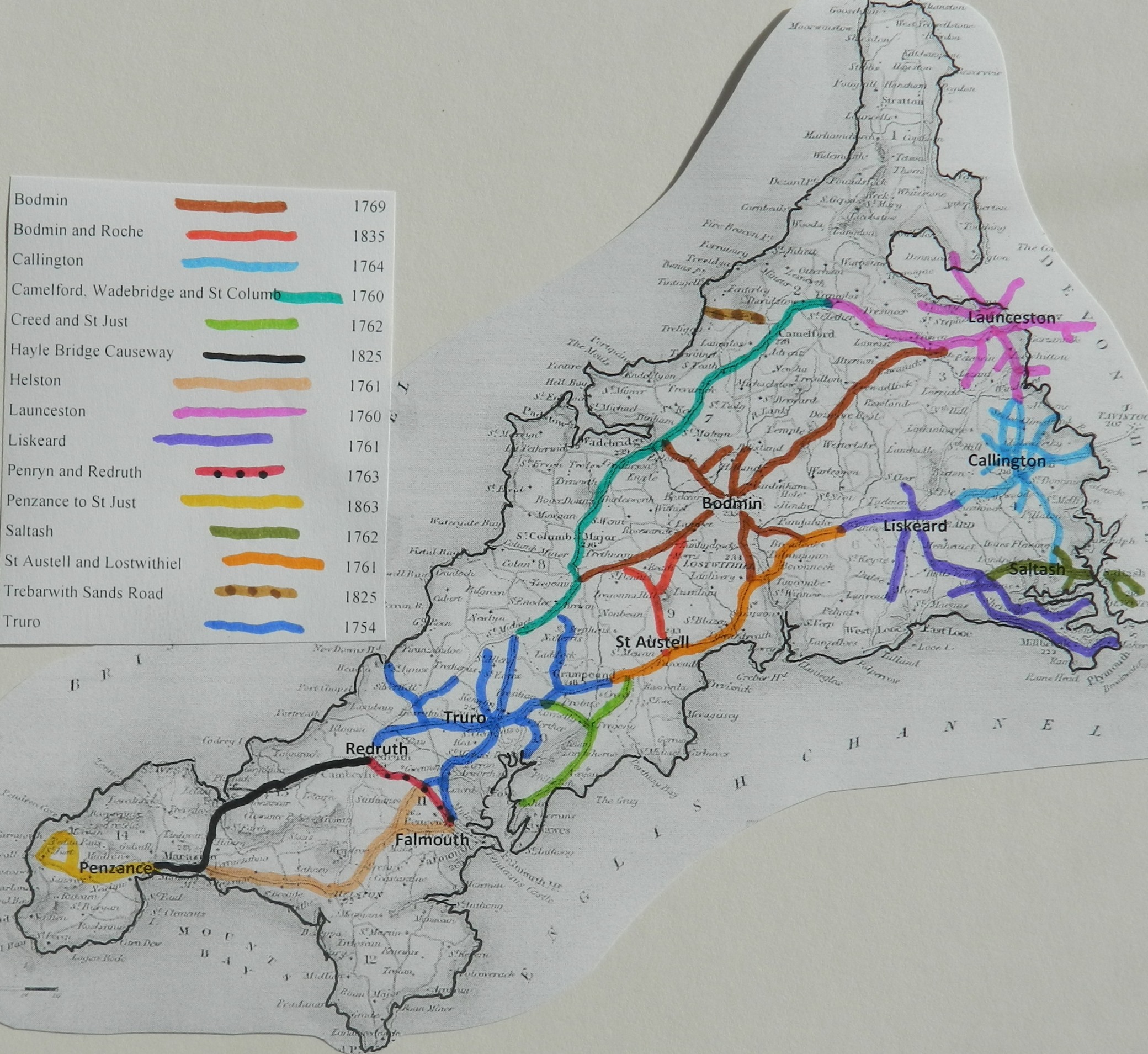
This trust was created in 1836 towards the very end of the turnpike era. It was responsible for the link road from Bodmin to the china clay mining area. It may have been, in practice, a new district of the Bodmin Trust.
|
Bodmin &
Roche District |
|
5&6 Wil4 c105 |
1835 |
|
Philip Wheeler of St Austell (clerk to the trust) reported
There are 10 miles 3 furl 26 pl of road thru 4 parishes – all repaired
by the trustees
3 toll gates and 2 side bars
The roads are stated to be in “good” condition – no part under
indictment for want of repair.
Through parishes of St Austell (5 miles), Roche (3miles), Luxulyan (2
miles), Lanivet (7 pls)
Click
here for a map
of Cornwall Turnpike Roads
Click
here to return to Turnpikes
Home
Return to Turnpikes in Cornwall general page
|
Road
Classification Number |
Route |
GATE NAME |
OS Grid Ref-
Prefi |
Easting |
Northing |
District |
Civil Parish |
Location (Name or
Number) |
Road or Street
(see across) |
Position |
Evidence |
Revised 24th Sept
2013 |
erected by
(Turnpike Trust or Authority) |
Bibliographic
refs |
|
A391 |
Bodmin to St
Austell |
Lockengate |
SX |
0318 |
6133 |
CWRE |
LUXULYAN |
two miles from
Lanivet |
|
|
; ; ; |
Bodmin and Roche |
Taylor P. (2001),
"The Toll-houses of Cornwall", p70 |
|
|
B3274
(A391) |
Bodmin to
St Austell |
Wood |
SX |
01079 |
52889 |
CWRE |
ST AUSTELL |
No's 72
& 74 |
Bodmin Road |
below
viaduct, bottom of hill north of town |
; ; ; |
Bodmin and
Roche |
Taylor P.
(2001), "The Toll-houses of Cornwall", p69 |
In the Milestone Society
Database, 6 are identified on A391 – all in Bodmin Roche stone style. (based on
Trust mileage, expect 10)